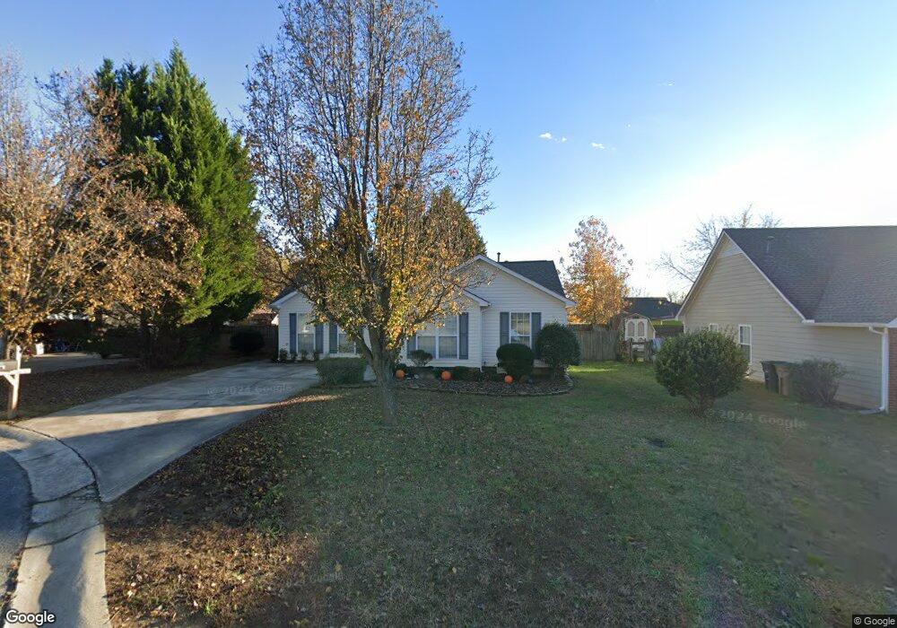
5905 Heathrow Ct Monroe, NC 28110
Estimated Value: $294,000 - $348,000
2
Beds
2
Baths
1,202
Sq Ft
$263/Sq Ft
Est. Value
About This Home
This home is located at 5905 Heathrow Ct, Monroe, NC 28110 and is currently estimated at $315,785, approximately $262 per square foot. 5905 Heathrow Ct is a home located in Union County with nearby schools including Sardis Elementary School, Porter Ridge Middle School, and Porter Ridge High School.
Ownership History
Date
Name
Owned For
Owner Type
Purchase Details
Closed on
Mar 27, 2006
Sold by
Lindley Andrew Paul and Lindley Michelle
Bought by
Voyzey Julie Ann
Current Estimated Value
Home Financials for this Owner
Home Financials are based on the most recent Mortgage that was taken out on this home.
Original Mortgage
$109,000
Outstanding Balance
$62,022
Interest Rate
6.19%
Mortgage Type
Fannie Mae Freddie Mac
Estimated Equity
$253,763
Purchase Details
Closed on
Dec 11, 2001
Sold by
Prudential Residential Svcs Ltd Prtnrshp
Bought by
Lindley Andrew Paul
Home Financials for this Owner
Home Financials are based on the most recent Mortgage that was taken out on this home.
Original Mortgage
$103,790
Interest Rate
6.5%
Create a Home Valuation Report for This Property
The Home Valuation Report is an in-depth analysis detailing your home's value as well as a comparison with similar homes in the area
Home Values in the Area
Average Home Value in this Area
Purchase History
| Date | Buyer | Sale Price | Title Company |
|---|---|---|---|
| Voyzey Julie Ann | $109,000 | None Available | |
| Lindley Andrew Paul | $107,000 | -- | |
| Prudential Residential Svcs Ltd Prtnrshp | -- | -- |
Source: Public Records
Mortgage History
| Date | Status | Borrower | Loan Amount |
|---|---|---|---|
| Open | Voyzey Julie Ann | $109,000 | |
| Previous Owner | Lindley Andrew Paul | $103,790 |
Source: Public Records
Tax History Compared to Growth
Tax History
| Year | Tax Paid | Tax Assessment Tax Assessment Total Assessment is a certain percentage of the fair market value that is determined by local assessors to be the total taxable value of land and additions on the property. | Land | Improvement |
|---|---|---|---|---|
| 2024 | $1,730 | $203,500 | $36,900 | $166,600 |
| 2023 | $1,716 | $203,500 | $36,900 | $166,600 |
| 2022 | $1,716 | $203,500 | $36,900 | $166,600 |
| 2021 | $1,716 | $203,500 | $36,900 | $166,600 |
| 2020 | $972 | $124,700 | $22,000 | $102,700 |
| 2019 | $1,256 | $124,700 | $22,000 | $102,700 |
| 2018 | $972 | $124,700 | $22,000 | $102,700 |
| 2017 | $1,320 | $124,700 | $22,000 | $102,700 |
| 2016 | $1,016 | $124,700 | $22,000 | $102,700 |
| 2015 | $1,032 | $124,700 | $22,000 | $102,700 |
| 2014 | $839 | $117,400 | $25,000 | $92,400 |
Source: Public Records
Map
Nearby Homes
- 5706 Sustar Dr
- 3900 Crimson Wing Dr
- 4311 Ethel Sustar Dr
- 5508 Burning Ridge Dr
- 5205 Sustar Dr
- 3013 Doughton Ln
- 2026 Union Grove Ln
- 2006 Paddington Dr
- 1009 Kemp Rd
- 3319 Creek Trail Rd
- 1010 Glen Hollow Dr
- 3612 Esther St
- 3702 Arthur St
- 3613 Arthur St
- 0 W Highway 74
- 3619 Wesley Chapel Stouts Rd
- 5901 Creft Cir
- 2842 Gray Fox Rd
- 4715 Jacquelyne Dr
- 6017 Creft Cir
- 5907 Heathrow Ct
- 5906 Prestwick Ln Unit 170
- 5906 Prestwick Ln
- 5903 Heathrow Ct
- 5908 Prestwick Ln
- 5902 Prestwick Ln
- 5901 Heathrow Ct
- 5909 Heathrow Ct
- 5904 Heathrow Ct
- 5900 Heathrow Ct
- 5910 Prestwick Ln
- 5900 Prestwick Ln
- 5902 Heathrow Ct
- 5908 Heathrow Ct
- 5901 Prestwick Ln
- 5905 White Cliffs Dr
- 5905 White Cliffs Dr Unit 155
- 5907 Prestwick Ln
- 5903 White Cliffs Dr
- 5907 White Cliffs Dr