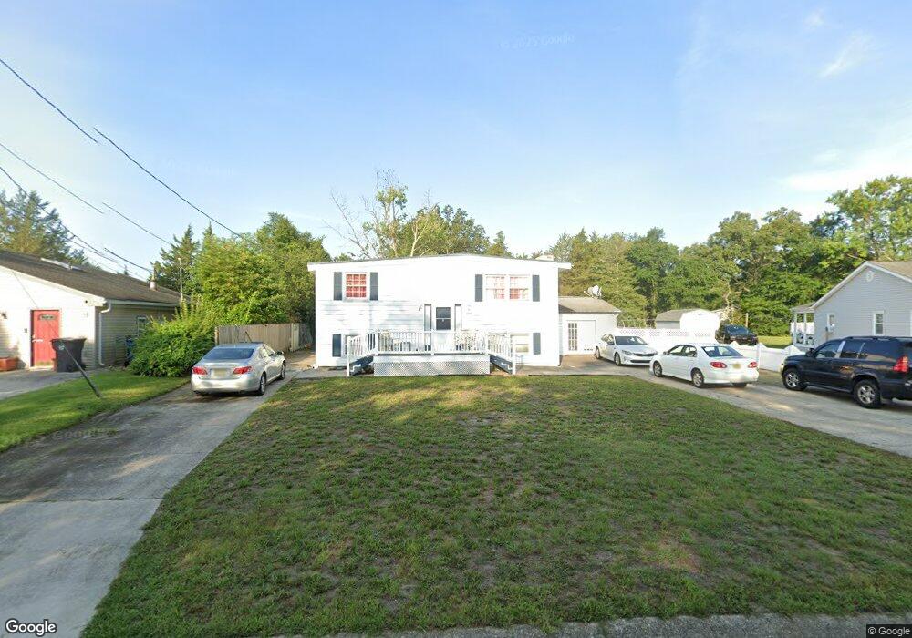
5906 Colony Dr Mays Landing, NJ 08330
Estimated Value: $380,000 - $424,321
--
Bed
--
Bath
2,590
Sq Ft
$156/Sq Ft
Est. Value
About This Home
This home is located at 5906 Colony Dr, Mays Landing, NJ 08330 and is currently estimated at $403,830, approximately $155 per square foot. 5906 Colony Dr is a home located in Atlantic County with nearby schools including Joseph Shaner School, George L. Hess Educational Complex, and William Davies Middle School.
Ownership History
Date
Name
Owned For
Owner Type
Purchase Details
Closed on
May 6, 2016
Sold by
Dejean Theolin
Bought by
Brutus Dorce Marie Suzette
Current Estimated Value
Purchase Details
Closed on
Sep 26, 2005
Sold by
Ernst Samuel
Bought by
Dejean Theolin and Dorce Marie
Home Financials for this Owner
Home Financials are based on the most recent Mortgage that was taken out on this home.
Original Mortgage
$200,000
Interest Rate
5.84%
Mortgage Type
Purchase Money Mortgage
Purchase Details
Closed on
Mar 10, 2004
Sold by
Ernst Sandra E
Bought by
Ernst Samuel J and Ernst Ann M
Purchase Details
Closed on
Apr 4, 2001
Sold by
Mcdermody Sara Andrea Werber and Rosenberg Richard
Bought by
Ernst Sandra E
Home Financials for this Owner
Home Financials are based on the most recent Mortgage that was taken out on this home.
Original Mortgage
$112,300
Interest Rate
6.57%
Mortgage Type
Balloon
Create a Home Valuation Report for This Property
The Home Valuation Report is an in-depth analysis detailing your home's value as well as a comparison with similar homes in the area
Home Values in the Area
Average Home Value in this Area
Purchase History
| Date | Buyer | Sale Price | Title Company |
|---|---|---|---|
| Brutus Dorce Marie Suzette | -- | None Available | |
| Dejean Theolin | $200,000 | -- | |
| Ernst Samuel J | -- | Lloyds & Handson Title Agenc | |
| Ernst Sandra E | $132,200 | -- |
Source: Public Records
Mortgage History
| Date | Status | Borrower | Loan Amount |
|---|---|---|---|
| Previous Owner | Dejean Theolin | $200,000 | |
| Previous Owner | Ernst Sandra E | $112,300 |
Source: Public Records
Tax History Compared to Growth
Tax History
| Year | Tax Paid | Tax Assessment Tax Assessment Total Assessment is a certain percentage of the fair market value that is determined by local assessors to be the total taxable value of land and additions on the property. | Land | Improvement |
|---|---|---|---|---|
| 2025 | $6,495 | $189,300 | $48,800 | $140,500 |
| 2024 | $6,495 | $189,300 | $48,800 | $140,500 |
| 2023 | $6,107 | $189,300 | $48,800 | $140,500 |
| 2022 | $6,107 | $189,300 | $48,800 | $140,500 |
| 2021 | $6,094 | $189,300 | $48,800 | $140,500 |
| 2020 | $6,094 | $189,300 | $48,800 | $140,500 |
| 2019 | $6,109 | $189,300 | $48,800 | $140,500 |
| 2018 | $5,895 | $189,300 | $48,800 | $140,500 |
| 2017 | $5,802 | $189,300 | $48,800 | $140,500 |
| 2016 | $5,639 | $189,300 | $48,800 | $140,500 |
| 2015 | $5,448 | $189,300 | $48,800 | $140,500 |
| 2014 | $5,488 | $208,900 | $53,800 | $155,100 |
Source: Public Records
Map
Nearby Homes
- 55 Lewis Dr
- 40 Vender Ln
- 18 Lewis Dr
- 94 Merlino Ln
- 5910 Somerset Dr
- 5906 Vine Dr
- 5910 Redwood Ct
- 5926 Berry Dr
- 42 Ernst Ct
- Bl 531 Lot 8&9 Adams Ave
- 0 Cape May Ave
- 22 Ernst Ct
- Lot:11.02-12.02 Estelle Ave
- B:534 L:11.01 Estelle Ave
- B:534 L:12.02 Estelle Ave
- B:534 L:11.02 Estelle Ave
- 1st First Ave
- 000 Apple St
- 0 Apple St
- Rt 50 and Old Mays Landing Rd
- 5904 Colony Dr
- 5908 Colony Dr
- 5909 Buttercup Ln
- 5930 Mulberry Dr
- 1527 Pinehurst Dr
- 5905 Colony Dr
- 5932 Mulberry Dr
- 5907 Colony Dr
- 1528 Old Egg Harbor Rd
- 1526 Old Egg Harbor Rd
- 1525 Pinehurst Dr
- 1531 Pinehurst Dr
- 1530 Old Egg Harbor Rd
- 1524 Old Egg Harbor Rd
- 5928 Mulberry Dr
- 5934 Mulberry Dr
- 1533 Pinehurst Dr
- 5906 Buttercup Ln
- 5904 Buttercup Ln
- 5926 Mulberry Dr