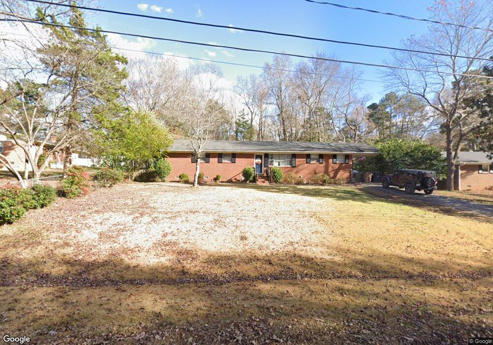
5909 Caroline Dr Matthews, NC 28104
Estimated Value: $387,833 - $400,000
4
Beds
2
Baths
1,528
Sq Ft
$256/Sq Ft
Est. Value
About This Home
This home is located at 5909 Caroline Dr, Matthews, NC 28104 and is currently estimated at $391,458, approximately $256 per square foot. 5909 Caroline Dr is a home located in Union County with nearby schools including Antioch Elementary School, Weddington Middle School, and Weddington High School.
Ownership History
Date
Name
Owned For
Owner Type
Purchase Details
Closed on
Dec 11, 2008
Sold by
Eanes Penny Sue Nickel and Eanes Steve
Bought by
Mccallister Joseph and Mccallister Melanie Lisa
Current Estimated Value
Home Financials for this Owner
Home Financials are based on the most recent Mortgage that was taken out on this home.
Original Mortgage
$138,000
Outstanding Balance
$92,290
Interest Rate
6.38%
Mortgage Type
VA
Estimated Equity
$299,168
Create a Home Valuation Report for This Property
The Home Valuation Report is an in-depth analysis detailing your home's value as well as a comparison with similar homes in the area
Home Values in the Area
Average Home Value in this Area
Purchase History
| Date | Buyer | Sale Price | Title Company |
|---|---|---|---|
| Mccallister Joseph | $138,000 | None Available |
Source: Public Records
Mortgage History
| Date | Status | Borrower | Loan Amount |
|---|---|---|---|
| Open | Mccallister Joseph | $138,000 |
Source: Public Records
Tax History Compared to Growth
Tax History
| Year | Tax Paid | Tax Assessment Tax Assessment Total Assessment is a certain percentage of the fair market value that is determined by local assessors to be the total taxable value of land and additions on the property. | Land | Improvement |
|---|---|---|---|---|
| 2024 | $2,100 | $246,300 | $46,200 | $200,100 |
| 2023 | $2,085 | $246,300 | $46,200 | $200,100 |
| 2022 | $2,085 | $246,300 | $46,200 | $200,100 |
| 2021 | $2,084 | $246,300 | $46,200 | $200,100 |
| 2020 | $954 | $121,400 | $22,000 | $99,400 |
| 2019 | $1,236 | $121,400 | $22,000 | $99,400 |
| 2018 | $0 | $121,400 | $22,000 | $99,400 |
| 2017 | $1,297 | $121,400 | $22,000 | $99,400 |
| 2016 | $1,267 | $121,400 | $22,000 | $99,400 |
| 2015 | $1,004 | $121,400 | $22,000 | $99,400 |
| 2014 | $1,025 | $144,760 | $30,000 | $114,760 |
Source: Public Records
Map
Nearby Homes
- 3424 Delamere Dr
- 1000 Sudbury Ln
- 2929 Matoka Trail
- 0000 Chestnut Ln
- 2034 Laney Pond Rd
- 2006 Laney Pond Rd
- 2004 Viscount Dr
- 2011 Trailwood Dr
- 7017 Holly Grove Ct
- 2029 Gable Way Ln
- 4121 Cedar Point Ave
- 5034 Stonehill Ln
- 700 Chestnut Ln
- 1113 Headwaters Ct
- 2044 Gable Way Ln
- 1227 Clover Ln
- 2065 Gable Way Ln
- 4148 Cedar Point Ave
- 315 Red Barn Trail
- 1009 Murandy Ln
- 5917 Caroline Dr
- 225 Middleton Ave
- 5925 Caroline Dr
- 5916 Davidson Dr
- 5900 Davidson Dr
- 232 Middleton Ave
- 300 Hollice Place
- 5933 Caroline Dr
- 216 Middleton Ave
- Lot 10 Hollice Place
- 0 Middleton Ave
- 5932 Davidson Dr
- 300 Middleton Ave
- 300 Middleton Ave Unit 11
- Lot 9 Hollice Place
- 200 Middleton Ave
- 6001 Caroline Dr
- 308 Hollice Place
- 6000 Davidson Dr
- 5925 Davidson Dr