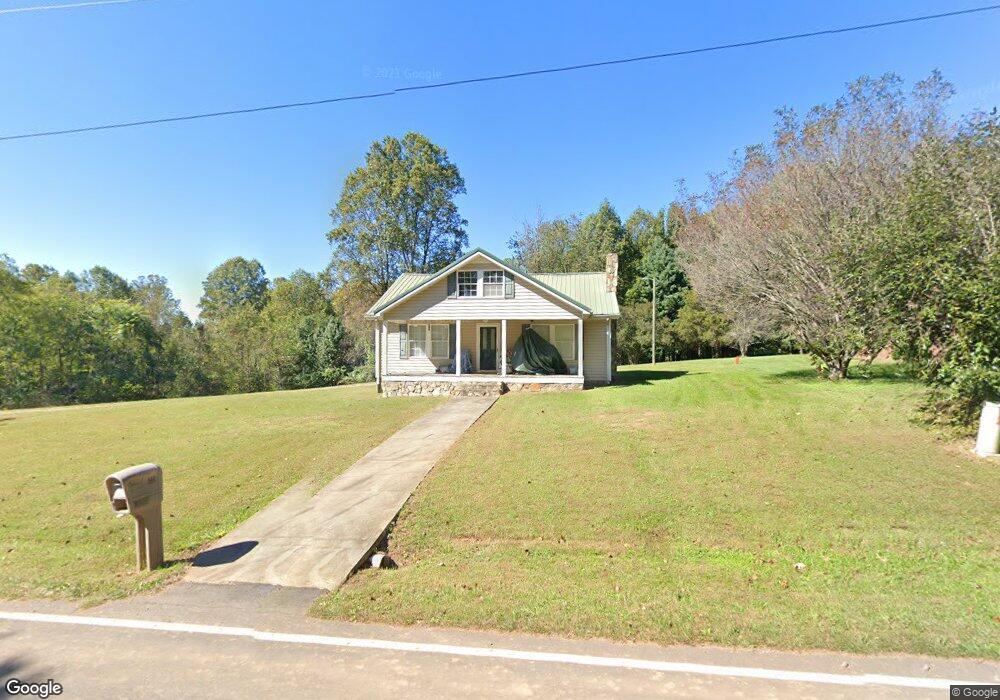
591 Armstrong Rd Pilot Mountain, NC 27041
Estimated Value: $206,000 - $333,000
3
Beds
2
Baths
1,728
Sq Ft
$140/Sq Ft
Est. Value
About This Home
This home is located at 591 Armstrong Rd, Pilot Mountain, NC 27041 and is currently estimated at $242,032, approximately $140 per square foot. 591 Armstrong Rd is a home located in Surry County with nearby schools including Westfield Elementary School, Pilot Mountain Middle School, and East Surry High School.
Ownership History
Date
Name
Owned For
Owner Type
Purchase Details
Closed on
Jun 13, 2006
Sold by
Barker Mckenzie Martha Jessup and Barker Martha Jessup
Bought by
Moore Randy and Moore Kimberly Dawn
Current Estimated Value
Home Financials for this Owner
Home Financials are based on the most recent Mortgage that was taken out on this home.
Original Mortgage
$90,100
Outstanding Balance
$52,688
Interest Rate
6.57%
Mortgage Type
New Conventional
Estimated Equity
$189,344
Create a Home Valuation Report for This Property
The Home Valuation Report is an in-depth analysis detailing your home's value as well as a comparison with similar homes in the area
Purchase History
| Date | Buyer | Sale Price | Title Company |
|---|---|---|---|
| Moore Randy | $90,500 | None Available |
Source: Public Records
Mortgage History
| Date | Status | Borrower | Loan Amount |
|---|---|---|---|
| Open | Moore Randy | $90,100 |
Source: Public Records
Tax History
| Year | Tax Paid | Tax Assessment Tax Assessment Total Assessment is a certain percentage of the fair market value that is determined by local assessors to be the total taxable value of land and additions on the property. | Land | Improvement |
|---|---|---|---|---|
| 2025 | $748 | $117,720 | $18,000 | $99,720 |
| 2024 | $655 | $97,760 | $16,800 | $80,960 |
| 2023 | $644 | $97,760 | $16,800 | $80,960 |
| 2022 | $644 | $97,760 | $16,800 | $80,960 |
| 2021 | $655 | $97,760 | $16,800 | $80,960 |
| 2020 | $619 | $88,750 | $16,800 | $71,950 |
| 2019 | $616 | $88,750 | $0 | $0 |
| 2018 | $615 | $88,750 | $0 | $0 |
| 2017 | $613 | $88,750 | $0 | $0 |
| 2016 | $613 | $88,750 | $0 | $0 |
| 2013 | -- | $90,280 | $0 | $0 |
Source: Public Records
Map
Nearby Homes
- Lot 5 Morosko Ln
- Lot 6 Morosko Ln
- 0 Chestnut Ridge Rd
- TBD Marbury Trail
- xx Gilley Rd Unit 20.63 acres
- 1096-1238 Cook School Rd Unit 97+/- AC Tract
- 446 Gilley Rd
- 2109 Cook School Rd
- 00 Simmons Rd
- 2725 Wilkes Ln
- 0 Wilkes Ln
- 2837 Wilkes Ln
- 2602 Wilkes Ln
- 3002 Alleghany Ln
- 6190 Alleghany Ln
- 1207 Alleghany Ln
- 9076 Alleghany Ln
- 3234 Alleghany Ln
- 300 Tom Hunter Rd
- 339 Jessup Grove Church Rd
- 599 Armstrong Rd
- 109 Sapphire Ln
- 615 Armstrong Rd
- 565 Armstrong Rd
- 157 Sapphire Ln
- 644 Armstrong Rd
- 183 Wildflower Ln
- 163 Wildflower Ln
- 433 Armstrong Rd
- 193 Daffodil Ln
- 454 Armstrong Rd
- 653 Armstrong Rd
- 263 Legends Ln
- 490 Armstrong Rd
- 450 Armstrong Rd
- 123 Daffodil Ln
- 448 Armstrong Rd
- 442 Armstrong Rd
- 398 Armstrong Rd
- 384 Armstrong Rd
Your Personal Tour Guide
Ask me questions while you tour the home.