Estimated Value: $547,509 - $607,000
4
Beds
3
Baths
3,525
Sq Ft
$165/Sq Ft
Est. Value
About This Home
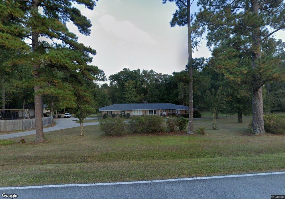
This home is located at 591 Blanchard Rd, Evans, GA 30809 and is currently estimated at $580,127, approximately $164 per square foot. 591 Blanchard Rd is a home located in Columbia County with nearby schools including Evans Elementary School, John F. Kennedy Middle School, and Evans Middle School.
Ownership History
Date
Name
Owned For
Owner Type
Purchase Details
Closed on
May 8, 2009
Sold by
Wren Ray B
Bought by
Spratley Richard W
Current Estimated Value
Home Financials for this Owner
Home Financials are based on the most recent Mortgage that was taken out on this home.
Original Mortgage
$327,000
Outstanding Balance
$206,161
Interest Rate
4.89%
Mortgage Type
VA
Estimated Equity
$373,966
Create a Home Valuation Report for This Property
The Home Valuation Report is an in-depth analysis detailing your home's value as well as a comparison with similar homes in the area
Home Values in the Area
Average Home Value in this Area
Purchase History
| Date | Buyer | Sale Price | Title Company |
|---|---|---|---|
| Spratley Richard W | $345,000 | -- |
Source: Public Records
Mortgage History
| Date | Status | Borrower | Loan Amount |
|---|---|---|---|
| Open | Spratley Richard W | $327,000 |
Source: Public Records
Tax History Compared to Growth
Tax History
| Year | Tax Paid | Tax Assessment Tax Assessment Total Assessment is a certain percentage of the fair market value that is determined by local assessors to be the total taxable value of land and additions on the property. | Land | Improvement |
|---|---|---|---|---|
| 2025 | $5,097 | $211,310 | $46,920 | $164,390 |
| 2024 | $5,128 | $202,957 | $46,794 | $156,163 |
| 2023 | $5,128 | $192,676 | $40,548 | $152,128 |
| 2022 | $4,862 | $184,921 | $36,048 | $148,873 |
| 2021 | $4,508 | $163,716 | $32,110 | $131,606 |
| 2020 | $4,292 | $152,518 | $28,735 | $123,783 |
| 2019 | $4,140 | $147,043 | $28,727 | $118,316 |
| 2018 | $4,025 | $142,429 | $25,906 | $116,523 |
| 2017 | $3,986 | $140,518 | $25,902 | $114,616 |
| 2016 | $3,961 | $144,829 | $27,671 | $117,158 |
| 2015 | $3,917 | $142,930 | $27,663 | $115,267 |
| 2014 | $3,902 | $140,579 | $26,521 | $114,058 |
Source: Public Records
Map
Nearby Homes
- 4709 Walnut Hill Dr
- 604 Kimberley Place
- 599 Windward Ct
- 385 Canterbury Dr
- 4648 Leeward Dr
- 604 Barberry Ct
- 4746 Rye Hill Ct
- 586 Gibbs Rd
- 703 Low Meadow Dr
- 702 Rye Hill Dr
- 5068 Hereford Farm Rd
- 4854 Hereford Farm Rd
- 928 Rollo Domino Cir
- 4670 La Pointe
- 4664 La Pointe
- 4876 Rolling Hill Rd
- 646 Wellington Dr
- 3465 Hilltop Trail
- 654 Whitney Shoals Rd
- 4136 Buffalo Trail
- 593 Blanchard Rd
- 0 Wildwood Dr Unit 507413
- 0 Wildwood Dr Unit 411733
- 0 Wildwood Dr Unit 468716
- 4737 Wildwood Dr
- 599 Blanchard Rd
- 604 Blanchard Rd
- 4738 Wildwood Dr
- 584 Blanchard Rd
- 607 Blanchard Rd
- 608 Blanchard Rd
- 4744 Wildwood Dr
- 4731 Wildwood Dr
- 613 Blanchard Rd
- 592 Blanchard Rd
- 4767 Sharon Dr
- 253 Blanchard Rd
- 625 Blanchard Rd
- 4728 Wildwood Dr
- 614 Blanchard Rd