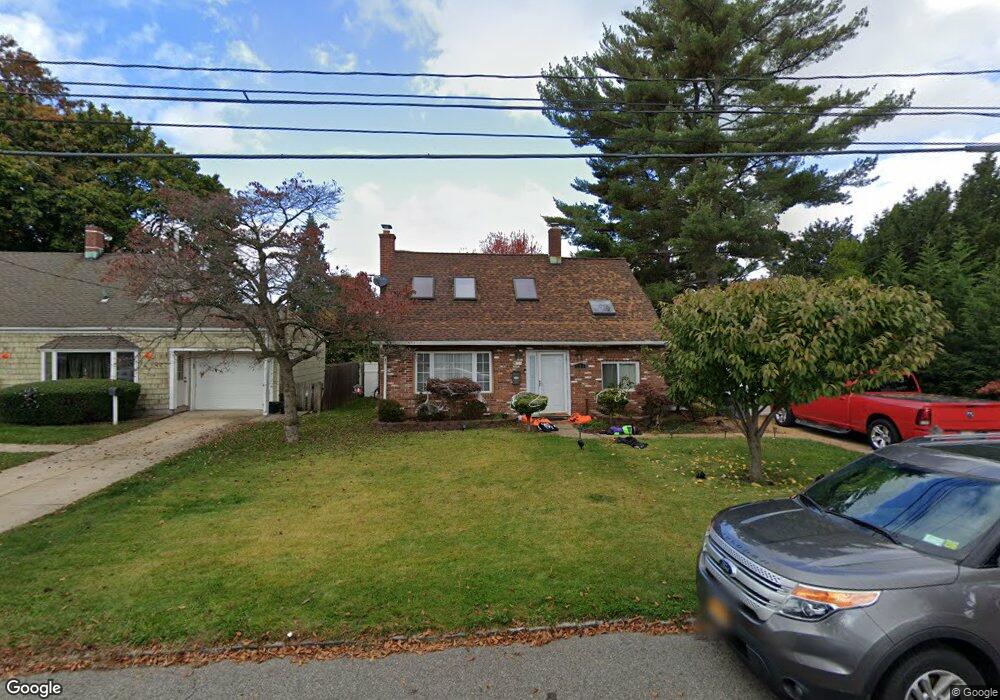
591 Bryant St Westbury, NY 11590
Estimated Value: $559,000 - $611,789
--
Bed
1
Bath
1,482
Sq Ft
$395/Sq Ft
Est. Value
About This Home
This home is located at 591 Bryant St, Westbury, NY 11590 and is currently estimated at $585,395, approximately $395 per square foot. 591 Bryant St is a home located in Nassau County with nearby schools including Westbury Middle School, Westbury High School, and St Brigid/Our Lady Of Hope Regional School.
Ownership History
Date
Name
Owned For
Owner Type
Purchase Details
Closed on
Nov 13, 2001
Sold by
S And K Prop Llc By George Serel
Bought by
Cervantes Jaime and Cervantes Garcia
Current Estimated Value
Purchase Details
Closed on
Dec 8, 2000
Sold by
Referee Rerise Gail A
Bought by
S And K Properties Llc And David Ney
Purchase Details
Closed on
Dec 4, 1995
Sold by
Fgb Realty Advisors Inc
Bought by
Dawkins Cedric
Home Financials for this Owner
Home Financials are based on the most recent Mortgage that was taken out on this home.
Original Mortgage
$94,500
Interest Rate
7.33%
Purchase Details
Closed on
Jan 18, 1995
Sold by
Scourby Nicholas Ref
Bought by
Fgb Realty Advisors Inc
Create a Home Valuation Report for This Property
The Home Valuation Report is an in-depth analysis detailing your home's value as well as a comparison with similar homes in the area
Home Values in the Area
Average Home Value in this Area
Purchase History
| Date | Buyer | Sale Price | Title Company |
|---|---|---|---|
| Cervantes Jaime | $250,000 | Kevin Finn | |
| S And K Properties Llc And David Ney | $134,100 | -- | |
| Dawkins Cedric | $105,000 | -- | |
| Fgb Realty Advisors Inc | $75,000 | -- |
Source: Public Records
Mortgage History
| Date | Status | Borrower | Loan Amount |
|---|---|---|---|
| Previous Owner | Dawkins Cedric | $94,500 |
Source: Public Records
Tax History Compared to Growth
Tax History
| Year | Tax Paid | Tax Assessment Tax Assessment Total Assessment is a certain percentage of the fair market value that is determined by local assessors to be the total taxable value of land and additions on the property. | Land | Improvement |
|---|---|---|---|---|
| 2025 | $10,615 | $340 | $188 | $152 |
| 2024 | $2,779 | $340 | $188 | $152 |
| 2023 | $11,589 | $340 | $188 | $152 |
| 2022 | $11,589 | $340 | $188 | $152 |
| 2021 | $12,340 | $327 | $181 | $146 |
| 2020 | $13,130 | $652 | $524 | $128 |
| 2019 | $13,404 | $652 | $524 | $128 |
| 2018 | $12,553 | $652 | $0 | $0 |
| 2017 | $8,956 | $652 | $524 | $128 |
| 2016 | $11,753 | $652 | $524 | $128 |
| 2015 | $2,667 | $652 | $524 | $128 |
| 2014 | $2,667 | $652 | $524 | $128 |
| 2013 | $2,517 | $652 | $524 | $128 |
Source: Public Records
Map
Nearby Homes
- 20 Longfellow Ave
- 646 Whittier St
- 671 Whittier St
- 544 Dryden St
- 54 School St Unit 315
- 906 Bromton Dr
- 2001 Wellington Ct
- 2040 Wellington Ct
- 806 Oliver Ave
- 1982 Stratford Dr
- 1148 Howard Dr
- 9 Grayston St
- 254 Brook St
- 537 Church St
- 474 Newton St
- 130 Post Ave Unit 303
- 130 Post Ave Unit 322
- 130 Post Ave Unit 316
- 130 Post Ave Unit 202
- 330 Maple Ave Unit 25