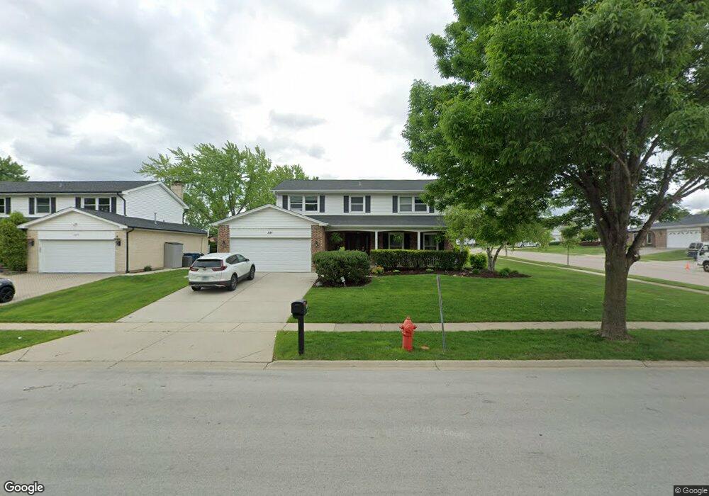
591 Sandpebble Dr Schaumburg, IL 60193
South Schaumburg NeighborhoodEstimated Value: $615,000 - $657,000
4
Beds
3
Baths
2,678
Sq Ft
$239/Sq Ft
Est. Value
About This Home
This home is located at 591 Sandpebble Dr, Schaumburg, IL 60193 and is currently estimated at $639,654, approximately $238 per square foot. 591 Sandpebble Dr is a home located in Cook County with nearby schools including Nathan Hale Elementary School, Robert Frost Junior High School, and Schaumburg High School.
Ownership History
Date
Name
Owned For
Owner Type
Purchase Details
Closed on
Aug 20, 2001
Sold by
Taylor Margaret J
Bought by
Rahn William D and Rahn Connie
Current Estimated Value
Home Financials for this Owner
Home Financials are based on the most recent Mortgage that was taken out on this home.
Original Mortgage
$220,000
Interest Rate
6.99%
Purchase Details
Closed on
Oct 16, 2000
Sold by
Taylor John D
Bought by
Taylor Margaret J
Create a Home Valuation Report for This Property
The Home Valuation Report is an in-depth analysis detailing your home's value as well as a comparison with similar homes in the area
Home Values in the Area
Average Home Value in this Area
Purchase History
| Date | Buyer | Sale Price | Title Company |
|---|---|---|---|
| Rahn William D | $320,000 | -- | |
| Taylor Margaret J | -- | -- |
Source: Public Records
Mortgage History
| Date | Status | Borrower | Loan Amount |
|---|---|---|---|
| Previous Owner | Rahn William D | $220,000 |
Source: Public Records
Tax History Compared to Growth
Tax History
| Year | Tax Paid | Tax Assessment Tax Assessment Total Assessment is a certain percentage of the fair market value that is determined by local assessors to be the total taxable value of land and additions on the property. | Land | Improvement |
|---|---|---|---|---|
| 2024 | $11,677 | $45,000 | $10,125 | $34,875 |
| 2023 | $11,295 | $45,000 | $10,125 | $34,875 |
| 2022 | $11,295 | $45,000 | $10,125 | $34,875 |
| 2021 | $10,280 | $37,247 | $7,593 | $29,654 |
| 2020 | $10,171 | $37,247 | $7,593 | $29,654 |
| 2019 | $10,174 | $41,386 | $7,593 | $33,793 |
| 2018 | $11,124 | $40,500 | $6,468 | $34,032 |
| 2017 | $10,966 | $40,500 | $6,468 | $34,032 |
| 2016 | $10,497 | $40,500 | $6,468 | $34,032 |
| 2015 | $10,165 | $36,600 | $5,625 | $30,975 |
| 2014 | $10,069 | $36,600 | $5,625 | $30,975 |
| 2013 | $9,794 | $36,600 | $5,625 | $30,975 |
Source: Public Records
Map
Nearby Homes
- 1109 Beach Comber Dr
- 415 Laconia Ln
- 357 Lucille Ln Unit 30
- 1008 Shannock Ln
- 988 Chelsea Ln
- 818 Brentwood Ct
- 1342 Lunt Ct Unit 56
- 1104 Taunton Ct
- 712 Dante Ct
- 1150 Attleboro Ct
- 516 W Weathersfield Way
- 1520 Grant St
- 1300 Cranbrook Dr
- 1285 Cranbrook Dr
- 507 Ash Ct
- 1027 Duxbury Ln
- 1171 Regency Dr
- 635 Limerick Ln Unit 2B
- 1126 Tiverton Ct
- 727 Killarney Ct Unit 1C
- 587 Sandpebble Dr
- 1031 Lighthouse Dr
- 583 Sandpebble Dr
- 1026 Lighthouse Dr
- 1030 Lighthouse Dr
- 1035 Lighthouse Dr
- 594 Sandpebble Dr
- 590 Sandpebble Dr
- 1030 Seaview Ct
- 1034 Lighthouse Dr
- 598 Sandpebble Dr
- 586 Sandpebble Dr
- 579 Sandpebble Dr
- 1039 Lighthouse Dr
- 582 Sandpebble Dr
- 1038 Lighthouse Dr
- 602 Sandpebble Dr
- 611 Sandpebble Dr
- 1034 Seaview Ct
- 1042 Lighthouse Dr