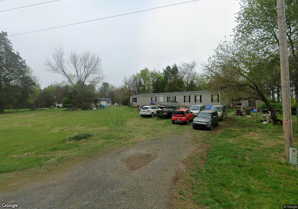
591 Spillman Rd Mocksville, NC 27028
Estimated Value: $185,000 - $216,000
3
Beds
2
Baths
1,824
Sq Ft
$109/Sq Ft
Est. Value
About This Home
This home is located at 591 Spillman Rd, Mocksville, NC 27028 and is currently estimated at $198,333, approximately $108 per square foot. 591 Spillman Rd is a home located in Davie County with nearby schools including Pinebrook Elementary School, North Davie Middle School, and Davie County High School.
Ownership History
Date
Name
Owned For
Owner Type
Purchase Details
Closed on
Aug 15, 2022
Sold by
Lashmit Henry Keith
Bought by
Lashmit Henry Keith and Lashmit Christina M
Current Estimated Value
Purchase Details
Closed on
Sep 10, 2009
Sold by
Lashmit Thomas F and Lashmit Lori N
Bought by
Lasmit Henry Keith and Lasmit Christina M
Create a Home Valuation Report for This Property
The Home Valuation Report is an in-depth analysis detailing your home's value as well as a comparison with similar homes in the area
Home Values in the Area
Average Home Value in this Area
Purchase History
| Date | Buyer | Sale Price | Title Company |
|---|---|---|---|
| Lashmit Henry Keith | $1,000 | -- | |
| Lashmit Henry Keith | $1,000 | None Listed On Document | |
| Lasmit Henry Keith | -- | None Availabale |
Source: Public Records
Tax History Compared to Growth
Tax History
| Year | Tax Paid | Tax Assessment Tax Assessment Total Assessment is a certain percentage of the fair market value that is determined by local assessors to be the total taxable value of land and additions on the property. | Land | Improvement |
|---|---|---|---|---|
| 2025 | $809 | $117,550 | $28,560 | $88,990 |
| 2024 | $735 | $95,060 | $22,070 | $72,990 |
| 2023 | $735 | $95,060 | $22,070 | $72,990 |
| 2022 | $735 | $95,060 | $22,070 | $72,990 |
| 2021 | $690 | $89,240 | $22,070 | $67,170 |
| 2020 | $622 | $80,000 | $22,070 | $57,930 |
| 2019 | $62,240 | $80,000 | $22,070 | $57,930 |
| 2018 | $622 | $80,000 | $22,070 | $57,930 |
| 2017 | $614 | $80,000 | $0 | $0 |
| 2016 | $663 | $86,340 | $0 | $0 |
| 2015 | $663 | $86,340 | $0 | $0 |
| 2014 | $570 | $86,340 | $0 | $0 |
| 2013 | -- | $86,340 | $0 | $0 |
Source: Public Records
Map
Nearby Homes
- 0 Mcknight Rd
- 4029 Estate Dr
- 844 Rainbow Rd
- 4011 Estate Dr
- Roller Mill II Plan at Adams Estates
- Roller Mill Plan at Adams Estates
- Oak Crest Plan at Adams Estates
- Heritage Bridge Plan at Adams Estates
- Birch Haven Courtyard Plan at Adams Estates
- 2643 Nc Highway 801 N
- 1270 Rainbow Rd
- 182 Woodburn Place
- 272 Morning Star Dr
- 270 Morning Star Dr
- 271 Morning Star Dr
- 266 Morning Star Dr
- 137 Starhaven Ct
- 133 Starhaven Ct
- 138 Starhaven Ct
- 120 Starhaven Ct
- 574 Spillman Rd
- 802 Sparks Rd
- 784 Sparks Rd
- 245 Sleepy Hollow Rd
- 132 Deerfield Dr
- 466 Spillman Rd
- 460 Spillman Rd
- 193 Arrowhead Rd
- 205 Arrowhead Rd
- 165 Redfield Rd
- 200 Redfield Rd
- 239 Arrowhead Rd
- 206 Deerfield Dr
- 659 Sparks Rd
- 128 Redfield Rd
- 402 Spillman Rd
- 204 Deerfield Dr
- 626 Sparks Rd
- 841 Spillman Rd
- 127 Triple h Trail