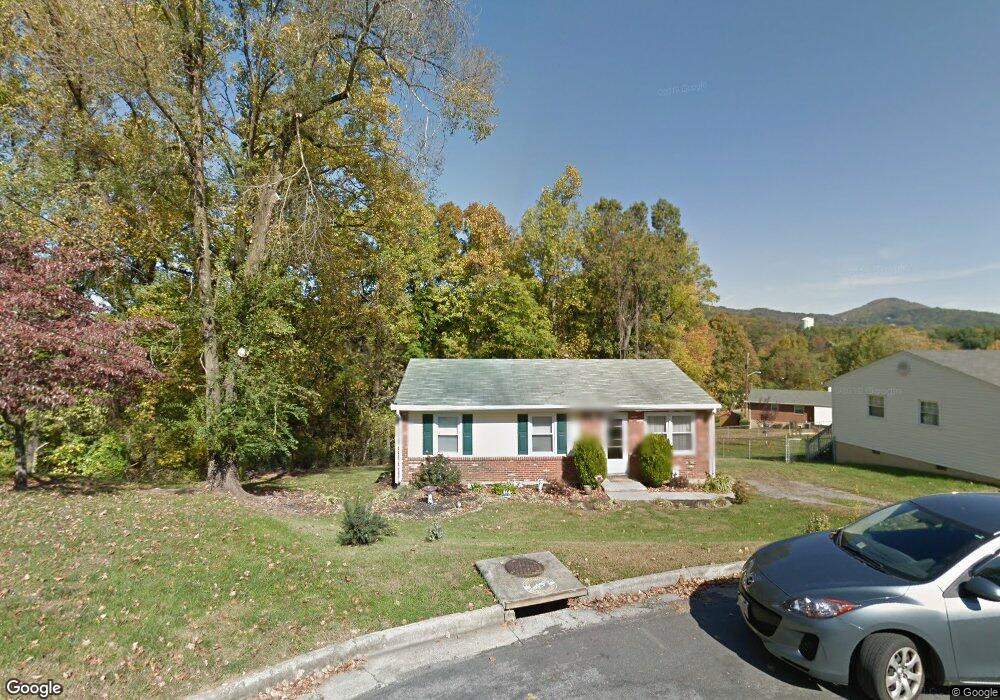
591 Stacie Dr Vinton, VA 24179
Estimated Value: $216,000 - $235,000
3
Beds
1
Bath
988
Sq Ft
$227/Sq Ft
Est. Value
About This Home
This home is located at 591 Stacie Dr, Vinton, VA 24179 and is currently estimated at $224,406, approximately $227 per square foot. 591 Stacie Dr is a home located in Roanoke County with nearby schools including Herman L. Horn Elementary School, William Byrd Middle School, and William Byrd High School.
Ownership History
Date
Name
Owned For
Owner Type
Purchase Details
Closed on
May 24, 2024
Sold by
Bower Marc A
Bought by
Bower Marc A and Bower Erin Lynn
Current Estimated Value
Purchase Details
Closed on
Apr 15, 2008
Sold by
Kosko John
Bought by
Bower Marc A
Home Financials for this Owner
Home Financials are based on the most recent Mortgage that was taken out on this home.
Original Mortgage
$118,743
Interest Rate
6.1%
Mortgage Type
New Conventional
Create a Home Valuation Report for This Property
The Home Valuation Report is an in-depth analysis detailing your home's value as well as a comparison with similar homes in the area
Purchase History
| Date | Buyer | Sale Price | Title Company |
|---|---|---|---|
| Bower Marc A | -- | None Listed On Document | |
| Bower Marc A | $114,950 | Mult |
Source: Public Records
Mortgage History
| Date | Status | Borrower | Loan Amount |
|---|---|---|---|
| Previous Owner | Bower Marc A | $118,743 |
Source: Public Records
Tax History
| Year | Tax Paid | Tax Assessment Tax Assessment Total Assessment is a certain percentage of the fair market value that is determined by local assessors to be the total taxable value of land and additions on the property. | Land | Improvement |
|---|---|---|---|---|
| 2025 | $1,792 | $174,000 | $37,100 | $136,900 |
| 2024 | $1,688 | $162,300 | $34,200 | $128,100 |
| 2023 | $1,491 | $140,700 | $34,200 | $106,500 |
| 2022 | $1,402 | $128,600 | $30,400 | $98,200 |
| 2021 | $1,267 | $116,200 | $26,600 | $89,600 |
| 2020 | $1,197 | $109,800 | $25,700 | $84,100 |
| 2019 | $1,126 | $103,300 | $25,700 | $77,600 |
| 2018 | $1,079 | $100,700 | $25,700 | $75,000 |
| 2017 | $1,079 | $99,000 | $25,700 | $73,300 |
| 2016 | $1,080 | $99,100 | $25,700 | $73,400 |
| 2015 | $1,080 | $99,100 | $25,700 | $73,400 |
| 2014 | $1,080 | $99,100 | $25,700 | $73,400 |
Source: Public Records
Map
Nearby Homes
- 1812 Mountain View Rd Unit & 1816
- 528 Holiday Rd
- 2060 Heys Ln
- 2044 Heys Ln
- 725 Ramada Rd
- 3015 Adam Dr
- 202 Georgia Ct NE
- 2839 Matthew Dr
- 3507 Pinnacle Ridge Rd NE
- 3706 Derby Dr
- 2525 Fountain Ln
- 314 Lynn Haven Cir
- 2165 Kings Walk Dr NE
- 2145 Kings Walk Dr NE
- 2141 Kings Walk Dr NE
- 3951 Blandfield Dr
- 344 Elm St
- 0 Vinyard Ave NE
- 0 Breezewood Cir
- 7074 Blue Ridge Pkwy
Your Personal Tour Guide
Ask me questions while you tour the home.