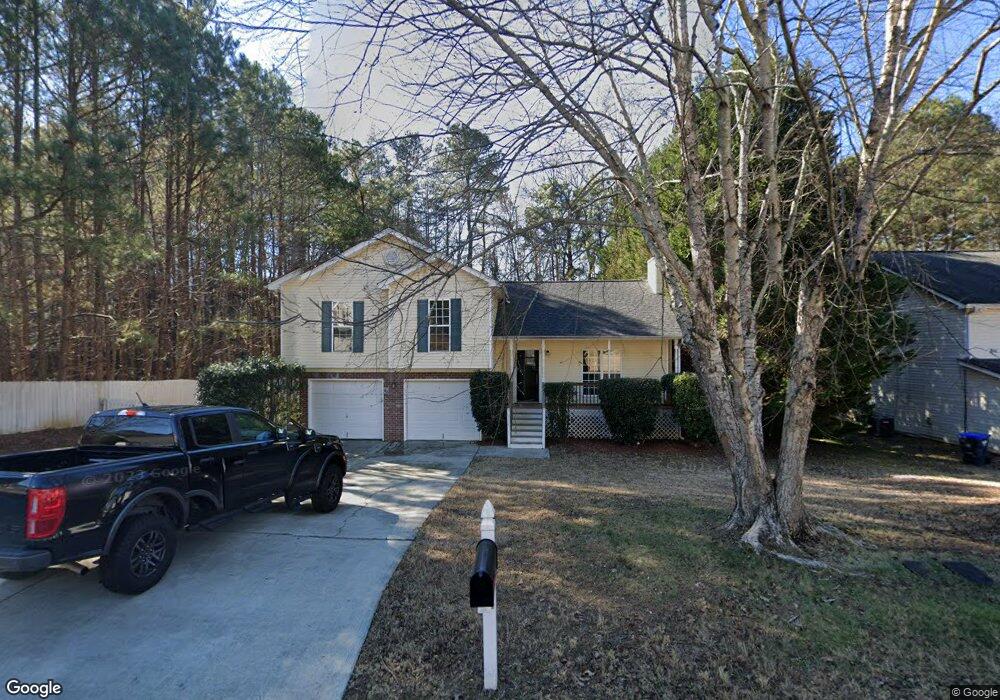
5910 April Dr NE Buford, GA 30518
Estimated Value: $367,000 - $395,000
4
Beds
3
Baths
1,806
Sq Ft
$210/Sq Ft
Est. Value
About This Home
This home is located at 5910 April Dr NE, Buford, GA 30518 and is currently estimated at $379,009, approximately $209 per square foot. 5910 April Dr NE is a home located in Gwinnett County with nearby schools including Sycamore Elementary School, Lanier Middle School, and Lanier High School.
Ownership History
Date
Name
Owned For
Owner Type
Purchase Details
Closed on
Dec 21, 2022
Sold by
Allgood Jessica J
Bought by
Lpf Blvd Atlanta Llc
Current Estimated Value
Purchase Details
Closed on
Oct 4, 2013
Sold by
Button Gerald B
Bought by
Cook Jessica J
Home Financials for this Owner
Home Financials are based on the most recent Mortgage that was taken out on this home.
Original Mortgage
$133,000
Interest Rate
4.58%
Mortgage Type
New Conventional
Purchase Details
Closed on
Apr 1, 2002
Sold by
Southfork Hms Inc
Bought by
Button Gerald B and Button Jennifer A
Home Financials for this Owner
Home Financials are based on the most recent Mortgage that was taken out on this home.
Original Mortgage
$127,650
Interest Rate
6.8%
Mortgage Type
New Conventional
Create a Home Valuation Report for This Property
The Home Valuation Report is an in-depth analysis detailing your home's value as well as a comparison with similar homes in the area
Home Values in the Area
Average Home Value in this Area
Purchase History
| Date | Buyer | Sale Price | Title Company |
|---|---|---|---|
| Lpf Blvd Atlanta Llc | $315,900 | -- | |
| Cook Jessica J | $140,000 | -- | |
| Button Gerald B | $134,400 | -- |
Source: Public Records
Mortgage History
| Date | Status | Borrower | Loan Amount |
|---|---|---|---|
| Previous Owner | Cook Jessica J | $133,000 | |
| Previous Owner | Button Gerald B | $127,650 |
Source: Public Records
Tax History Compared to Growth
Tax History
| Year | Tax Paid | Tax Assessment Tax Assessment Total Assessment is a certain percentage of the fair market value that is determined by local assessors to be the total taxable value of land and additions on the property. | Land | Improvement |
|---|---|---|---|---|
| 2025 | $555 | $148,160 | $26,000 | $122,160 |
| 2024 | $5,171 | $148,160 | $26,000 | $122,160 |
| 2023 | $5,171 | $126,360 | $26,000 | $100,360 |
| 2022 | $2,857 | $121,320 | $22,000 | $99,320 |
| 2021 | $2,229 | $88,000 | $16,000 | $72,000 |
| 2020 | $2,614 | $88,000 | $16,000 | $72,000 |
| 2019 | $2,426 | $96,760 | $16,000 | $80,760 |
| 2018 | $2,498 | $84,600 | $16,000 | $68,600 |
| 2016 | $1,999 | $64,880 | $12,800 | $52,080 |
| 2015 | $1,794 | $56,320 | $9,200 | $47,120 |
| 2014 | -- | $56,000 | $9,200 | $46,800 |
Source: Public Records
Map
Nearby Homes
- 5880 April Dr Unit 1
- 5683 Riverside Walk Dr
- 6050 April Dr
- 5870 Tallant Dr
- 1240 Magellan Dr
- 1250 Magellan Dr
- 1260 Magellan Dr
- Hampstead Plan at Arbors at Richland Creek
- Lancaster Plan at Arbors at Richland Creek
- Savoy Plan at Arbors at Richland Creek
- 1275 Riverside Rd
- 5757 Riverside Dr Unit 2
- 5800 S Richland Creek Rd
- 5680 Princeton Oaks Dr
- 6897 Barker Station Walk
- 5650 Princeton Oaks Dr
- 6737 Barker Station Walk
- 915 Riverside Rd Unit 3
- 5910 April Dr
- 5910 April Dr Unit 2
- 5920 April Dr
- 5890 April Dr Unit 1
- 5930 April Dr Unit 1
- 5935 April Dr
- 5915 April Dr
- 5905 April Dr Unit 47
- 5905 April Dr
- 0 April Dr NE Unit 8468002
- 0 April Dr NE Unit 8204172
- 0 April Dr NE Unit 7394682
- 0 April Dr NE Unit 7233504
- 0 April Dr NE Unit 8962592
- 0 April Dr NE Unit 9025987
- 0 April Dr NE Unit 7526945
- 0 April Dr NE Unit 8222785
- 0 April Dr NE
- 5895 April Dr
- 5940 April Dr Unit 1