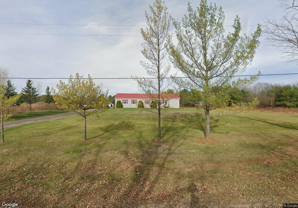
5910 Dove Rd Kimball, MI 48074
Estimated Value: $260,000 - $363,000
4
Beds
3
Baths
2,400
Sq Ft
$133/Sq Ft
Est. Value
About This Home
This home is located at 5910 Dove Rd, Kimball, MI 48074 and is currently estimated at $320,000, approximately $133 per square foot. 5910 Dove Rd is a home located in St. Clair County with nearby schools including Kimball Elementary School, Central Middle School, and Port Huron High School.
Ownership History
Date
Name
Owned For
Owner Type
Purchase Details
Closed on
Feb 1, 2018
Sold by
Cummins Kevins M
Bought by
Cummins Kevins M and Cummins Laura A
Current Estimated Value
Home Financials for this Owner
Home Financials are based on the most recent Mortgage that was taken out on this home.
Original Mortgage
$102,000
Outstanding Balance
$86,385
Interest Rate
3.99%
Mortgage Type
New Conventional
Estimated Equity
$233,615
Purchase Details
Closed on
Sep 10, 2009
Sold by
Federal National Mortgage Association
Bought by
Cummins Kevin
Purchase Details
Closed on
Mar 28, 2008
Sold by
Wells Fargo Bank Na
Bought by
Federal National Mortgage Association
Purchase Details
Closed on
Mar 20, 2008
Sold by
Ferrier Douglas M and Ferrier Alysia M
Bought by
Wells Fargo Bank Na
Create a Home Valuation Report for This Property
The Home Valuation Report is an in-depth analysis detailing your home's value as well as a comparison with similar homes in the area
Home Values in the Area
Average Home Value in this Area
Purchase History
| Date | Buyer | Sale Price | Title Company |
|---|---|---|---|
| Cummins Kevins M | -- | -- | |
| Cummins Kevin | $94,000 | Warranty Title Agency Llc | |
| Federal National Mortgage Association | -- | None Available | |
| Wells Fargo Bank Na | $202,228 | None Available |
Source: Public Records
Mortgage History
| Date | Status | Borrower | Loan Amount |
|---|---|---|---|
| Open | Cummins Kevins M | $102,000 |
Source: Public Records
Tax History Compared to Growth
Tax History
| Year | Tax Paid | Tax Assessment Tax Assessment Total Assessment is a certain percentage of the fair market value that is determined by local assessors to be the total taxable value of land and additions on the property. | Land | Improvement |
|---|---|---|---|---|
| 2025 | $2,410 | $132,900 | $0 | $0 |
| 2024 | $1,365 | $134,500 | $0 | $0 |
| 2023 | $1,250 | $129,000 | $0 | $0 |
| 2022 | $2,153 | $108,000 | $0 | $0 |
| 2021 | $1,943 | $100,400 | $0 | $0 |
| 2020 | $1,943 | $89,800 | $89,800 | $0 |
| 2019 | $1,907 | $76,900 | $0 | $0 |
| 2018 | $1,730 | $69,700 | $0 | $0 |
| 2017 | $1,694 | $85,200 | $0 | $0 |
| 2016 | $956 | $85,200 | $0 | $0 |
| 2015 | -- | $77,200 | $77,200 | $0 |
| 2014 | -- | $70,900 | $70,900 | $0 |
| 2013 | -- | $66,100 | $0 | $0 |
Source: Public Records
Map
Nearby Homes
- 1876 Morningstar Ave
- 00 Griswold Rd
- 6417 Dove Rd
- 2007 Edward Ln E
- 2022 Edward Ln W
- 5510 Griswold Rd
- 1371 Sturdevant Rd
- 2047 Edward Ln E
- 6376 Ravenswood Rd
- 2019 Edward Ln E
- 1701 Allen Rd
- 1604 Allen Rd
- V/L Allen
- 1091 Allen Rd
- 1979 Allen Rd
- 0 Wadhams Rd Unit 50155021
- 1830 Leland Rd
- 0 Allen Rd Unit 20250008597
- 0 Allen Rd Unit 20250008612
- 6140 S Branch Ln
- 5907 Dove Rd
- 5936 Dove Rd
- 5880 Dove Rd
- 5856 Dove Rd
- 5901 Dove Rd
- 5853 Dove Rd
- 5955 Dove Rd
- 5841 Dove Rd
- 5828 Dove Rd
- 0 Lapeer Rd Parcel 3 Unit 28048758
- 0 Ravenswood-Parcel 3 Rd Unit 29027412
- 0 Lapeer Rd Parcel 3 Unit 29100215
- 0 Pine River Rd Unit 210016175
- 0 Ravenswood-Parcel 3 Rd Unit 210075957
- 0 Ravenswood -Parcel 1 Rd Unit 210075811
- 0 Ravenswood-Parcel 2 Rd Unit 210075910
- 0 Vac Smiths Creek Rd Unit 213036125
- 0 Vac Mayer Rd Unit 213042652
- 0 Vac Smiths Creek Rd Unit 213046069
- 0 Vac Smiths Creek Rd Unit 213083485