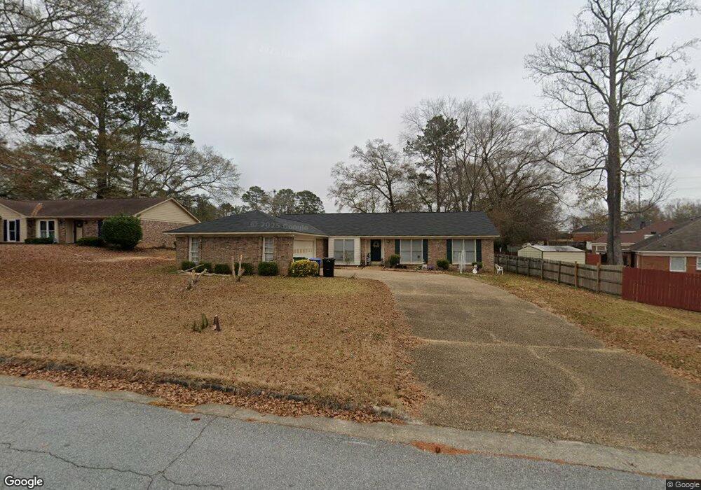
5910 Ironstone Dr Columbus, GA 31907
Midland NeighborhoodEstimated Value: $244,000 - $272,000
3
Beds
2
Baths
2,009
Sq Ft
$126/Sq Ft
Est. Value
About This Home
This home is located at 5910 Ironstone Dr, Columbus, GA 31907 and is currently estimated at $253,775, approximately $126 per square foot. 5910 Ironstone Dr is a home located in Muscogee County with nearby schools including Waddell Elementary School, Aaron Cohn Middle School, and Shaw High School.
Ownership History
Date
Name
Owned For
Owner Type
Purchase Details
Closed on
Apr 6, 2022
Sold by
Realistry Acquisitions Llc
Bought by
Lannu Patrick and Lannu Catherine F
Current Estimated Value
Home Financials for this Owner
Home Financials are based on the most recent Mortgage that was taken out on this home.
Original Mortgage
$198,850
Outstanding Balance
$186,061
Interest Rate
3.89%
Mortgage Type
New Conventional
Estimated Equity
$67,714
Purchase Details
Closed on
Dec 16, 2021
Sold by
Blackmon Brenda A
Bought by
Realistry Acquisitions Llc
Create a Home Valuation Report for This Property
The Home Valuation Report is an in-depth analysis detailing your home's value as well as a comparison with similar homes in the area
Home Values in the Area
Average Home Value in this Area
Purchase History
| Date | Buyer | Sale Price | Title Company |
|---|---|---|---|
| Lannu Patrick | $205,000 | None Listed On Document | |
| Realistry Acquisitions Llc | $158,000 | None Listed On Document | |
| Realistry Acquisitions Llc | $158,000 | -- |
Source: Public Records
Mortgage History
| Date | Status | Borrower | Loan Amount |
|---|---|---|---|
| Open | Lannu Patrick | $198,850 |
Source: Public Records
Tax History Compared to Growth
Tax History
| Year | Tax Paid | Tax Assessment Tax Assessment Total Assessment is a certain percentage of the fair market value that is determined by local assessors to be the total taxable value of land and additions on the property. | Land | Improvement |
|---|---|---|---|---|
| 2025 | $2,694 | $80,208 | $10,940 | $69,268 |
| 2024 | $2,693 | $80,208 | $10,940 | $69,268 |
| 2023 | $2,015 | $82,000 | $10,040 | $71,960 |
| 2022 | $2,581 | $63,200 | $10,200 | $53,000 |
| 2021 | $2,360 | $57,800 | $10,940 | $46,860 |
| 2020 | $2,361 | $57,800 | $10,940 | $46,860 |
| 2019 | $2,368 | $57,800 | $10,940 | $46,860 |
| 2018 | $2,368 | $57,800 | $10,940 | $46,860 |
| 2017 | $2,376 | $57,800 | $10,940 | $46,860 |
| 2016 | $3,102 | $75,200 | $8,346 | $66,854 |
| 2015 | $3,106 | $75,200 | $8,346 | $66,854 |
| 2014 | $3,110 | $75,200 | $8,346 | $66,854 |
| 2013 | -- | $75,200 | $8,346 | $66,854 |
Source: Public Records
Map
Nearby Homes
- 5717 Flat Rock Rd
- 6321 Milgen Rd Unit 3
- 7170 Beaver Run Rd
- 6437 Woodbriar Ln
- 5434 Rockhurst Dr
- 7101 Cross Tie Dr
- 7265 E Wynfield Loop
- 2 Mink Ct
- 7593 Beaver Run Rd
- 5 Mink Ct
- 7613 Mockernut Way
- 6055 Psalmond Rd
- 6544 Mink Dr
- 6236 Olde Towne Dr
- 6606 Widgeon Dr
- 6215 Parker Dr
- 5640 Lakeshore Rd
- 6834 Beaver Trail
- 6601 Psalmond Rd
- 6454 Patriot Dr
- 6901 Flagstone Dr
- 5920 Ironstone Dr
- 6916 Sandstone Ct
- 6909 Flagstone Dr
- 6924 Sandstone Ct
- 5909 Ironstone Dr
- 5901 Ironstone Dr
- 5925 Ironstone Dr
- 6917 Flagstone Dr
- 6909 Sandstone Ct
- 6917 Sandstone Ct
- 6901 Sandstone Ct
- 6932 Sandstone Ct
- 5841 Ironstone Dr
- 5933 Ironstone Dr
- 6900 Flagstone Dr
- 6925 Sandstone Ct
- 7 S Theri Ct
- 6908 Flagstone Dr
- 8 S Theri Ct