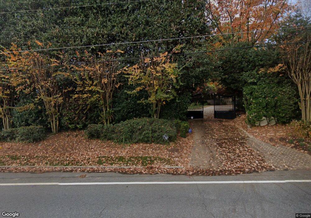
5910 Long Island Dr NW Atlanta, GA 30328
Estimated Value: $2,372,706 - $3,917,000
6
Beds
6
Baths
9,374
Sq Ft
$331/Sq Ft
Est. Value
About This Home
This home is located at 5910 Long Island Dr NW, Atlanta, GA 30328 and is currently estimated at $3,100,569, approximately $330 per square foot. 5910 Long Island Dr NW is a home located in Fulton County with nearby schools including Heards Ferry Elementary School, Ridgeview Charter School, and Riverwood International Charter School.
Ownership History
Date
Name
Owned For
Owner Type
Purchase Details
Closed on
Nov 12, 1999
Sold by
Mcgovern Michael
Bought by
Mcgovern Michael and Mcgovern Elizabeth B
Current Estimated Value
Purchase Details
Closed on
Feb 5, 1998
Sold by
Megel Dorothy P
Bought by
Mcgovern Michael
Home Financials for this Owner
Home Financials are based on the most recent Mortgage that was taken out on this home.
Original Mortgage
$800,000
Interest Rate
6.5%
Mortgage Type
New Conventional
Create a Home Valuation Report for This Property
The Home Valuation Report is an in-depth analysis detailing your home's value as well as a comparison with similar homes in the area
Home Values in the Area
Average Home Value in this Area
Purchase History
| Date | Buyer | Sale Price | Title Company |
|---|---|---|---|
| Mcgovern Michael | -- | -- | |
| Mcgovern Michael | $1,200,000 | -- |
Source: Public Records
Mortgage History
| Date | Status | Borrower | Loan Amount |
|---|---|---|---|
| Previous Owner | Mcgovern Michael | $800,000 |
Source: Public Records
Tax History Compared to Growth
Tax History
| Year | Tax Paid | Tax Assessment Tax Assessment Total Assessment is a certain percentage of the fair market value that is determined by local assessors to be the total taxable value of land and additions on the property. | Land | Improvement |
|---|---|---|---|---|
| 2025 | $25,009 | $2,067,200 | $130,000 | $1,937,200 |
| 2023 | $43,583 | $1,544,080 | $96,680 | $1,447,400 |
| 2022 | $23,614 | $1,017,120 | $137,040 | $880,080 |
| 2021 | $23,543 | $1,016,640 | $125,360 | $891,280 |
| 2020 | $23,806 | $1,179,640 | $128,040 | $1,051,600 |
| 2019 | $24,007 | $1,158,800 | $125,800 | $1,033,000 |
| 2018 | $19,951 | $811,040 | $106,800 | $704,240 |
| 2017 | $20,531 | $617,880 | $199,920 | $417,960 |
| 2016 | $20,533 | $617,880 | $199,920 | $417,960 |
| 2015 | $19,686 | $590,880 | $199,920 | $390,960 |
| 2014 | $20,446 | $590,880 | $199,920 | $390,960 |
Source: Public Records
Map
Nearby Homes
- 261 Mount Vernon Hwy NW
- 277 Mount Vernon Hwy NW
- 5800 de Claire Ct
- 702 Bass Way
- 265 Glen Lake Dr NW
- 140 Grosvenor Place
- 290 Glen Lake Dr NW
- 5757 Long Island Dr NW
- 5860 Riverwood Dr
- 500 Cameron Manor Way NW
- 905 Lancaster Way NW
- 580 Cliftwood Ct NE
- 45 Forrest Place
- 25 Forrest Place
- 460 Riverside Pkwy NW
- 5920 Long Island Dr NW
- 5930 Long Island Dr NW
- 915 Greyfield Place NW
- 925 Greyfield Place NW
- 5845 de Claire Ct
- 905 Greyfield Place NW
- 0 Greyfield Place NW Unit 7243708
- 0 Greyfield Place NW
- 935 Greyfield Place NW
- 5800 Long Grove Dr NW
- 5810 Long Grove Dr NW
- 5790 Long Grove Dr NW
- 5855 de Claire Ct
- 5825 de Claire Ct
- 5950 Long Island Dr NW
- 945 Greyfield Place NW
- 5820 Long Grove Dr NW
- 5780 Long Grove Dr NW
- 910 Greyfield Place NW
- 5835 de Claire Ct NW
