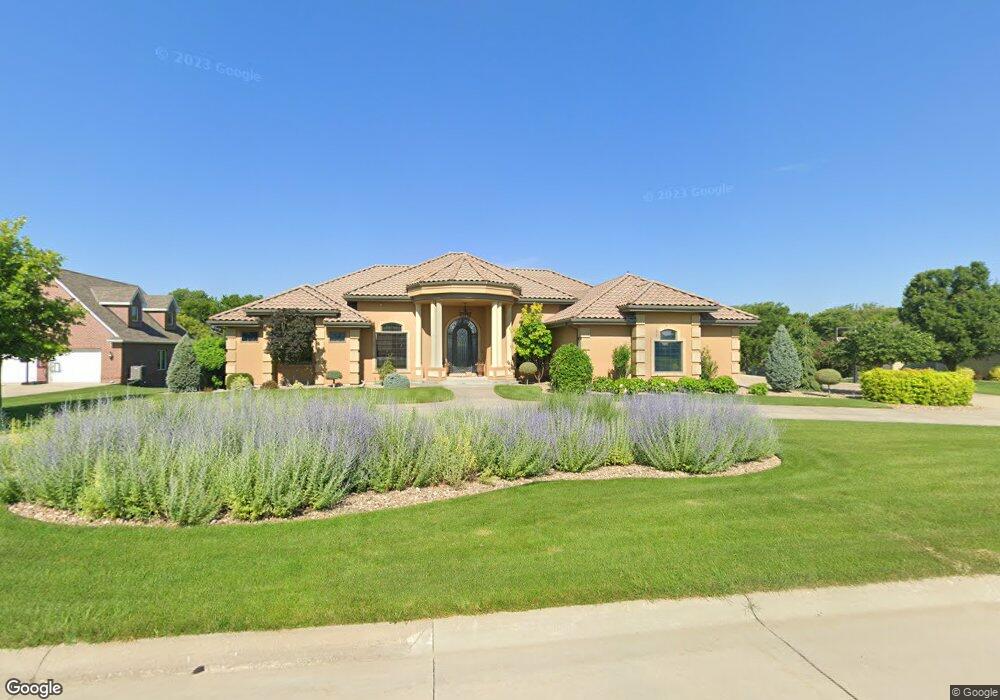
5911 Quail Ridge Ave Hastings, NE 68901
Estimated Value: $1,028,413 - $1,258,000
4
Beds
6
Baths
3,972
Sq Ft
$291/Sq Ft
Est. Value
About This Home
This home is located at 5911 Quail Ridge Ave, Hastings, NE 68901 and is currently estimated at $1,157,471, approximately $291 per square foot. 5911 Quail Ridge Ave is a home located in Adams County with nearby schools including Adams County 15, Wallace School, and Adams Central Elementary School.
Ownership History
Date
Name
Owned For
Owner Type
Purchase Details
Closed on
Mar 2, 2014
Sold by
Powers Vern P and Powers Cheryl A
Bought by
Pershing Matthew and Pershing Stephanie
Current Estimated Value
Home Financials for this Owner
Home Financials are based on the most recent Mortgage that was taken out on this home.
Original Mortgage
$637,500
Outstanding Balance
$481,914
Interest Rate
4.27%
Mortgage Type
New Conventional
Estimated Equity
$675,557
Create a Home Valuation Report for This Property
The Home Valuation Report is an in-depth analysis detailing your home's value as well as a comparison with similar homes in the area
Home Values in the Area
Average Home Value in this Area
Purchase History
| Date | Buyer | Sale Price | Title Company |
|---|---|---|---|
| Pershing Matthew | $800,000 | Elizabeth Prairie Title |
Source: Public Records
Mortgage History
| Date | Status | Borrower | Loan Amount |
|---|---|---|---|
| Open | Pershing Matthew | $637,500 |
Source: Public Records
Tax History Compared to Growth
Tax History
| Year | Tax Paid | Tax Assessment Tax Assessment Total Assessment is a certain percentage of the fair market value that is determined by local assessors to be the total taxable value of land and additions on the property. | Land | Improvement |
|---|---|---|---|---|
| 2024 | $12,247 | $1,009,877 | $86,915 | $922,962 |
| 2023 | $14,397 | $910,499 | $86,915 | $823,584 |
| 2022 | $15,447 | $910,499 | $86,915 | $823,584 |
| 2021 | $14,866 | $903,439 | $75,544 | $827,895 |
| 2020 | $14,480 | $903,439 | $75,544 | $827,895 |
| 2019 | $14,118 | $903,439 | $75,544 | $827,895 |
| 2018 | $14,004 | $882,335 | $64,880 | $817,455 |
| 2017 | $13,896 | $882,335 | $0 | $0 |
| 2016 | $12,675 | $828,855 | $64,880 | $763,975 |
| 2011 | -- | $583,630 | $44,215 | $539,415 |
Source: Public Records
Map
Nearby Homes
- 508 Quail Cir
- 5905 Mallard Way
- 5804 Pheasant Run Ave
- 15 Village Dr
- 920 Highland Dr
- 843 Highland Dr
- 5402 Randolph Cir
- 0 Jordan Way
- 635 E Lochland Rd
- XXX E Osborne Dr
- 3610 Wendell Dr
- 3202 Lake Park Ln
- 602 Dockside Cove
- 2907 Lakeview Cove
- 3109 W Laux Dr
- 3107 W Laux Dr
- 604 Brooking Cir
- 2900 Wendell Dr
- 3117 Frahm Ln
- 3211 E Laux Dr
- 5907 Quail Ridge Ave
- 6001 Quail Ridge Ave
- 5914 Quail Ridge Ave
- 5905 Quail Ridge Ave
- 5910 Quail Ridge Ave
- 6005 Quail Ridge Ave
- 5903 Quail Ridge Ave
- 605 Mallard Cir
- 5906 Quail Ridge Ave
- 511 Quail Cir
- 604 Mallard Cir
- 603 Mallard Cir
- 6101 Quail Ridge Ave
- 5901 Quail Ridge Ave
- 507 Quail Cir
- 504 Quail Cir
- 6104 Quail Ridge Ave
- 600 Mallard Cir
- 604 Foxrun
- 503 Quail Cir