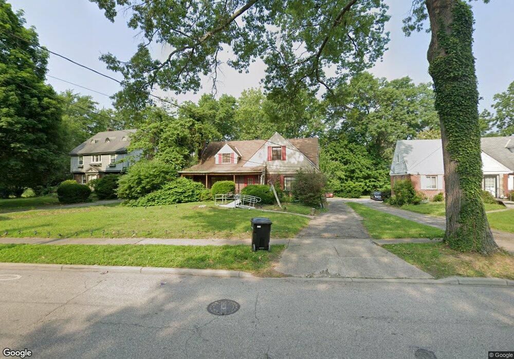
5911 Red Bank Rd Cincinnati, OH 45213
Kennedy Heights NeighborhoodEstimated Value: $310,000 - $355,000
3
Beds
2
Baths
1,252
Sq Ft
$272/Sq Ft
Est. Value
About This Home
This home is located at 5911 Red Bank Rd, Cincinnati, OH 45213 and is currently estimated at $340,399, approximately $271 per square foot. 5911 Red Bank Rd is a home located in Hamilton County with nearby schools including John P. Parker School, Shroder High School, and Clark Montessori High School.
Ownership History
Date
Name
Owned For
Owner Type
Purchase Details
Closed on
Jun 30, 2011
Sold by
Burnet Capital Llc
Bought by
H/H Group Llc
Current Estimated Value
Purchase Details
Closed on
Nov 25, 2007
Sold by
Jones Larry
Bought by
Jones Larry and Jones Judy C
Purchase Details
Closed on
Oct 18, 2007
Sold by
Estate Of Rufus Jones
Bought by
Jones Larry
Purchase Details
Closed on
Dec 4, 1998
Sold by
Estate Of Ida Jones
Bought by
Jones Rufus
Create a Home Valuation Report for This Property
The Home Valuation Report is an in-depth analysis detailing your home's value as well as a comparison with similar homes in the area
Home Values in the Area
Average Home Value in this Area
Purchase History
| Date | Buyer | Sale Price | Title Company |
|---|---|---|---|
| H/H Group Llc | $84,500 | Attorney | |
| Burnet Capital Llc | $55,000 | American Homeland Title Agen | |
| Jones Larry | -- | None Available | |
| Jones Larry | -- | None Available | |
| Jones Rufus | -- | -- |
Source: Public Records
Tax History Compared to Growth
Tax History
| Year | Tax Paid | Tax Assessment Tax Assessment Total Assessment is a certain percentage of the fair market value that is determined by local assessors to be the total taxable value of land and additions on the property. | Land | Improvement |
|---|---|---|---|---|
| 2024 | $4,650 | $77,662 | $21,623 | $56,039 |
| 2023 | $4,755 | $77,662 | $21,623 | $56,039 |
| 2022 | $3,777 | $55,262 | $16,289 | $38,973 |
| 2021 | $3,631 | $55,262 | $16,289 | $38,973 |
| 2020 | $3,737 | $55,262 | $16,289 | $38,973 |
| 2019 | $3,616 | $48,906 | $14,417 | $34,489 |
| 2018 | $3,622 | $48,906 | $14,417 | $34,489 |
| 2017 | $3,440 | $48,906 | $14,417 | $34,489 |
| 2016 | $4,117 | $57,761 | $14,651 | $43,110 |
| 2015 | $3,713 | $57,761 | $14,651 | $43,110 |
| 2014 | $3,739 | $57,761 | $14,651 | $43,110 |
| 2013 | $3,623 | $55,010 | $13,955 | $41,055 |
Source: Public Records
Map
Nearby Homes
- 3766 Aikenside Ave
- 57 Red Bank Rd
- 3813 Congreve Ave
- 6133 Red Bank Rd
- 6007 Lillian Ave
- 6063 Woodford Ct
- 3751 Dunloe Ave
- 6097 W Fordham Place
- 3635 Northdale Place
- 5473 Ehrling Rd
- 6124 Hedge Ave
- 6047 Kennedy Ave
- 5565 Ehrling Rd
- 6212 Coleridge Ave
- 3969 S Fordham Place
- 3717 Standish Ave
- 3962 S Fordham Place
- 6218 Coleridge Ave
- 6218 Kennedy Ave
- 3824 Standish Ave
- 5915 Red Bank Rd
- 5905 Red Bank Rd
- 5921 Red Bank Rd
- 5867 Red Bank Rd
- 5925 Red Bank Rd
- 5922 Red Bank Rd
- 5857 Red Bank Rd
- 3771 Woodford Rd
- 5916 Red Bank Rd
- 3765 Woodford Rd
- 3759 Woodford Rd
- 5906 Red Bank Rd
- 5852 Pointer Ln
- 5850 Pointer Ln
- 5859 Red Bank Rd
- 3746 Aikenside Ave
- 3740 Aikenside Ave
- 3750 Aikenside Ave
- 3753 Woodford Rd
- 5853 Pointer Ln