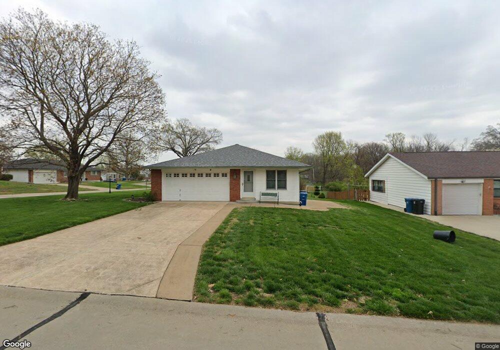
5912 Savio Dr Saint Louis, MO 63123
Estimated Value: $308,000 - $334,000
3
Beds
2
Baths
1,713
Sq Ft
$189/Sq Ft
Est. Value
About This Home
This home is located at 5912 Savio Dr, Saint Louis, MO 63123 and is currently estimated at $324,029, approximately $189 per square foot. 5912 Savio Dr is a home located in St. Louis County with nearby schools including Mesnier Primary School, Gotsch Intermediate School, and Rogers Middle School.
Ownership History
Date
Name
Owned For
Owner Type
Purchase Details
Closed on
Jun 22, 2007
Sold by
Swenson Steven C and Swenson Kathleen A
Bought by
Geiser Nancy J and Geiser Gerald J
Current Estimated Value
Home Financials for this Owner
Home Financials are based on the most recent Mortgage that was taken out on this home.
Original Mortgage
$70,000
Outstanding Balance
$42,833
Interest Rate
6.19%
Mortgage Type
Purchase Money Mortgage
Estimated Equity
$281,196
Purchase Details
Closed on
Dec 23, 2002
Sold by
Bixler Janice J
Bought by
Swenson Steven C and Swenson Kathleen A
Home Financials for this Owner
Home Financials are based on the most recent Mortgage that was taken out on this home.
Original Mortgage
$127,100
Interest Rate
5.96%
Create a Home Valuation Report for This Property
The Home Valuation Report is an in-depth analysis detailing your home's value as well as a comparison with similar homes in the area
Home Values in the Area
Average Home Value in this Area
Purchase History
| Date | Buyer | Sale Price | Title Company |
|---|---|---|---|
| Geiser Nancy J | $210,000 | None Available | |
| Swenson Steven C | $158,900 | -- |
Source: Public Records
Mortgage History
| Date | Status | Borrower | Loan Amount |
|---|---|---|---|
| Open | Geiser Nancy J | $70,000 | |
| Previous Owner | Swenson Steven C | $127,100 |
Source: Public Records
Tax History Compared to Growth
Tax History
| Year | Tax Paid | Tax Assessment Tax Assessment Total Assessment is a certain percentage of the fair market value that is determined by local assessors to be the total taxable value of land and additions on the property. | Land | Improvement |
|---|---|---|---|---|
| 2025 | $4,140 | $54,300 | $13,680 | $40,620 |
| 2024 | $4,140 | $51,460 | $16,590 | $34,870 |
| 2023 | $4,002 | $51,460 | $16,590 | $34,870 |
| 2022 | $3,816 | $44,690 | $13,490 | $31,200 |
| 2021 | $3,727 | $44,690 | $13,490 | $31,200 |
| 2020 | $3,516 | $39,330 | $8,890 | $30,440 |
| 2019 | $3,510 | $39,330 | $8,890 | $30,440 |
| 2018 | $3,188 | $31,560 | $8,550 | $23,010 |
| 2017 | $3,168 | $31,560 | $8,550 | $23,010 |
| 2016 | $2,607 | $27,570 | $8,550 | $19,020 |
| 2015 | $2,620 | $27,570 | $8,550 | $19,020 |
| 2014 | $2,807 | $29,450 | $8,230 | $21,220 |
Source: Public Records
Map
Nearby Homes
- 6126 Savio Dr
- 5900 Apple Valley Dr
- 7561 Terri Lynn Dr
- 7647 Genesta St
- 8019 Gramond Dr
- 6529 Anna Grace Ln
- 8027 McGee St
- 7637 Fleta St
- 8022 Joel Ave
- 6724 Preservation Pkwy
- 8029 Joel Ave
- 8032 Joel Ave
- 7610 Fleta St
- 7908 Fleta St
- 6870 Foxcroft Dr
- Magnolia Plan at The Preserve - Designer Collection
- Wyatt Plan at The Preserve - Designer Collection
- Calvin Plan at The Preserve - Designer Collection
- Ivy Plan at The Preserve - Designer Collection
- Avery Plan at The Preserve - Designer Collection
- 7730 Ravenhill Dr
- 5906 Savio Dr
- 5909 Savio Dr
- 5909 Pebble Hill Dr
- 6000 Savio Dr
- 5900 Savio Dr
- 5901 Savio Dr
- 7723 Ravenhill Dr
- 5901 Pebble Hill Dr
- 7709 Ravenhill Dr
- 6001 Pebble Hill Dr
- 7704 Ravenhill Dr
- 6008 Savio Dr
- 7631 Mission Valley Dr
- 7640 Mission Valley Dr
- 6009 Pebble Hill Dr
- 7644 Mission Valley Dr
- 7701 Ravenhill Dr
- 7800 Apple Valley Dr
- 5906 Pebble Hill Dr