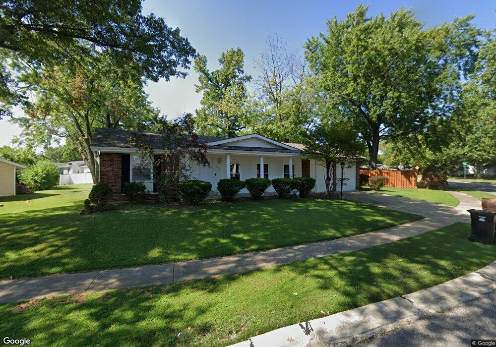
5912 Sir Edward Ct Florissant, MO 63033
Estimated Value: $212,000 - $235,000
3
Beds
2
Baths
1,474
Sq Ft
$151/Sq Ft
Est. Value
About This Home
This home is located at 5912 Sir Edward Ct, Florissant, MO 63033 and is currently estimated at $223,153, approximately $151 per square foot. 5912 Sir Edward Ct is a home located in St. Louis County with nearby schools including Jamestown Elementary School, Central Middle School, and Hazelwood Central High School.
Ownership History
Date
Name
Owned For
Owner Type
Purchase Details
Closed on
Aug 20, 2024
Sold by
Callahan Cleo S
Bought by
Callahan Dennette Michelle
Current Estimated Value
Purchase Details
Closed on
Jul 26, 1999
Sold by
Ward Kevin M and Ward Linda J
Bought by
Callahan Cleo S
Home Financials for this Owner
Home Financials are based on the most recent Mortgage that was taken out on this home.
Original Mortgage
$91,953
Interest Rate
7.63%
Mortgage Type
FHA
Create a Home Valuation Report for This Property
The Home Valuation Report is an in-depth analysis detailing your home's value as well as a comparison with similar homes in the area
Home Values in the Area
Average Home Value in this Area
Purchase History
| Date | Buyer | Sale Price | Title Company |
|---|---|---|---|
| Callahan Dennette Michelle | -- | None Listed On Document | |
| Callahan Cleo S | $92,000 | -- |
Source: Public Records
Mortgage History
| Date | Status | Borrower | Loan Amount |
|---|---|---|---|
| Previous Owner | Callahan Cleo S | $91,953 |
Source: Public Records
Tax History Compared to Growth
Tax History
| Year | Tax Paid | Tax Assessment Tax Assessment Total Assessment is a certain percentage of the fair market value that is determined by local assessors to be the total taxable value of land and additions on the property. | Land | Improvement |
|---|---|---|---|---|
| 2025 | $3,021 | $35,990 | $4,940 | $31,050 |
| 2024 | $3,021 | $33,440 | $3,420 | $30,020 |
| 2023 | $3,011 | $33,440 | $3,420 | $30,020 |
| 2022 | $2,743 | $27,090 | $5,700 | $21,390 |
| 2021 | $2,595 | $27,090 | $5,700 | $21,390 |
| 2020 | $2,440 | $23,710 | $4,940 | $18,770 |
| 2019 | $2,420 | $23,710 | $4,940 | $18,770 |
| 2018 | $2,106 | $19,040 | $1,920 | $17,120 |
| 2017 | $2,103 | $19,040 | $1,920 | $17,120 |
| 2016 | $1,874 | $16,660 | $2,680 | $13,980 |
| 2015 | $1,831 | $16,660 | $2,680 | $13,980 |
| 2014 | $1,616 | $14,610 | $3,670 | $10,940 |
Source: Public Records
Map
Nearby Homes
- 12095 El Camara Dr
- 12292 Jerries Ln
- 12065 El Camara Dr
- 11951 Jerries Ln
- 5348 Trailoaks Dr
- 5432 Trailbend Dr
- 12136 La Padera Ln
- 5372 Trailbend Dr
- 5239 Trailoaks Dr
- 12455 Jerries Ln
- 6250 Pennyrich Ct
- 12320 Missile Ln
- 5226 Suntrail Dr
- 11774 El Somo Ct
- 11922 La Padera Ln
- 12582 Springtrail Dr
- 11760 Sheffield Dr
- 6530 Farm Pond Ct
- 6480 Hadden Bay Dr
- 6320 Hadden Bay Dr
- 5932 Sir Edward Ct
- 12152 Jerries Ln
- 12142 Jerries Ln
- 5942 Sir Edward Ct
- 5921 Sir Edward Ct
- 5931 Sir Edward Ct
- 5911 Sir Edward Ct
- 12172 Jerries Ln
- 5941 Sir Edward Ct
- 12132 Jerries Ln
- 5951 Sir Edward Ct
- 5952 Sir Edward Ct
- 12151 Jerries Ln
- 12182 Jerries Ln
- 12141 Jerries Ln
- 5961 Sir Edward Ct
- 12122 Jerries Ln
- 5891 Sir Edward Ln
- 5882 Sir Edward Ln
- 5962 Sir Edward Ct