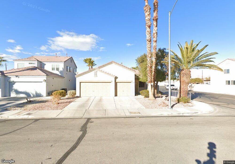
5912 Spinnaker Point Ave Las Vegas, NV 89110
Estimated Value: $389,000 - $427,000
3
Beds
2
Baths
1,488
Sq Ft
$272/Sq Ft
Est. Value
About This Home
This home is located at 5912 Spinnaker Point Ave, Las Vegas, NV 89110 and is currently estimated at $405,292, approximately $272 per square foot. 5912 Spinnaker Point Ave is a home located in Clark County with nearby schools including Kirk Adams Elementary School, Duane D. Keller Middle School, and Eldorado High School.
Ownership History
Date
Name
Owned For
Owner Type
Purchase Details
Closed on
Jun 13, 2003
Sold by
Kmetz Paul R and Kmetz Theresa M
Bought by
Kmetz Paul R and Kmetz Theresa M
Current Estimated Value
Purchase Details
Closed on
Sep 22, 1999
Sold by
Abc Development Group Ltd
Bought by
Kmetz Paul R and Kmetz Theresa M
Home Financials for this Owner
Home Financials are based on the most recent Mortgage that was taken out on this home.
Original Mortgage
$137,450
Interest Rate
8.24%
Create a Home Valuation Report for This Property
The Home Valuation Report is an in-depth analysis detailing your home's value as well as a comparison with similar homes in the area
Home Values in the Area
Average Home Value in this Area
Purchase History
| Date | Buyer | Sale Price | Title Company |
|---|---|---|---|
| Kmetz Paul R | -- | -- | |
| Kmetz Paul R | $152,766 | Old Republic Title Company |
Source: Public Records
Mortgage History
| Date | Status | Borrower | Loan Amount |
|---|---|---|---|
| Previous Owner | Kmetz Paul R | $137,450 |
Source: Public Records
Tax History Compared to Growth
Tax History
| Year | Tax Paid | Tax Assessment Tax Assessment Total Assessment is a certain percentage of the fair market value that is determined by local assessors to be the total taxable value of land and additions on the property. | Land | Improvement |
|---|---|---|---|---|
| 2025 | $1,242 | $91,237 | $30,450 | $60,787 |
| 2024 | $1,206 | $91,237 | $30,450 | $60,787 |
| 2023 | $1,206 | $87,505 | $30,100 | $57,405 |
| 2022 | $1,171 | $78,297 | $25,900 | $52,397 |
| 2021 | $1,137 | $73,006 | $23,100 | $49,906 |
| 2020 | $1,101 | $71,934 | $22,400 | $49,534 |
| 2019 | $1,069 | $68,173 | $19,250 | $48,923 |
| 2018 | $1,038 | $62,722 | $15,750 | $46,972 |
| 2017 | $1,824 | $62,200 | $14,700 | $47,500 |
| 2016 | $984 | $43,437 | $10,500 | $32,937 |
| 2015 | $981 | $43,517 | $10,500 | $33,017 |
| 2014 | $952 | $32,717 | $4,550 | $28,167 |
Source: Public Records
Map
Nearby Homes
- 5854 Heather Marie Dr
- 5907 Zawawi Ct
- 266 Lyra Ln
- 0 Madge Ln
- 262 Solicito St
- 316 Linn Ln
- 523 Moon Chase St
- 563 Moon Chase St
- 522 Wheaties Way
- 6209 Exquisite Ave
- 131 Beesley Dr
- 5794 Sea Breeze Ave
- 741 Round Table Dr
- 740 Santree Cir
- 5529 Cedar Ave
- 360 Sir Richard Dr E
- 656 N Christy Ln
- 1148 Orchard View St Unit 2
- 5583 Orchard Ln Unit 152
- 6400 Stewart Ave
- 6495 New Brunswick
- 1571 Betty Ln
- 5902 Spinnaker Point Ave Unit 1
- 5932 Spinnaker Point Ave
- 5942 Spinnaker Point Ave
- 5913 Spinnaker Point Ave
- 5903 Spinnaker Point Ave
- 5923 Spinnaker Point Ave Unit 1
- 5933 Spinnaker Point Ave
- 5952 Spinnaker Point Ave
- 5943 Spinnaker Point Ave Unit 1
- 386 Searchlight Dr
- 386 Searchlight Dr
- 392 Searchlight Dr
- 380 Searchlight Dr
- 5900 Stewart Ave
- 374 Searchlight Dr
- 5962 Spinnaker Point Ave
- 5953 Spinnaker Point Ave
- 5914 Bushra Ct Unit 1