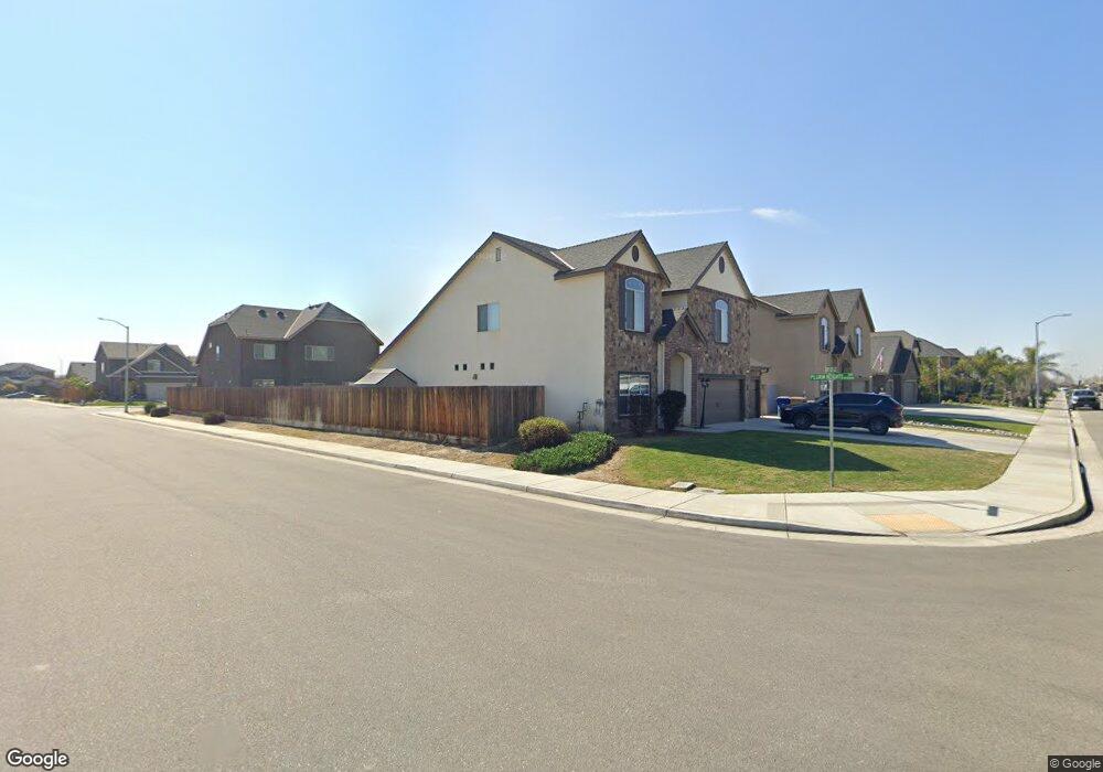
5913 Cape Cod Ave Bakersfield, CA 93313
Panama NeighborhoodEstimated Value: $469,629 - $530,000
4
Beds
3
Baths
1,507
Sq Ft
$334/Sq Ft
Est. Value
About This Home
This home is located at 5913 Cape Cod Ave, Bakersfield, CA 93313 and is currently estimated at $503,157, approximately $333 per square foot. 5913 Cape Cod Ave is a home with nearby schools including Bill L. Williams Elementary School, Stonecreek Junior High School, and Ridgeview High School.
Ownership History
Date
Name
Owned For
Owner Type
Purchase Details
Closed on
Apr 27, 2015
Sold by
Moran Yesenia Margarita
Bought by
Moran Andrew Anthony
Current Estimated Value
Home Financials for this Owner
Home Financials are based on the most recent Mortgage that was taken out on this home.
Original Mortgage
$291,175
Outstanding Balance
$108,088
Interest Rate
3.64%
Mortgage Type
New Conventional
Estimated Equity
$395,069
Purchase Details
Closed on
Apr 9, 2015
Sold by
Lennar Fresno Inc
Bought by
Moran Andrew Anthony
Home Financials for this Owner
Home Financials are based on the most recent Mortgage that was taken out on this home.
Original Mortgage
$291,175
Outstanding Balance
$108,088
Interest Rate
3.64%
Mortgage Type
New Conventional
Estimated Equity
$395,069
Create a Home Valuation Report for This Property
The Home Valuation Report is an in-depth analysis detailing your home's value as well as a comparison with similar homes in the area
Home Values in the Area
Average Home Value in this Area
Purchase History
| Date | Buyer | Sale Price | Title Company |
|---|---|---|---|
| Moran Andrew Anthony | -- | North American Title Co Inc | |
| Moran Andrew Anthony | $311,500 | North American Title Company |
Source: Public Records
Mortgage History
| Date | Status | Borrower | Loan Amount |
|---|---|---|---|
| Open | Moran Andrew Anthony | $291,175 | |
| Closed | Moran Andrew Anthony | $291,175 |
Source: Public Records
Tax History
| Year | Tax Paid | Tax Assessment Tax Assessment Total Assessment is a certain percentage of the fair market value that is determined by local assessors to be the total taxable value of land and additions on the property. | Land | Improvement |
|---|---|---|---|---|
| 2025 | $5,089 | $373,765 | $60,089 | $313,676 |
| 2024 | $5,003 | $366,437 | $58,911 | $307,526 |
| 2023 | $5,003 | $359,253 | $57,756 | $301,497 |
| 2022 | $4,801 | $352,210 | $56,624 | $295,586 |
| 2021 | $4,666 | $345,305 | $55,514 | $289,791 |
| 2020 | $4,605 | $341,765 | $54,945 | $286,820 |
| 2019 | $4,544 | $341,765 | $54,945 | $286,820 |
| 2018 | $4,346 | $328,496 | $52,812 | $275,684 |
| 2017 | $4,267 | $322,056 | $51,777 | $270,279 |
| 2016 | $4,013 | $315,742 | $50,762 | $264,980 |
| 2015 | $1,441 | $71,632 | $32,632 | $39,000 |
Source: Public Records
Map
Nearby Homes
- 9000 Farmington Way
- 6225 Thorton Ave
- 6405 Thorton Ave
- 5918 Esmerelda Ave
- 5808 Esmerelda Ave
- 5414 Red Wheat Ave
- 6009 Moonstone Peak Dr
- 5612 Mckee Rd
- 5805 Moonstone Peak Dr
- 5831 Mardal Ave
- 10000 Fitchburg Dr
- 5809 Commonwealth Ave
- 6200 Whaleback Ave
- 9506 Orchard Grass Ct
- 8216 Coral Point Ct
- 5917 Vespucci Ave
- 6003 Vespucci Ave
- 6203 Caruso Ave
- 4403 Oceanrock Ave
- 6208 Caruso Ave
- 6003 Cape Cod Ave
- 5902 Provincetown Ave
- 6007 Cape Cod Ave
- 5906 Provincetown Ave
- 9300 Pilgrim Heights Dr
- 9306 Pilgrim Heights Dr
- 5910 Provincetown Ave
- 5912 Cape Cod Ave
- 6000 Cape Cod Ave
- 9312 Pilgrim Heights Dr
- 6011 Cape Cod Ave
- 5906 Cape Cod Ave
- 6004 Cape Cod Ave
- 9318 Pilgrim Heights Dr
- 5900 Cape Cod Ave
- 6000 Provincetown Ave
- 6008 Cape Cod Ave
- 6103 Cape Cod Ave
- 9301 Wareham Dr
- 9305 Wareham Dr
Your Personal Tour Guide
Ask me questions while you tour the home.