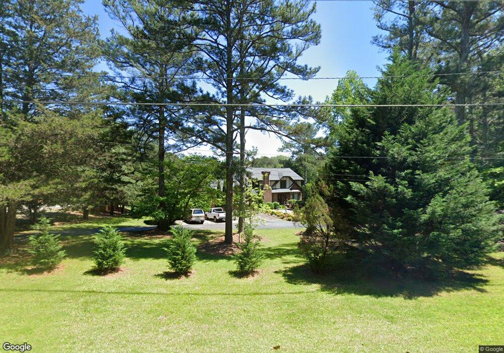
5913 Smoke Rise Ct Unit 1 Stone Mountain, GA 30087
Estimated Value: $569,000 - $609,756
5
Beds
4
Baths
2,678
Sq Ft
$222/Sq Ft
Est. Value
About This Home
This home is located at 5913 Smoke Rise Ct Unit 1, Stone Mountain, GA 30087 and is currently estimated at $593,439, approximately $221 per square foot. 5913 Smoke Rise Ct Unit 1 is a home located in Gwinnett County with nearby schools including Camp Creek Elementary School, Trickum Middle School, and Parkview High School.
Ownership History
Date
Name
Owned For
Owner Type
Purchase Details
Closed on
Apr 9, 2004
Sold by
Jacob Ronald H
Bought by
Griffin Jamie H
Current Estimated Value
Home Financials for this Owner
Home Financials are based on the most recent Mortgage that was taken out on this home.
Original Mortgage
$222,400
Outstanding Balance
$103,782
Interest Rate
5.54%
Mortgage Type
New Conventional
Estimated Equity
$489,657
Purchase Details
Closed on
Mar 5, 2002
Sold by
Smokerise Land Tr
Bought by
Jacob Ronald H
Home Financials for this Owner
Home Financials are based on the most recent Mortgage that was taken out on this home.
Original Mortgage
$249,000
Interest Rate
6.85%
Mortgage Type
New Conventional
Create a Home Valuation Report for This Property
The Home Valuation Report is an in-depth analysis detailing your home's value as well as a comparison with similar homes in the area
Home Values in the Area
Average Home Value in this Area
Purchase History
| Date | Buyer | Sale Price | Title Company |
|---|---|---|---|
| Griffin Jamie H | $278,000 | -- | |
| Jacob Ronald H | -- | -- |
Source: Public Records
Mortgage History
| Date | Status | Borrower | Loan Amount |
|---|---|---|---|
| Open | Griffin Jamie H | $222,400 | |
| Previous Owner | Jacob Ronald H | $249,000 |
Source: Public Records
Tax History Compared to Growth
Tax History
| Year | Tax Paid | Tax Assessment Tax Assessment Total Assessment is a certain percentage of the fair market value that is determined by local assessors to be the total taxable value of land and additions on the property. | Land | Improvement |
|---|---|---|---|---|
| 2024 | $6,939 | $224,240 | $36,160 | $188,080 |
| 2023 | $6,939 | $194,440 | $40,120 | $154,320 |
| 2022 | $5,662 | $165,040 | $36,120 | $128,920 |
| 2021 | $5,198 | $139,440 | $29,720 | $109,720 |
| 2020 | $5,231 | $139,440 | $29,720 | $109,720 |
| 2019 | $5,044 | $129,440 | $29,720 | $99,720 |
| 2018 | $4,436 | $111,880 | $24,120 | $87,760 |
| 2016 | $4,199 | $104,680 | $18,920 | $85,760 |
| 2015 | $4,251 | $104,680 | $18,920 | $85,760 |
| 2014 | $4,274 | $104,680 | $18,920 | $85,760 |
Source: Public Records
Map
Nearby Homes
- 292 Old Rosser Rd
- 5741 Wolf Laurel Ln SW
- 353 Old Rosser Rd
- 262 Harmony Grove Rd
- 5887 Stow Dr
- 5779 Chisholm Trail SW
- 29 Lankford Rd
- 127 Roe Hampton Ln
- 483 Rollingwood Dr
- 5796 Princeton Run Trail
- 507 Castleaire Dr Unit 1
- 507 Castlearie Dr
- 5798 Lost Grove Dr NW
- 5817 Lost Grove Dr NW Unit 2
- 5533 N Wind Dr SW
- 5781 Four Winds Dr SW Unit 1B
- 5578 Four Winds Dr SW Unit 3
- 5521 E Wind Dr SW
- 5836 Rue Villa Ln Unit 2
- 0 Smoke Rise Ct SW Unit 3235198
- 0 Smoke Rise Ct SW Unit 8602335
- 0 Smoke Rise Ct SW Unit 8090195
- 0 Smoke Rise Ct SW Unit 3125847
- 0 Smoke Rise Ct SW
- 208 Old Rosser Rd
- 5903 Smoke Rise Ct
- 5912 Smoke Rise Ct
- 219 Old Rosser Rd Unit 2
- 207 Old Rosser Rd
- 196 Old Rosser Rd
- 5893 Smoke Rise Ct
- 5902 Smoke Rise Ct
- 72 Parkstone Ct Unit 2
- 43 Wolverton Ct
- 244 Old Rosser Rd Unit 1
- 184 Old Rosser Rd
- 5883 Smoke Rise Ct
- 71 Parkstone Ct
- 256 Old Rosser Rd