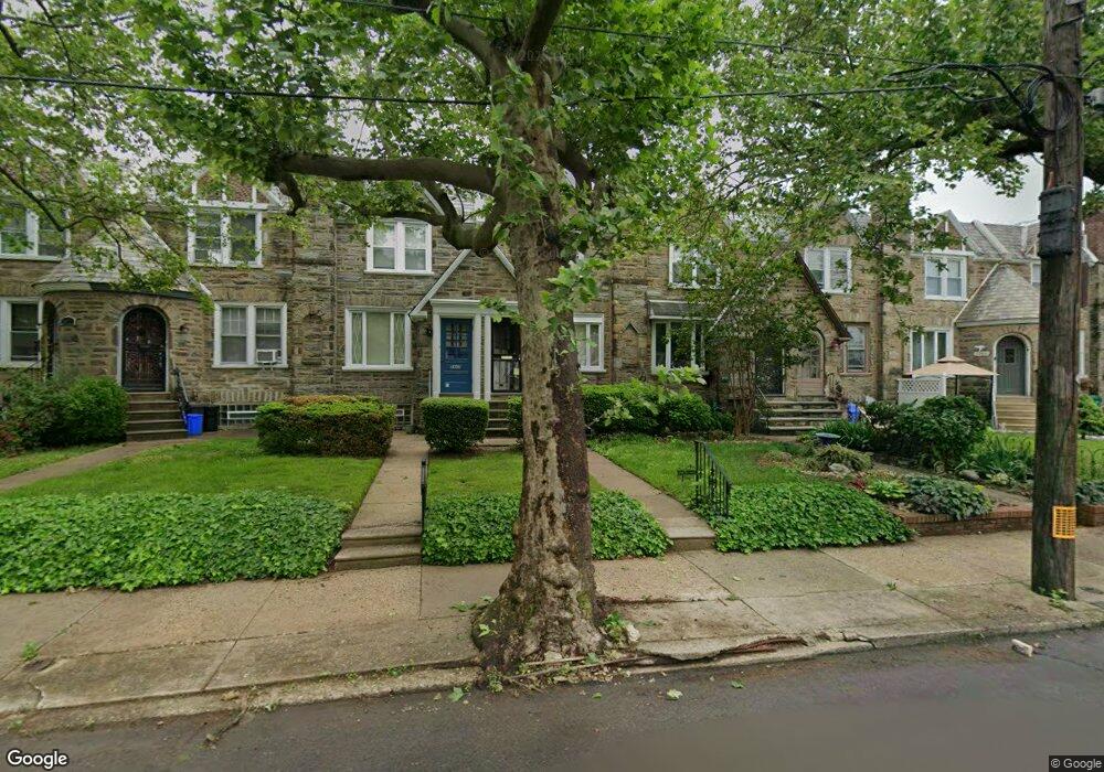
5915 Horrocks St Philadelphia, PA 19149
Mayfair NeighborhoodEstimated Value: $231,473 - $252,000
3
Beds
1
Bath
1,472
Sq Ft
$163/Sq Ft
Est. Value
About This Home
This home is located at 5915 Horrocks St, Philadelphia, PA 19149 and is currently estimated at $239,368, approximately $162 per square foot. 5915 Horrocks St is a home located in Philadelphia County with nearby schools including Ziegler William H School, Frankford High School, and The Philadelphia Charter School for the Arts & Sciences.
Ownership History
Date
Name
Owned For
Owner Type
Purchase Details
Closed on
Dec 11, 2002
Sold by
Hershman Linda Judith and Ojeda Karen
Bought by
Lockman Ronald
Current Estimated Value
Home Financials for this Owner
Home Financials are based on the most recent Mortgage that was taken out on this home.
Original Mortgage
$71,250
Outstanding Balance
$30,151
Interest Rate
6.16%
Estimated Equity
$209,217
Create a Home Valuation Report for This Property
The Home Valuation Report is an in-depth analysis detailing your home's value as well as a comparison with similar homes in the area
Home Values in the Area
Average Home Value in this Area
Purchase History
| Date | Buyer | Sale Price | Title Company |
|---|---|---|---|
| Lockman Ronald | $75,000 | -- |
Source: Public Records
Mortgage History
| Date | Status | Borrower | Loan Amount |
|---|---|---|---|
| Open | Lockman Ronald | $71,250 |
Source: Public Records
Tax History Compared to Growth
Tax History
| Year | Tax Paid | Tax Assessment Tax Assessment Total Assessment is a certain percentage of the fair market value that is determined by local assessors to be the total taxable value of land and additions on the property. | Land | Improvement |
|---|---|---|---|---|
| 2026 | $2,261 | $208,300 | $41,660 | $166,640 |
| 2025 | $2,261 | $208,300 | $41,660 | $166,640 |
| 2024 | $2,261 | $208,300 | $41,660 | $166,640 |
| 2023 | $2,261 | $161,500 | $32,300 | $129,200 |
| 2022 | $985 | $116,500 | $32,300 | $84,200 |
| 2021 | $1,615 | $0 | $0 | $0 |
| 2020 | $1,615 | $0 | $0 | $0 |
| 2019 | $1,550 | $0 | $0 | $0 |
| 2018 | $1,187 | $0 | $0 | $0 |
| 2017 | $1,607 | $0 | $0 | $0 |
| 2016 | $1,187 | $0 | $0 | $0 |
| 2015 | $1,136 | $0 | $0 | $0 |
| 2014 | -- | $114,800 | $23,496 | $91,304 |
| 2012 | -- | $15,456 | $1,572 | $13,884 |
Source: Public Records
Map
Nearby Homes
- 1530 Van Kirk St
- 1431 Rosalie St
- 6005 Horrocks St
- 1613 Van Kirk St
- 5828 Akron St
- 1622 E Howell St
- 7753 E Roosevelt Blvd
- 7600 E Roosevelt Blvd Unit 206
- 7600 E Roosevelt Blvd Unit 212
- 7600 E Roosevelt Blvd Unit 909
- 7600 E Roosevelt Blvd Unit 705
- 7600 E Roosevelt Blvd Unit 701
- 7600 E Roosevelt Blvd Unit 806
- 7600 E Roosevelt Blvd Unit 904
- 7600 E Roosevelt Blvd Unit 604
- 6632 E Roosevelt Blvd
- 7040 E Roosevelt Blvd
- 6054 E Roosevelt Blvd
- 7536 E Roosevelt Blvd
- 6840 E Roosevelt Blvd
- 5913 Horrocks St
- 5917 Horrocks St
- 5919 Horrocks St
- 5911 Horrocks St
- 5921 Horrocks St
- 5909 Horrocks St
- 5919 Horrocks St
- 5907 Horrocks St
- 5905 Horrocks St
- 5923 Horrocks St
- 5903 Horrocks St
- 5901 Horrocks St
- 5925 Horrocks St
- 5927 Horrocks St
- 1455 Van Kirk St
- 5912 Horrocks St
- 5910 Horrocks St
- 5914 Horrocks St
- 5929 Horrocks St
- 5916 Horrocks St