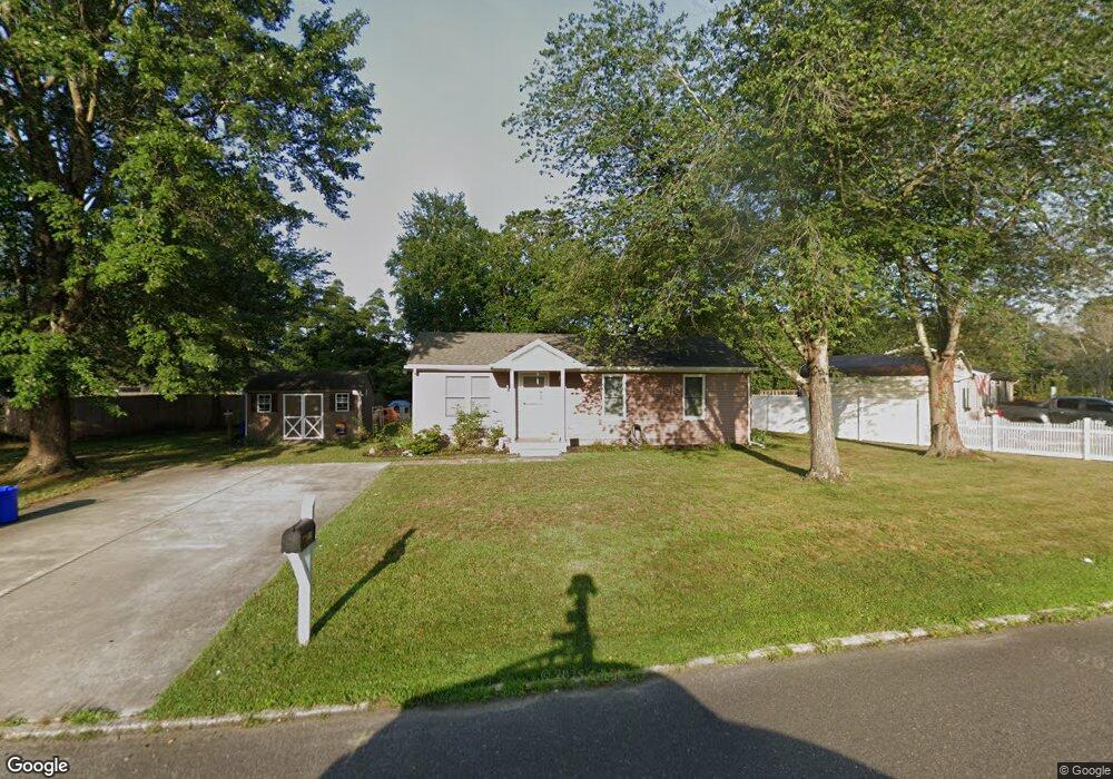
5915 Maple Dr Mays Landing, NJ 08330
Estimated Value: $270,000 - $328,000
2
Beds
2
Baths
960
Sq Ft
$304/Sq Ft
Est. Value
About This Home
This home is located at 5915 Maple Dr, Mays Landing, NJ 08330 and is currently estimated at $292,108, approximately $304 per square foot. 5915 Maple Dr is a home located in Atlantic County with nearby schools including Joseph Shaner School, George L. Hess Educational Complex, and William Davies Middle School.
Ownership History
Date
Name
Owned For
Owner Type
Purchase Details
Closed on
Jan 6, 2010
Sold by
U S Bank National Association
Bought by
Dreager Mary Teresa
Current Estimated Value
Home Financials for this Owner
Home Financials are based on the most recent Mortgage that was taken out on this home.
Original Mortgage
$121,584
Outstanding Balance
$79,176
Interest Rate
4.79%
Mortgage Type
New Conventional
Estimated Equity
$212,932
Purchase Details
Closed on
Aug 18, 2009
Sold by
Rinaldo Thomas E and Rinaldo Sharon L
Bought by
Us Bank National Association
Purchase Details
Closed on
Sep 17, 1999
Sold by
Smithouser Audrey A and Smithouser David J
Bought by
Rinaldo Thomas and Sheehan Sharon
Home Financials for this Owner
Home Financials are based on the most recent Mortgage that was taken out on this home.
Original Mortgage
$89,800
Interest Rate
8.1%
Mortgage Type
FHA
Create a Home Valuation Report for This Property
The Home Valuation Report is an in-depth analysis detailing your home's value as well as a comparison with similar homes in the area
Home Values in the Area
Average Home Value in this Area
Purchase History
| Date | Buyer | Sale Price | Title Company |
|---|---|---|---|
| Dreager Mary Teresa | $119,200 | Land Title Services Nj Inc | |
| Us Bank National Association | -- | None Available | |
| Rinaldo Thomas | $90,000 | Liberty Title Agency |
Source: Public Records
Mortgage History
| Date | Status | Borrower | Loan Amount |
|---|---|---|---|
| Open | Dreager Mary Teresa | $121,584 | |
| Previous Owner | Rinaldo Thomas | $89,800 |
Source: Public Records
Tax History Compared to Growth
Tax History
| Year | Tax Paid | Tax Assessment Tax Assessment Total Assessment is a certain percentage of the fair market value that is determined by local assessors to be the total taxable value of land and additions on the property. | Land | Improvement |
|---|---|---|---|---|
| 2025 | $4,659 | $135,800 | $47,700 | $88,100 |
| 2024 | $4,659 | $135,800 | $47,700 | $88,100 |
| 2023 | $4,381 | $135,800 | $47,700 | $88,100 |
| 2022 | $4,381 | $135,800 | $47,700 | $88,100 |
| 2021 | $4,371 | $135,800 | $47,700 | $88,100 |
| 2020 | $4,371 | $135,800 | $47,700 | $88,100 |
| 2019 | $4,382 | $135,800 | $47,700 | $88,100 |
| 2018 | $4,201 | $134,900 | $47,700 | $87,200 |
| 2017 | $4,135 | $134,900 | $47,700 | $87,200 |
| 2016 | $3,995 | $134,100 | $47,700 | $86,400 |
| 2015 | $3,859 | $134,100 | $47,700 | $86,400 |
| 2014 | $3,764 | $143,300 | $52,500 | $90,800 |
Source: Public Records
Map
Nearby Homes
- 5910 Somerset Dr
- 5906 Vine Dr
- 5910 Redwood Ct
- 5926 Berry Dr
- 55 Lewis Dr
- 40 Vender Ln
- 18 Lewis Dr
- 94 Merlino Ln
- 000 Apple St
- 42 Ernst Ct
- Bl 531 Lot 8&9 Adams Ave
- 0 Apple St
- 0 Cape May Ave
- Lot:11.02-12.02 Estelle Ave
- B:534 L:11.01 Estelle Ave
- B:534 L:12.02 Estelle Ave
- B:534 L:11.02 Estelle Ave
- 22 Ernst Ct
- 1st First Ave
- Rt 50 and Old Mays Landing Rd
- 5917 Maple Dr
- 5913 Maple Dr
- 1550 Brook Ct
- 1548 Brook Ct
- 5919 Maple Dr
- 5911 Maple Dr
- 5924 Maple Dr
- 5922 Maple Dr
- 5926 Maple Dr
- 5920 Maple Dr
- 5928 Maple Dr
- 1552 Old Egg Harbor Rd
- 5909 Maple Dr
- 1554 Old Egg Harbor Rd
- 5918 Maple Dr
- 1546 Brook Ct
- 5930 Maple Dr
- 5907 Somerset Dr
- 5916 Maple Dr
- 5906 Somerset Dr