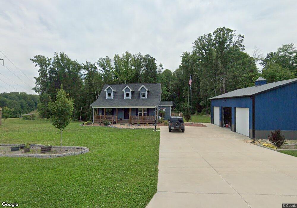
5915 Pack Dr Walkertown, NC 27051
Estimated Value: $358,000 - $403,000
--
Bed
4
Baths
2,956
Sq Ft
$127/Sq Ft
Est. Value
About This Home
This home is located at 5915 Pack Dr, Walkertown, NC 27051 and is currently estimated at $375,067, approximately $126 per square foot. 5915 Pack Dr is a home with nearby schools including Walkertown Elementary School, Walkertown Middle, and Walkertown High School.
Ownership History
Date
Name
Owned For
Owner Type
Purchase Details
Closed on
Nov 26, 2008
Sold by
Tuttle Ivy J and Tilley Gail J
Bought by
Carter Eric N and Carter April L
Current Estimated Value
Home Financials for this Owner
Home Financials are based on the most recent Mortgage that was taken out on this home.
Original Mortgage
$12,150
Interest Rate
5%
Mortgage Type
Purchase Money Mortgage
Create a Home Valuation Report for This Property
The Home Valuation Report is an in-depth analysis detailing your home's value as well as a comparison with similar homes in the area
Home Values in the Area
Average Home Value in this Area
Purchase History
| Date | Buyer | Sale Price | Title Company |
|---|---|---|---|
| Carter Eric N | $13,500 | None Available |
Source: Public Records
Mortgage History
| Date | Status | Borrower | Loan Amount |
|---|---|---|---|
| Closed | Carter Eric N | $12,150 |
Source: Public Records
Tax History
| Year | Tax Paid | Tax Assessment Tax Assessment Total Assessment is a certain percentage of the fair market value that is determined by local assessors to be the total taxable value of land and additions on the property. | Land | Improvement |
|---|---|---|---|---|
| 2025 | $1,844 | $369,000 | $56,200 | $312,800 |
| 2024 | $1,844 | $235,900 | $33,600 | $202,300 |
| 2023 | $1,844 | $235,900 | $33,600 | $202,300 |
| 2022 | $1,844 | $235,900 | $33,600 | $202,300 |
| 2021 | $1,844 | $235,900 | $33,600 | $202,300 |
| 2020 | $1,782 | $209,500 | $26,800 | $182,700 |
| 2019 | $1,625 | $188,800 | $26,800 | $162,000 |
| 2018 | $146 | $17,600 | $17,600 | $0 |
| 2016 | $146 | $17,594 | $17,594 | $0 |
Source: Public Records
Map
Nearby Homes
- 5671 Walnut Cove Rd
- 5091 Donna Marie Ct
- 5309 Belmont Garden Dr
- 5334 Belmont Garden Dr
- 5340 Belmont Garden Dr
- 5346 Belmont Garden Dr
- 5352 Belmont Garden Dr
- 5358 Belmont Garden Dr
- 5364 Belmont Garden Dr
- 3115 Chapel St
- 3139 Chapel St
- 4515 Rocklane Dr
- 2722 Darrow Rd
- 4445 Mecum Rd
- 5245 Esher Dr
- 3518 Dharma Trail
- 2417 Krishna Ln
- 2429 Krishna Ln
- 2411 Krishna Ln
- 3570 Annie Ln
Your Personal Tour Guide
Ask me questions while you tour the home.