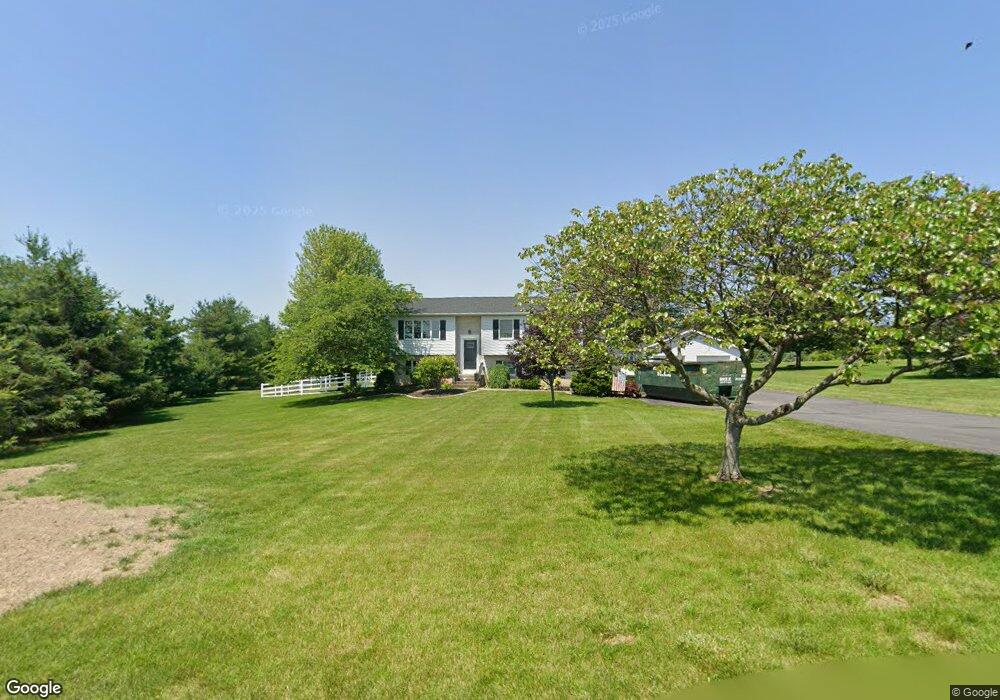
5918 Bottom Rd Slatington, PA 18080
Washington Township NeighborhoodEstimated Value: $390,000 - $475,000
4
Beds
2
Baths
1,756
Sq Ft
$243/Sq Ft
Est. Value
About This Home
This home is located at 5918 Bottom Rd, Slatington, PA 18080 and is currently estimated at $425,842, approximately $242 per square foot. 5918 Bottom Rd is a home located in Lehigh County with nearby schools including Deep Creek Central Elementary School, Grassfield Elementary School, and Peters Elementary School.
Ownership History
Date
Name
Owned For
Owner Type
Purchase Details
Closed on
Jun 30, 2009
Sold by
Richards James M
Bought by
Fairfield Todd J
Current Estimated Value
Home Financials for this Owner
Home Financials are based on the most recent Mortgage that was taken out on this home.
Original Mortgage
$170,000
Outstanding Balance
$110,953
Interest Rate
5.31%
Mortgage Type
New Conventional
Estimated Equity
$314,889
Purchase Details
Closed on
Aug 27, 1997
Sold by
Moyer Melvin E and Moyer Rose T
Bought by
Richards James Michael and Richards A
Purchase Details
Closed on
Nov 11, 1986
Sold by
Billie Douglas G and Billie Jeanette M
Bought by
Moyer Melvin E and Moyer Rose T
Purchase Details
Closed on
Sep 5, 1985
Sold by
Mayer Margaret J
Bought by
Billie Douglas G and Billie Jeanette M
Purchase Details
Closed on
Jun 9, 1980
Bought by
Mayer Margaret J
Create a Home Valuation Report for This Property
The Home Valuation Report is an in-depth analysis detailing your home's value as well as a comparison with similar homes in the area
Home Values in the Area
Average Home Value in this Area
Purchase History
| Date | Buyer | Sale Price | Title Company |
|---|---|---|---|
| Fairfield Todd J | $217,000 | -- | |
| Richards James Michael | $122,400 | -- | |
| Moyer Melvin E | $19,500 | -- | |
| Billie Douglas G | $18,500 | -- | |
| Mayer Margaret J | $19,000 | -- |
Source: Public Records
Mortgage History
| Date | Status | Borrower | Loan Amount |
|---|---|---|---|
| Open | Fairfield Todd J | $170,000 |
Source: Public Records
Tax History Compared to Growth
Tax History
| Year | Tax Paid | Tax Assessment Tax Assessment Total Assessment is a certain percentage of the fair market value that is determined by local assessors to be the total taxable value of land and additions on the property. | Land | Improvement |
|---|---|---|---|---|
| 2025 | $6,518 | $221,300 | $64,100 | $157,200 |
| 2024 | $6,406 | $221,300 | $64,100 | $157,200 |
| 2023 | $5,464 | $194,100 | $64,100 | $130,000 |
| 2022 | $5,366 | $194,100 | $130,000 | $64,100 |
| 2021 | $5,275 | $194,100 | $64,100 | $130,000 |
| 2020 | $5,162 | $194,100 | $64,100 | $130,000 |
| 2019 | $5,027 | $194,100 | $64,100 | $130,000 |
| 2018 | $4,639 | $183,500 | $64,100 | $119,400 |
| 2017 | $4,626 | $183,500 | $64,100 | $119,400 |
| 2016 | -- | $183,500 | $64,100 | $119,400 |
| 2015 | -- | $183,500 | $64,100 | $119,400 |
| 2014 | -- | $183,500 | $64,100 | $119,400 |
Source: Public Records
Map
Nearby Homes
- 5706 Pennsylvania 873
- 5734 Route 873
- 5706 Route 873
- 3735 Highland Rd
- 6265 Venture Ct
- 5905 Glencrest Blvd
- 6210 Hazen Ct
- 6313 Nisbet Ct
- 5651 Park Valley Rd
- 6337 Nisbet Ct
- 3576 Neffs Laurys Rd
- 6215 Rachel Dr
- 5191 Cassidy Dr
- 5353 Route 309
- 5148 Pennsylvania 873
- 5153 Shawnee Blvd
- 5820 Harvest Place
- 5033 Ancinetta Dr
- 6752 Old Grange Rd
- 6614 Oak Dr
- 5930 Bottom Rd
- 4127 Park Ave
- 5942 Bottom Rd
- 4122 Park Ave
- 4145 Park Ave
- 5954 Bottom Rd
- 4163 Park Ave
- 4235 Carolyn Dr
- 5967 Bottom Rd Unit 6007
- 4223 Carolyn Dr
- 4229 Carolyn Dr
- 4241 Carolyn Dr
- 6010 Bottom Rd
- 4241 Park Ave
- 4217 Carolyn Dr
- 6019 Bottom Rd
- 4230 Park Ave
- 4247 Carolyn Dr
- 4259 Carolyn Dr
- 4265 Carolyn Dr