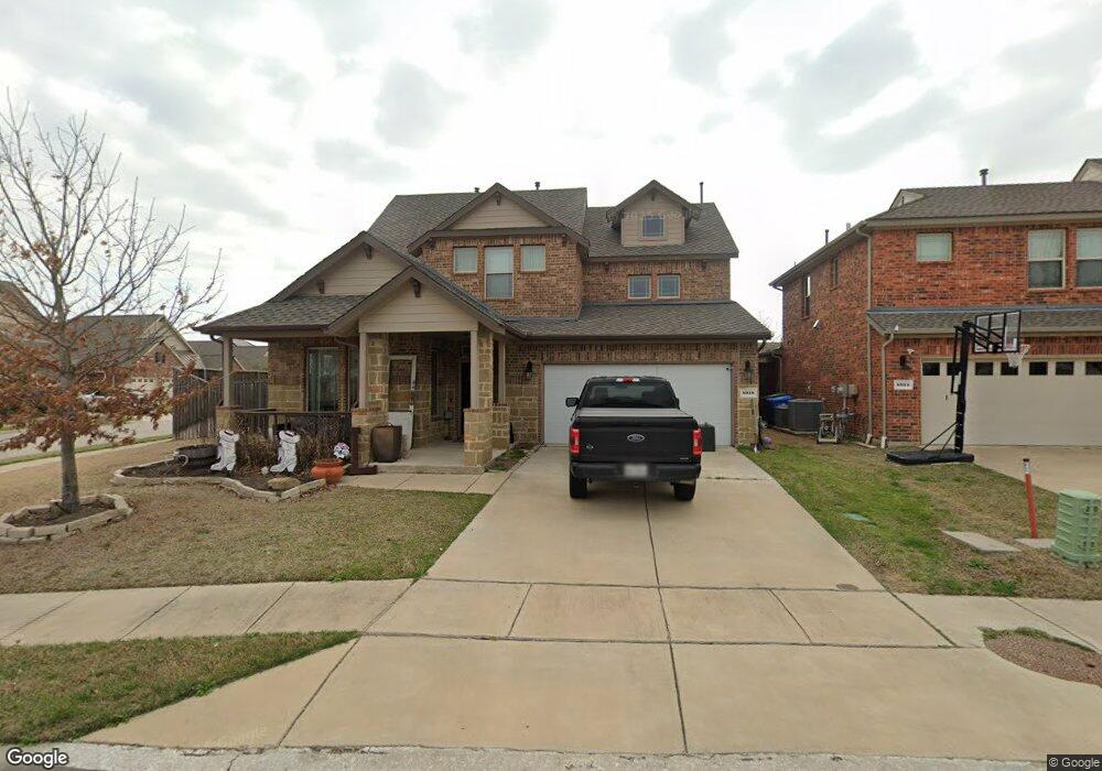
5918 Lotus Dr Rowlett, TX 75089
Springfield NeighborhoodEstimated Value: $483,364 - $541,000
4
Beds
4
Baths
2,755
Sq Ft
$187/Sq Ft
Est. Value
About This Home
This home is located at 5918 Lotus Dr, Rowlett, TX 75089 and is currently estimated at $516,341, approximately $187 per square foot. 5918 Lotus Dr is a home with nearby schools including Harmony School of Innovation - Garland, Wesleyan Christian Academy, and Lake Cities Montessori School.
Ownership History
Date
Name
Owned For
Owner Type
Purchase Details
Closed on
Jun 30, 2016
Sold by
D R Horton Texas Ltd
Bought by
Louthan Kylie J and Louthan Martin D
Current Estimated Value
Home Financials for this Owner
Home Financials are based on the most recent Mortgage that was taken out on this home.
Original Mortgage
$235,580
Outstanding Balance
$188,064
Interest Rate
3.58%
Mortgage Type
New Conventional
Estimated Equity
$328,277
Create a Home Valuation Report for This Property
The Home Valuation Report is an in-depth analysis detailing your home's value as well as a comparison with similar homes in the area
Home Values in the Area
Average Home Value in this Area
Purchase History
| Date | Buyer | Sale Price | Title Company |
|---|---|---|---|
| Louthan Kylie J | -- | None Available |
Source: Public Records
Mortgage History
| Date | Status | Borrower | Loan Amount |
|---|---|---|---|
| Open | Louthan Kylie J | $235,580 |
Source: Public Records
Tax History Compared to Growth
Tax History
| Year | Tax Paid | Tax Assessment Tax Assessment Total Assessment is a certain percentage of the fair market value that is determined by local assessors to be the total taxable value of land and additions on the property. | Land | Improvement |
|---|---|---|---|---|
| 2025 | $7,718 | $485,020 | $100,000 | $385,020 |
| 2024 | $7,718 | $513,570 | $85,000 | $428,570 |
| 2023 | $7,718 | $513,570 | $85,000 | $428,570 |
| 2022 | $7,003 | $441,180 | $0 | $0 |
| 2021 | $7,709 | $294,480 | $66,000 | $228,480 |
| 2020 | $7,778 | $294,480 | $66,000 | $228,480 |
| 2019 | $8,462 | $294,480 | $66,000 | $228,480 |
| 2018 | $8,522 | $294,480 | $66,000 | $228,480 |
| 2017 | $3,934 | $294,480 | $66,000 | $228,480 |
| 2016 | $3,481 | $119,940 | $50,000 | $69,940 |
| 2015 | -- | $45,000 | $45,000 | $0 |
Source: Public Records
Map
Nearby Homes
- 2221 Petunia Ln
- 5909 Brookline Dr
- 2314 Marigold Dr
- 1501 Patty Cir
- 5806 Beacon Dr
- 6718 Livingstone St
- 6110 Tacoma St
- 7013 Tremont Ln
- 6617 Stamps St
- 2001 Maggis Meadow Ln
- 6306 Debbie Cir
- 6317 Locust St
- 6518 Teresa Ln
- 6913 Brandford Rd
- 5702 Antioch Dr
- 1709 Northampton Dr
- 6510 White Oak Dr
- 7005 Buckhorn Dr
- 6407 Redwood Ln
- 5516 Maple Ln