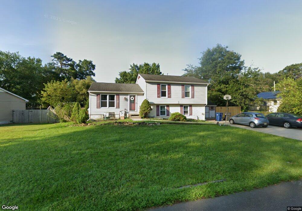
5919 Maple Dr Mays Landing, NJ 08330
Estimated Value: $329,000 - $369,000
3
Beds
2
Baths
1,676
Sq Ft
$211/Sq Ft
Est. Value
About This Home
This home is located at 5919 Maple Dr, Mays Landing, NJ 08330 and is currently estimated at $353,349, approximately $210 per square foot. 5919 Maple Dr is a home located in Atlantic County with nearby schools including Joseph Shaner School, George L. Hess Educational Complex, and William Davies Middle School.
Ownership History
Date
Name
Owned For
Owner Type
Purchase Details
Closed on
Sep 30, 2008
Sold by
Perez Juan C and Perez Michele A
Bought by
Lynch Robert and Lynch Melissa
Current Estimated Value
Home Financials for this Owner
Home Financials are based on the most recent Mortgage that was taken out on this home.
Original Mortgage
$209,250
Outstanding Balance
$139,879
Interest Rate
6.54%
Mortgage Type
Purchase Money Mortgage
Estimated Equity
$213,470
Purchase Details
Closed on
Aug 15, 2005
Sold by
Tobon Jose
Bought by
Perez Juan and Perez Michele
Home Financials for this Owner
Home Financials are based on the most recent Mortgage that was taken out on this home.
Original Mortgage
$188,000
Interest Rate
5.79%
Mortgage Type
Purchase Money Mortgage
Purchase Details
Closed on
May 24, 2002
Sold by
Scull Kevin F and Scull Kari S
Bought by
Tobon Jose F
Home Financials for this Owner
Home Financials are based on the most recent Mortgage that was taken out on this home.
Original Mortgage
$134,934
Interest Rate
7%
Mortgage Type
FHA
Create a Home Valuation Report for This Property
The Home Valuation Report is an in-depth analysis detailing your home's value as well as a comparison with similar homes in the area
Home Values in the Area
Average Home Value in this Area
Purchase History
| Date | Buyer | Sale Price | Title Company |
|---|---|---|---|
| Lynch Robert | $232,500 | Foundation Title Llc Northfi | |
| Perez Juan | $235,000 | -- | |
| Tobon Jose F | $136,000 | -- |
Source: Public Records
Mortgage History
| Date | Status | Borrower | Loan Amount |
|---|---|---|---|
| Open | Lynch Robert | $209,250 | |
| Previous Owner | Perez Juan | $188,000 | |
| Previous Owner | Tobon Jose F | $134,934 |
Source: Public Records
Tax History Compared to Growth
Tax History
| Year | Tax Paid | Tax Assessment Tax Assessment Total Assessment is a certain percentage of the fair market value that is determined by local assessors to be the total taxable value of land and additions on the property. | Land | Improvement |
|---|---|---|---|---|
| 2025 | $6,111 | $178,100 | $47,900 | $130,200 |
| 2024 | $6,111 | $178,100 | $47,900 | $130,200 |
| 2023 | $5,746 | $178,100 | $47,900 | $130,200 |
| 2022 | $5,746 | $178,100 | $47,900 | $130,200 |
| 2021 | $5,733 | $178,100 | $47,900 | $130,200 |
| 2020 | $5,733 | $178,100 | $47,900 | $130,200 |
| 2019 | $5,747 | $178,100 | $47,900 | $130,200 |
| 2018 | $5,546 | $178,100 | $47,900 | $130,200 |
| 2017 | $5,459 | $178,100 | $47,900 | $130,200 |
| 2016 | $5,306 | $178,100 | $47,900 | $130,200 |
| 2015 | $5,126 | $178,100 | $47,900 | $130,200 |
| 2014 | $5,165 | $196,600 | $52,900 | $143,700 |
Source: Public Records
Map
Nearby Homes
- 5910 Somerset Dr
- 5906 Vine Dr
- 5910 Redwood Ct
- 5926 Berry Dr
- 55 Lewis Dr
- 40 Vender Ln
- 18 Lewis Dr
- 94 Merlino Ln
- 000 Apple St
- 42 Ernst Ct
- Bl 531 Lot 8&9 Adams Ave
- 0 Apple St
- 0 Cape May Ave
- Lot:11.02-12.02 Estelle Ave
- B:534 L:11.01 Estelle Ave
- B:534 L:12.02 Estelle Ave
- B:534 L:11.02 Estelle Ave
- 22 Ernst Ct
- 1st First Ave
- Rt 50 and Old Mays Landing Rd
- 5917 Maple Dr
- 1554 Old Egg Harbor Rd
- 1550 Brook Ct
- 1552 Old Egg Harbor Rd
- 5930 Maple Dr
- 5915 Maple Dr
- 1556 Old Egg Harbor Rd
- 5928 Maple Dr
- 1548 Brook Ct
- 5913 Maple Dr
- 5926 Maple Dr
- 1558 Old Egg Harbor Rd
- 5924 Maple Dr
- 5911 Maple Dr
- 1546 Brook Ct
- 5938 Cedarcroft Dr
- 5936 Cedarcroft Dr
- 1544 Old Egg Harbor Rd
- 5934 Cedarcroft Dr
- 5940 Cedarcroft Dr