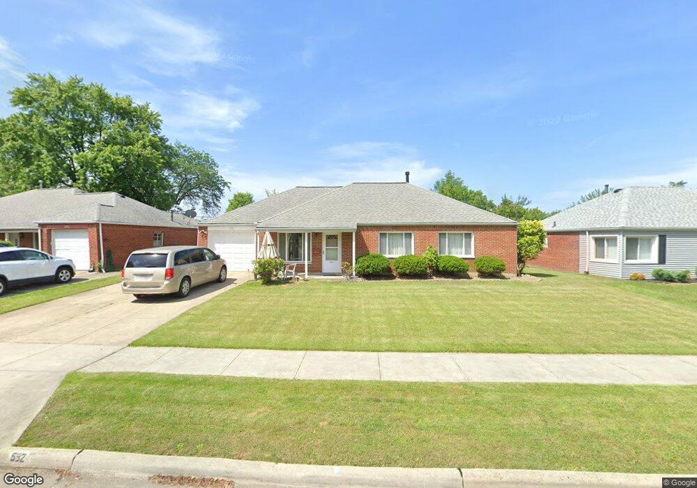
592 Hemlock Dr Euclid, OH 44132
Estimated Value: $182,281 - $211,000
4
Beds
2
Baths
1,935
Sq Ft
$101/Sq Ft
Est. Value
About This Home
This home is located at 592 Hemlock Dr, Euclid, OH 44132 and is currently estimated at $194,820, approximately $100 per square foot. 592 Hemlock Dr is a home located in Cuyahoga County with nearby schools including Shoreview Elementary School, Euclid High School, and Ss. Robert & William Catholic School.
Ownership History
Date
Name
Owned For
Owner Type
Purchase Details
Closed on
Jun 29, 2011
Sold by
Estate Of Rose B Grabitz and Dixon Rosemarie T
Bought by
Berry Robert A
Current Estimated Value
Home Financials for this Owner
Home Financials are based on the most recent Mortgage that was taken out on this home.
Original Mortgage
$77,874
Outstanding Balance
$56,008
Interest Rate
5.5%
Mortgage Type
FHA
Estimated Equity
$138,812
Purchase Details
Closed on
Feb 16, 1989
Sold by
Mckee William J
Bought by
Dambrosia Christopher J
Purchase Details
Closed on
Nov 28, 1983
Sold by
Mckee William J and Mckee Mary E
Bought by
Mckee William J
Purchase Details
Closed on
Jan 1, 1975
Bought by
Mckee William J and Mckee Mary E
Create a Home Valuation Report for This Property
The Home Valuation Report is an in-depth analysis detailing your home's value as well as a comparison with similar homes in the area
Home Values in the Area
Average Home Value in this Area
Purchase History
| Date | Buyer | Sale Price | Title Company |
|---|---|---|---|
| Berry Robert A | $79,900 | Ohio Real Title | |
| Dambrosia Christopher J | $65,500 | -- | |
| Mckee William J | -- | -- | |
| Mckee William J | -- | -- |
Source: Public Records
Mortgage History
| Date | Status | Borrower | Loan Amount |
|---|---|---|---|
| Open | Berry Robert A | $77,874 |
Source: Public Records
Tax History Compared to Growth
Tax History
| Year | Tax Paid | Tax Assessment Tax Assessment Total Assessment is a certain percentage of the fair market value that is determined by local assessors to be the total taxable value of land and additions on the property. | Land | Improvement |
|---|---|---|---|---|
| 2024 | $3,497 | $50,785 | $10,325 | $40,460 |
| 2023 | $3,799 | $44,420 | $9,140 | $35,280 |
| 2022 | $3,711 | $44,420 | $9,140 | $35,280 |
| 2021 | $4,132 | $44,420 | $9,140 | $35,280 |
| 2020 | $3,465 | $33,670 | $6,930 | $26,740 |
| 2019 | $3,118 | $96,200 | $19,800 | $76,400 |
| 2018 | $2,820 | $33,670 | $6,930 | $26,740 |
| 2017 | $2,712 | $24,050 | $5,530 | $18,520 |
| 2016 | $2,718 | $24,050 | $5,530 | $18,520 |
| 2015 | $2,475 | $24,050 | $5,530 | $18,520 |
| 2014 | $2,475 | $24,050 | $5,530 | $18,520 |
Source: Public Records
Map
Nearby Homes
- 27190 Shoreview Ave
- 27101 Zeman Ave
- 559 Sycamore Dr
- 577 Sycamore Dr
- 26951 Shirley Ave
- 461 E 271st St
- 546 Walnut Dr
- 440 E 271st St
- 29038 Fuller Ave
- 712 E 266th St
- 26471 Shoreview Ave
- 26471 Farringdon Ave
- 445 E 275th St
- 415 E 266th St
- 26351 Farringdon Ave
- 780 E 266th St
- 26430 Drakefield Ave
- 26230 Oriole Ave
- 26171 Shoreview Ave
- 405 E 262nd St