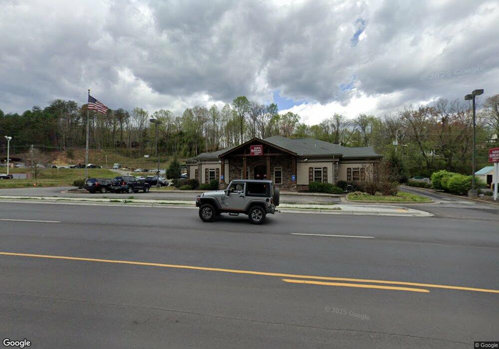
592 U S 64 Murphy, NC 28906
Studio
--
Bath
6,932
Sq Ft
39,204
Sq Ft
About This Home
This home is located at 592 U S 64, Murphy, NC 28906. 592 U S 64 is a home located in Cherokee County with nearby schools including Murphy Elementary School, Murphy Middle School, and Murphy High School.
Ownership History
Date
Name
Owned For
Owner Type
Purchase Details
Closed on
Aug 26, 2021
Sold by
Peoples Bank
Bought by
Cherokee County Farm Bureau Inc
Home Financials for this Owner
Home Financials are based on the most recent Mortgage that was taken out on this home.
Original Mortgage
$600,000
Outstanding Balance
$525,178
Interest Rate
2.8%
Mortgage Type
Seller Take Back
Purchase Details
Closed on
May 15, 2018
Sold by
Peoples Bank Of East Tennessee
Bought by
Gray S Family Practice Inc
Home Financials for this Owner
Home Financials are based on the most recent Mortgage that was taken out on this home.
Original Mortgage
$1,175,000
Interest Rate
2.09%
Mortgage Type
Land Contract Argmt. Of Sale
Purchase Details
Closed on
Sep 7, 2007
Sold by
White Nell and White Douglas M
Bought by
Apalachian Community Bank Fsb
Create a Home Valuation Report for This Property
The Home Valuation Report is an in-depth analysis detailing your home's value as well as a comparison with similar homes in the area
Home Values in the Area
Average Home Value in this Area
Purchase History
| Date | Buyer | Sale Price | Title Company |
|---|---|---|---|
| Cherokee County Farm Bureau Inc | $1,100,000 | None Listed On Document | |
| Gray S Family Practice Inc | $1,350,000 | None Available | |
| Apalachian Community Bank Fsb | $61,000 | -- |
Source: Public Records
Mortgage History
| Date | Status | Borrower | Loan Amount |
|---|---|---|---|
| Open | Cherokee County Farm Bureau Inc | $600,000 | |
| Previous Owner | Gray S Family Practice Inc | $1,175,000 |
Source: Public Records
Tax History
| Year | Tax Paid | Tax Assessment Tax Assessment Total Assessment is a certain percentage of the fair market value that is determined by local assessors to be the total taxable value of land and additions on the property. | Land | Improvement |
|---|---|---|---|---|
| 2025 | $7,776 | $1,274,710 | $0 | $0 |
| 2024 | $61 | $997,520 | $0 | $0 |
| 2023 | $9,472 | $997,520 | $0 | $0 |
| 2022 | $9,472 | $1,552,780 | $0 | $0 |
| 2021 | $0 | $1,552,780 | $306,000 | $1,246,780 |
| 2020 | $6,412 | $1,552,780 | $0 | $0 |
| 2019 | $6,889 | $1,324,720 | $0 | $0 |
| 2018 | $6,889 | $1,324,720 | $0 | $0 |
| 2017 | $0 | $1,232,980 | $0 | $0 |
| 2016 | $6,412 | $1,232,980 | $0 | $0 |
| 2015 | $6,412 | $1,232,980 | $360,000 | $872,980 |
| 2012 | -- | $1,232,980 | $360,000 | $872,980 |
Source: Public Records
Map
Nearby Homes
- 155 Fort Butler St
- Lot 10 Holly Hill Ridge
- 0 Stonebrook Dr
- 16 Beal Cir
- 0 Trillium Trail
- 000 Trillium Trail
- 6300 U S Highway 64
- 12216 U S Highway 64 Unit LOT 1
- 12216 U S Highway 64
- 727 Hiwassee St
- 43 Hitchcock St
- 12-4 Cardinal Rd
- 67 Lowell St
- Lot 56 Indian Rock Springs
- 0 Wolf Print Unit 153880
- 44 Noelle's Pass
- 67 Noelle's Pass
- 94 Noelles Pass
- 0 Friendship Unit 155669
- 67 Noelles Pass
- 592 W Us Highway 64
- 592 W Us Highway 64
- 176 Old Ranger Rd
- 1.4 ACRE Old Ranger Road (In City Limits)
- 10 Skyline Dr
- 89 Fort Butler St
- 75 Fort Butler St
- 230 Old Ranger Rd
- 63 Fort Butler St
- 6 Skyline Dr
- 20 Fort Butler St
- 19 Fort Butler St
- 18 Fort Butler St
- 17 Fort Butler St
- 16 Fort Butler St
- 14 Fort Butler St
- 13 Fort Butler St
- 12 Fort Butler St
- 11 Fort Butler St
- 10 Fort Butler St
Your Personal Tour Guide
Ask me questions while you tour the home.