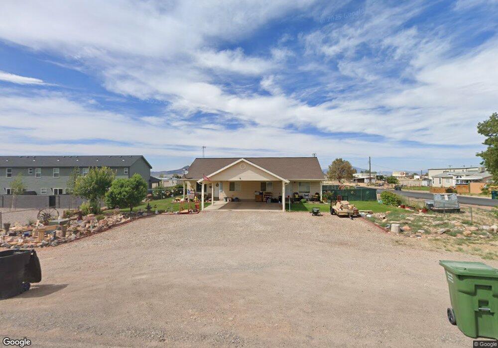
592 W 400 N 1&2 Parowan, UT 84761
Estimated Value: $427,000 - $457,000
--
Bed
--
Bath
--
Sq Ft
0.3
Acres
About This Home
This home is located at 592 W 400 N 1&2, Parowan, UT 84761 and is currently estimated at $437,468. 592 W 400 N 1&2 is a home located in Iron County with nearby schools including Parowan School, Parowan High School, and Cedar City High School.
Ownership History
Date
Name
Owned For
Owner Type
Purchase Details
Closed on
Mar 18, 2025
Sold by
Baldwin Troy H
Bought by
Demswin Enterprises Llc
Current Estimated Value
Purchase Details
Closed on
Mar 29, 2012
Sold by
Lefevre Matthew A
Bought by
Mist Investments & Property Management L
Purchase Details
Closed on
Mar 21, 2012
Sold by
Mist Investments & Property Management L
Bought by
Lefevre Matthew A
Purchase Details
Closed on
May 25, 2007
Sold by
Lefevre Matthew A
Bought by
Mist Investmet & Property Managment Llc
Home Financials for this Owner
Home Financials are based on the most recent Mortgage that was taken out on this home.
Original Mortgage
$185,600
Interest Rate
6.14%
Mortgage Type
New Conventional
Purchase Details
Closed on
Jan 18, 2007
Sold by
Lefevre Matthew A
Bought by
Leferve Matthew A
Create a Home Valuation Report for This Property
The Home Valuation Report is an in-depth analysis detailing your home's value as well as a comparison with similar homes in the area
Home Values in the Area
Average Home Value in this Area
Purchase History
| Date | Buyer | Sale Price | Title Company |
|---|---|---|---|
| Demswin Enterprises Llc | -- | None Listed On Document | |
| Mist Investments & Property Management L | -- | None Available | |
| Lefevre Matthew A | -- | Advanced Title Insurance Age | |
| Mist Investmet & Property Managment Llc | -- | -- | |
| Leferve Matthew A | -- | -- |
Source: Public Records
Mortgage History
| Date | Status | Borrower | Loan Amount |
|---|---|---|---|
| Previous Owner | Mist Investmet & Property Managment Llc | $185,600 |
Source: Public Records
Tax History Compared to Growth
Tax History
| Year | Tax Paid | Tax Assessment Tax Assessment Total Assessment is a certain percentage of the fair market value that is determined by local assessors to be the total taxable value of land and additions on the property. | Land | Improvement |
|---|---|---|---|---|
| 2025 | $1,703 | $211,390 | $43,637 | $167,753 |
| 2023 | $1,511 | $128,465 | $38,960 | $89,505 |
| 2022 | $1,196 | $124,925 | $35,420 | $89,505 |
| 2021 | $1,069 | $111,645 | $22,140 | $89,505 |
| 2020 | $1,090 | $100,560 | $22,140 | $78,420 |
| 2019 | $1,092 | $96,120 | $22,140 | $73,980 |
| 2018 | $1,082 | $93,230 | $19,250 | $73,980 |
| 2017 | $1,109 | $93,230 | $19,250 | $73,980 |
| 2016 | $1,087 | $86,505 | $19,250 | $67,255 |
| 2015 | $805 | $60,500 | $0 | $0 |
| 2014 | $843 | $60,500 | $0 | $0 |
Source: Public Records
Map
Nearby Homes
- 16 Acft Water Rights
- 0 W Frontage Rd
- .8 miles W Frontage Rd
- West W Frontage Rd
- 190 N 900 W
- 191 N 875 W Unit Mountain Valley Sub.
- 191 N 875 W
- 190 N 875 W
- 191 N 850 W
- 162 N 900 W
- 181 N 850 W
- 162 N 875 W
- 150 900 W
- 180 N 850 W
- 900 W Gap Rd
- 163 N 850 W
- S End of 900 W
- 162 N 850 W
- 152 N 850 W
- 592 W 400 N Unit 1&2