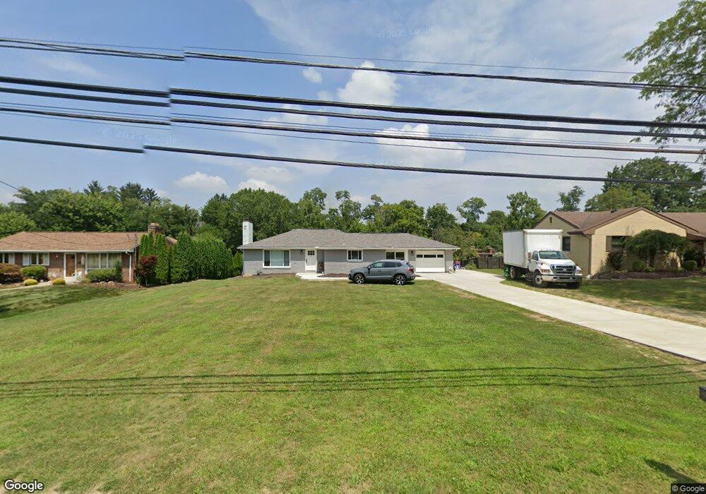
592 W Mcmurray Rd Canonsburg, PA 15317
Estimated Value: $225,000 - $259,522
3
Beds
1
Bath
1,238
Sq Ft
$198/Sq Ft
Est. Value
About This Home
This home is located at 592 W Mcmurray Rd, Canonsburg, PA 15317 and is currently estimated at $245,381, approximately $198 per square foot. 592 W Mcmurray Rd is a home located in Washington County with nearby schools including Canon-Mcmillan Senior High School.
Ownership History
Date
Name
Owned For
Owner Type
Purchase Details
Closed on
Apr 7, 2023
Sold by
South Hills Property Management Llc
Bought by
Sopko Ronald W
Current Estimated Value
Purchase Details
Closed on
Apr 3, 2023
Sold by
Price Michael S
Bought by
South Hills Property Management Llc
Purchase Details
Closed on
Feb 5, 2023
Sold by
Stanisic Matthew
Bought by
South Hills Property Management Llc
Purchase Details
Closed on
Oct 24, 2022
Sold by
Price Michael S
Bought by
Stanisic Matthew
Purchase Details
Closed on
Sep 26, 2022
Sold by
Washington County Tax Claim Bureau
Bought by
Price Michael S
Create a Home Valuation Report for This Property
The Home Valuation Report is an in-depth analysis detailing your home's value as well as a comparison with similar homes in the area
Home Values in the Area
Average Home Value in this Area
Purchase History
| Date | Buyer | Sale Price | Title Company |
|---|---|---|---|
| Sopko Ronald W | $180,000 | None Listed On Document | |
| South Hills Property Management Llc | -- | None Listed On Document | |
| South Hills Property Management Llc | $140,000 | -- | |
| Stanisic Matthew | -- | -- | |
| Price Michael S | $60,000 | -- |
Source: Public Records
Tax History Compared to Growth
Tax History
| Year | Tax Paid | Tax Assessment Tax Assessment Total Assessment is a certain percentage of the fair market value that is determined by local assessors to be the total taxable value of land and additions on the property. | Land | Improvement |
|---|---|---|---|---|
| 2025 | $2,511 | $146,900 | $78,400 | $68,500 |
| 2024 | $2,345 | $146,900 | $78,400 | $68,500 |
| 2023 | $2,345 | $146,900 | $78,400 | $68,500 |
| 2022 | $2,338 | $146,900 | $78,400 | $68,500 |
| 2021 | $2,338 | $146,900 | $78,400 | $68,500 |
| 2020 | $2,220 | $146,900 | $78,400 | $68,500 |
| 2019 | $2,183 | $146,900 | $78,400 | $68,500 |
| 2018 | $2,137 | $146,900 | $78,400 | $68,500 |
| 2017 | $465 | $146,900 | $78,400 | $68,500 |
| 2016 | $465 | $13,338 | $1,491 | $11,847 |
| 2015 | $1,475 | $13,338 | $1,491 | $11,847 |
| 2014 | $485 | $13,338 | $1,491 | $11,847 |
| 2013 | $485 | $13,338 | $1,491 | $11,847 |
Source: Public Records
Map
Nearby Homes
- 1029 Woodlawn Dr
- 151 Liberty Blvd
- 118 Maple Ridge Dr
- 113 Maple Ridge Ct
- 205 Maple Ridge Dr
- 153 Twilight Dr
- 235 Liberty Blvd
- 238 Maple Ridge Dr
- The Franklin Plan at Southpointe
- The Betsy Ross Plan at Southpointe
- The Washington Plan at Southpointe
- The Grant Plan at Southpointe
- The Hancock Plan at Southpointe
- 1009 Waterford Ct W
- 454 Independence Way
- 612 Hunting Creek Rd
- 304 Maple Ridge Dr
- 310 Maple Ridge Dr
- Lot 211 Hunters Crossing
- Lot 1 N Spring Valley Rd
- 594 W Mcmurray Rd
- 590 W Mcmurray Rd
- 588 W Mcmurray Rd
- 1357 Morgan Cir
- 596 W Mcmurray Rd
- 586 W Mcmurray Rd
- 1124 Woodlawn Dr
- 312 Azalea Ct
- 310 Azalea Ct
- 308 Azalea Ct
- 584 W Mcmurray Rd
- 300 Azalea Ct
- 306 Azalea Ct
- 1122 Woodlawn Dr
- 18 Walnut St
- 302 Azalea Ct
- 1120 Woodlawn Dr
- 304 Azalea Ct
- 582 W Mcmurray Rd
- 313 Azalea Ct