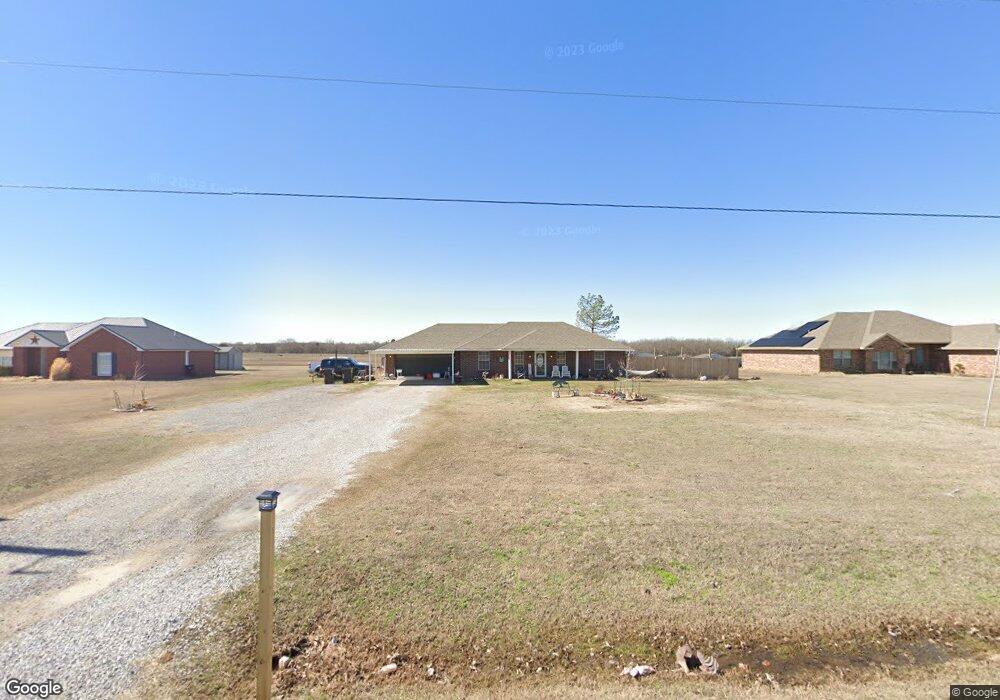
5920 Brangus Rd Shawnee, OK 74804
Estimated Value: $196,000 - $274,000
3
Beds
2
Baths
1,376
Sq Ft
$171/Sq Ft
Est. Value
About This Home
This home is located at 5920 Brangus Rd, Shawnee, OK 74804 and is currently estimated at $235,716, approximately $171 per square foot. 5920 Brangus Rd is a home located in Pottawatomie County.
Ownership History
Date
Name
Owned For
Owner Type
Purchase Details
Closed on
May 16, 2019
Sold by
Wilcox Brian S and Wilcox Kindra
Bought by
Sheey Mclntirff Jerry and Sheey Mclntirff
Current Estimated Value
Home Financials for this Owner
Home Financials are based on the most recent Mortgage that was taken out on this home.
Original Mortgage
$132,949
Outstanding Balance
$115,918
Interest Rate
4%
Mortgage Type
FHA
Estimated Equity
$119,798
Purchase Details
Closed on
Sep 27, 2002
Sold by
Jones Herman and Jones Lindda
Bought by
Wilcox Brian and Lindra She
Create a Home Valuation Report for This Property
The Home Valuation Report is an in-depth analysis detailing your home's value as well as a comparison with similar homes in the area
Home Values in the Area
Average Home Value in this Area
Purchase History
| Date | Buyer | Sale Price | Title Company |
|---|---|---|---|
| Sheey Mclntirff Jerry | $134,000 | Choice Title Insurance | |
| Wilcox Brian | $12,500 | -- |
Source: Public Records
Mortgage History
| Date | Status | Borrower | Loan Amount |
|---|---|---|---|
| Open | Sheey Mclntirff Jerry | $132,949 |
Source: Public Records
Tax History Compared to Growth
Tax History
| Year | Tax Paid | Tax Assessment Tax Assessment Total Assessment is a certain percentage of the fair market value that is determined by local assessors to be the total taxable value of land and additions on the property. | Land | Improvement |
|---|---|---|---|---|
| 2025 | $1,854 | $16,576 | $276 | $16,300 |
| 2024 | $1,812 | $15,787 | $1,650 | $14,137 |
| 2023 | $1,812 | $15,787 | $1,650 | $14,137 |
| 2022 | $1,790 | $15,787 | $1,650 | $14,137 |
| 2021 | $1,844 | $15,787 | $1,650 | $14,137 |
| 2020 | $1,907 | $16,080 | $1,650 | $14,430 |
| 2019 | $1,673 | $14,213 | $1,579 | $12,634 |
| 2018 | $1,541 | $13,536 | $1,498 | $12,038 |
| 2017 | $1,471 | $12,891 | $1,411 | $11,480 |
| 2016 | $1,156 | $12,278 | $1,325 | $10,953 |
| 2015 | $1,099 | $11,693 | $1,396 | $10,297 |
| 2014 | $1,046 | $11,136 | $1,356 | $9,780 |
Source: Public Records
Map
Nearby Homes
- 43844 Limestone Dr
- 127 Castle Rock Ln
- 110 Cuyler Dr
- 8888 Arthur Rd
- 7777 Arthur Rd
- 5505 Capricorn
- 5707 Earl Dr
- 207 Hope Ave
- 126 Hope Ave
- 213 Hope Ave
- 219 Hope Ave
- 103 Trimble Dr
- 138 Trimble Dr
- 0000 Big Sky Dr
- 43289 Garrett's Lake Rd
- 7110 Brangus Rd
- 12906 Waterside Way
- 43512 E 45th St
- 44233 Whitetail Rd
- 44237 Whitetail Rd
- 6004 Brangus Rd
- 6014 Brangus Rd
- 6100 Brangus Rd
- 5900 Brangus Rd
- 5822 Brangus Rd
- 6106 Brangus Rd
- 5816 Brangus Rd
- 5908 Brangus Rd
- 6200 Brangus Rd
- 43941 Limestone Dr
- 43900 Limestone Dr
- 43842 Limestone Dr
- 43865 Limestone Dr
- 43950 Limestone Dr
- 5812 Brangus Rd Unit SHA
- 43908 Westech Rd
- 0 Brangus Rd
- 43910 Westech Rd
- 1 Brangus Rd
- 5806 Brangus Rd