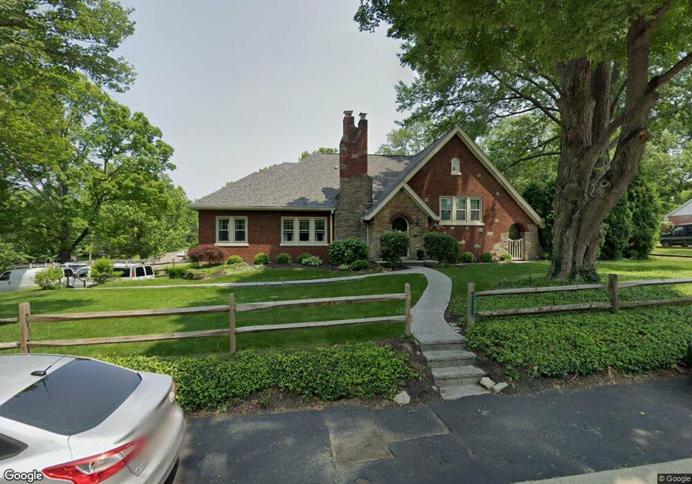
5920 Euclid Rd Cincinnati, OH 45236
Estimated Value: $589,000 - $629,785
4
Beds
2
Baths
3,874
Sq Ft
$158/Sq Ft
Est. Value
About This Home
This home is located at 5920 Euclid Rd, Cincinnati, OH 45236 and is currently estimated at $613,196, approximately $158 per square foot. 5920 Euclid Rd is a home located in Hamilton County with nearby schools including Indian Hill Primary School, Indian Hill Elementary School, and Indian Hill Middle School.
Ownership History
Date
Name
Owned For
Owner Type
Purchase Details
Closed on
Aug 18, 1998
Sold by
Pitner Gregory A
Bought by
Pitner Elizabeth M
Current Estimated Value
Create a Home Valuation Report for This Property
The Home Valuation Report is an in-depth analysis detailing your home's value as well as a comparison with similar homes in the area
Home Values in the Area
Average Home Value in this Area
Purchase History
| Date | Buyer | Sale Price | Title Company |
|---|---|---|---|
| Pitner Elizabeth M | -- | -- |
Source: Public Records
Tax History
| Year | Tax Paid | Tax Assessment Tax Assessment Total Assessment is a certain percentage of the fair market value that is determined by local assessors to be the total taxable value of land and additions on the property. | Land | Improvement |
|---|---|---|---|---|
| 2025 | $6,437 | $160,413 | $35,011 | $125,402 |
| 2024 | $6,265 | $160,413 | $35,011 | $125,402 |
| 2023 | $6,303 | $160,413 | $35,011 | $125,402 |
| 2022 | $5,742 | $119,571 | $23,947 | $95,624 |
| 2021 | $5,593 | $119,571 | $23,947 | $95,624 |
| 2020 | $4,989 | $119,571 | $23,947 | $95,624 |
| 2019 | $4,694 | $104,888 | $21,007 | $83,881 |
| 2018 | $4,704 | $104,888 | $21,007 | $83,881 |
| 2017 | $4,485 | $104,888 | $21,007 | $83,881 |
| 2016 | $3,672 | $85,078 | $19,117 | $65,961 |
| 2015 | $3,699 | $85,078 | $19,117 | $65,961 |
| 2014 | $3,676 | $85,078 | $19,117 | $65,961 |
| 2013 | $3,629 | $81,029 | $18,207 | $62,822 |
Source: Public Records
Map
Nearby Homes
- 5635 Euclid Rd
- 7633 Montgomery Rd
- 7633 Montgomery Rd Unit 3
- 7752 Montgomery Rd
- 4248 South Ave
- 7034 East Ave
- 4155 Home St
- 4300 Hegner Ave
- 6705 Elwynne Dr
- 6656 Plainfield Rd
- 6829 Alpine Ave
- 4106 Orchard Ln
- 4025 Deer Park Ave
- 6495 Dawson Rd
- 3964 Zinsle Ave
- 4050 O'Leary Ave
- 3990 Superior Ave
- 6752 Rose Crest Ave
- 8095 Camner Ave
- 4123 Hoffman Ave
- 6920 Ken Arbre Dr
- 5948 Euclid Rd
- 6924 Ken Arbre Dr
- 6887 Fox Hill Ln
- 6901 Ken Arbre Dr
- 6926 Ken Arbre Dr
- 6915 Ken Arbre Dr
- 6905 Fox Hill Ln
- 5964 Euclid Rd
- 6921 Fox Hill Ln
- 6928 Ken Arbre Dr
- 6891 Ken Arbre Dr
- 6921 Ken Arbre Dr
- 6927 Ken Arbre Dr
- 5993 Saint Regis Dr
- 5982 Euclid Rd
- 6873 Fox Hill Ln
- 5975 Saint Regis Dr
- 5854 Euclid Rd
- 6932 Ken Arbre Dr
Your Personal Tour Guide
Ask me questions while you tour the home.