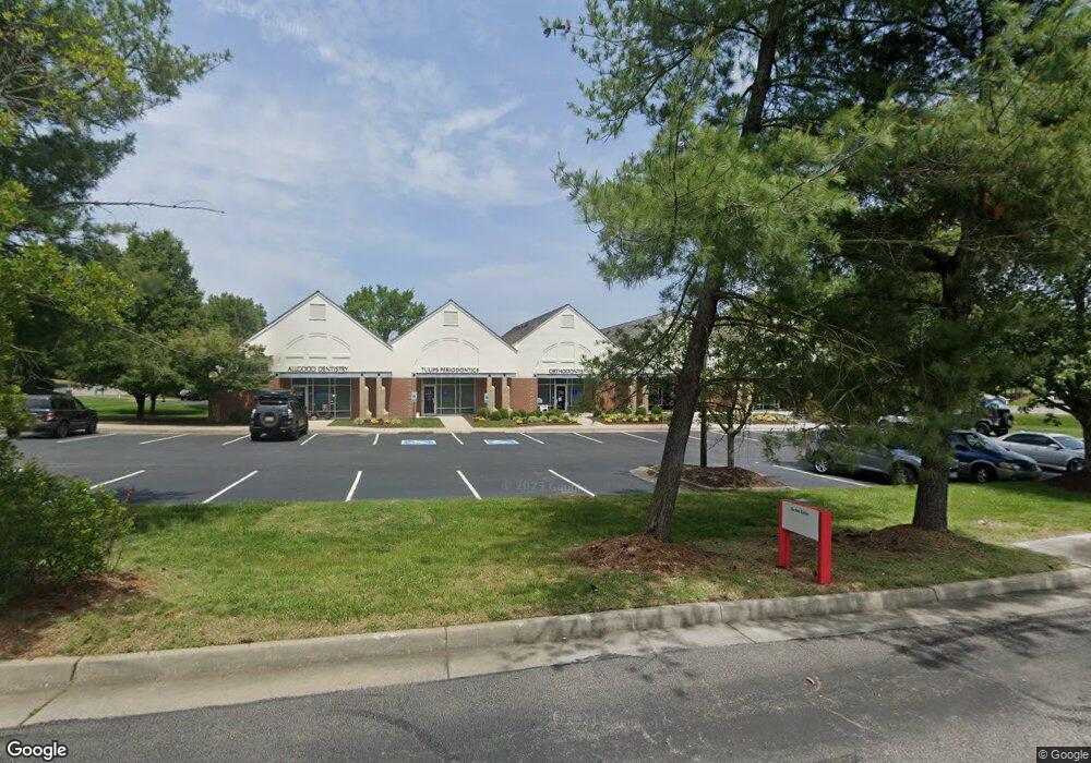
5921 Harbour Ln Midlothian, VA 23112
Estimated Value: $2,943,864
--
Bed
--
Bath
8,774
Sq Ft
$336/Sq Ft
Est. Value
About This Home
This home is located at 5921 Harbour Ln, Midlothian, VA 23112 and is currently estimated at $2,943,864, approximately $335 per square foot. 5921 Harbour Ln is a home located in Chesterfield County with nearby schools including Clover Hill Elementary School, Swift Creek Middle, and Clover Hill High.
Ownership History
Date
Name
Owned For
Owner Type
Purchase Details
Closed on
Apr 10, 2019
Sold by
Harbor Pointe Medical Associates Lp
Bought by
Champagne Toast Llc
Current Estimated Value
Home Financials for this Owner
Home Financials are based on the most recent Mortgage that was taken out on this home.
Original Mortgage
$1,487,500
Outstanding Balance
$1,307,777
Interest Rate
4.3%
Mortgage Type
Commercial
Estimated Equity
$1,636,087
Create a Home Valuation Report for This Property
The Home Valuation Report is an in-depth analysis detailing your home's value as well as a comparison with similar homes in the area
Home Values in the Area
Average Home Value in this Area
Purchase History
| Date | Buyer | Sale Price | Title Company |
|---|---|---|---|
| Champagne Toast Llc | $1,750,000 | Stewart Land Title |
Source: Public Records
Mortgage History
| Date | Status | Borrower | Loan Amount |
|---|---|---|---|
| Open | Champagne Toast Llc | $1,487,500 |
Source: Public Records
Tax History Compared to Growth
Tax History
| Year | Tax Paid | Tax Assessment Tax Assessment Total Assessment is a certain percentage of the fair market value that is determined by local assessors to be the total taxable value of land and additions on the property. | Land | Improvement |
|---|---|---|---|---|
| 2025 | $14,026 | $1,542,300 | $789,600 | $752,700 |
| 2024 | $14,026 | $1,539,700 | $789,600 | $750,100 |
| 2023 | $13,162 | $1,446,400 | $789,600 | $656,800 |
| 2022 | $15,123 | $1,643,800 | $700,800 | $943,000 |
| 2021 | $15,916 | $1,643,800 | $700,800 | $943,000 |
| 2020 | $15,616 | $1,643,800 | $700,800 | $943,000 |
| 2019 | $14,243 | $1,499,300 | $668,800 | $830,500 |
| 2018 | $12,783 | $1,308,400 | $668,800 | $639,600 |
| 2017 | $12,836 | $1,308,400 | $668,800 | $639,600 |
| 2016 | $12,561 | $1,308,400 | $668,800 | $639,600 |
| 2015 | $12,456 | $1,297,500 | $668,800 | $628,700 |
| 2014 | $12,456 | $1,297,500 | $668,800 | $628,700 |
Source: Public Records
Map
Nearby Homes
- 31 Spinnaker Cove Dr
- 13628 Baycraft Terrace
- 4902 Court Ridge Terrace
- 6001 Harbourwood Ct
- 13300 Court Ridge Rd
- 4714 Five Springs Ct
- 13501 Buck Rub Dr
- 5601 Promontory Pointe Rd
- 13305 Pointer Ridge Terrace
- 7136 Velvet Antler Dr
- 13207 Gate Post Ct
- 13812 Rockport Landing Rd
- 13905 N Point Rd
- 7112 Deer Thicket Dr
- 7018 Spring Trace Terrace
- 13707 Swale Ln
- 5806 Bayport Landing Ct
- 4825 Cloverleigh Dr
- 4821 Cloverleigh Dr
- 4829 Cloverleigh Dr
- 6030 Harbour Park Dr
- 13500 Harbour Pointe Pkwy
- 5948 Harbour Park Dr
- 5942 Harbour Park Dr
- 5936 Harbour Park Dr
- 5954 Harbour Park Dr
- 5920 Harbour Ln
- 6002 Harbour Park Dr
- 5930 Harbour Park Dr
- 6081 Harbour Park Dr
- 5924 Harbour Park Dr
- 6001 Harbour Park Dr
- 13501 Hull Street Rd
- 5955 Harbour Park Dr
- 6099 Harbour Park Dr
- 13510 Hull Street Rd
- 5949 Harbour Park Dr
- 6007 Harbour Park Dr
- 13511 Hull Street Rd
- 5943 Harbour Park Dr