R
Seller's Agent in 2025
Reinaldo Pagan
COLLINI REAL ESTATE, LLC
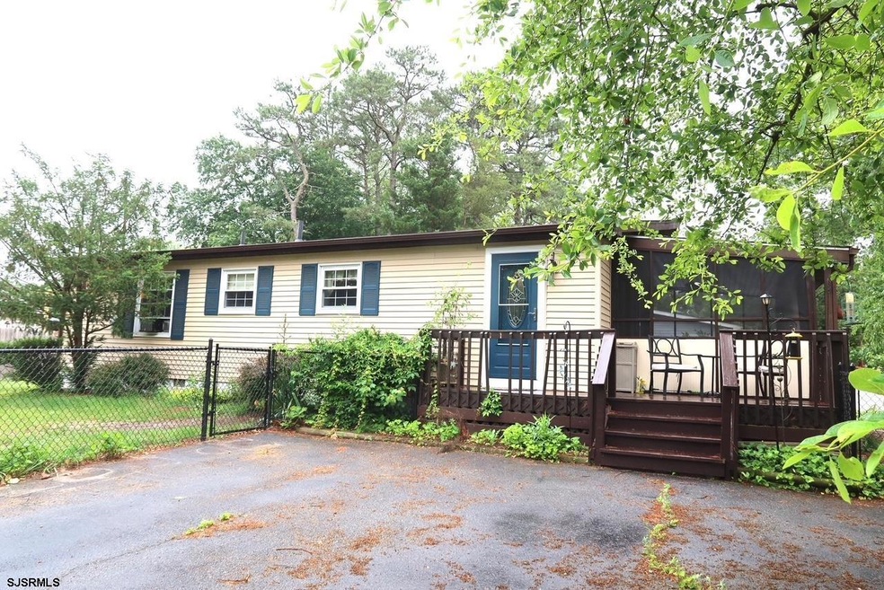
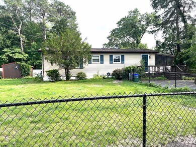
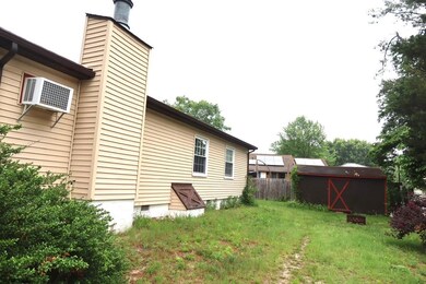
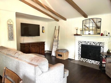
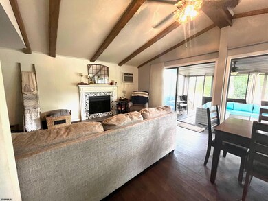
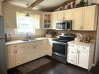
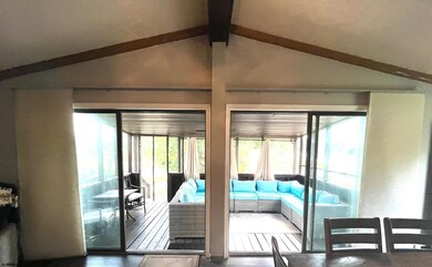
**Back on the market** Charming 3BR/1BA Move-in ready rancher on a spacious corner lot in the desirable Cloverleaf neighborhood. This home features a warm open floor plan with newer laminate flooring throughout, a cozy fireplace, and efficient gas heat. The inviting house features a cottage-style kitchen and a timelessly updated bathroom. Enjoy the outdoors with a large screened-in porch, a newer fenced-in yard, and an oversized horseshoe driveway with plenty of parking. Window & Wall A/C units. Conveniently located near shopping, dining, and major roadways. A perfect blend of comfort, character, and convenience. Unrelated to the property, the original Buyer's financing has not been approved. Don’t miss this one!
Last Agent to Sell the Property
Reinaldo Pagan
COLLINI REAL ESTATE, LLC Listed on: 06/17/2025
| Date | Type | Sale Price | Title Company |
|---|---|---|---|
| Warranty Deed | $310,000 | Lloyds & Handson Title | |
| Executors Deed | -- | None Listed On Document | |
| Interfamily Deed Transfer | -- | -- | |
| Bargain Sale Deed | $86,000 | Fidelity National Title | |
| Deed | $1,400 | -- |
| Date | Status | Loan Amount | Loan Type |
|---|---|---|---|
| Open | $304,385 | New Conventional | |
| Closed | $304,385 | FHA | |
| Previous Owner | $85,296 | FHA |
| Date | Event | Price | List to Sale | Price per Sq Ft |
|---|---|---|---|---|
| 09/18/2025 09/18/25 | Sold | $310,000 | 0.0% | -- |
| 09/05/2025 09/05/25 | Price Changed | $310,000 | +7.3% | -- |
| 09/03/2025 09/03/25 | Price Changed | $289,000 | -6.8% | -- |
| 08/23/2025 08/23/25 | Price Changed | $310,000 | 0.0% | -- |
| 08/23/2025 08/23/25 | For Sale | $310,000 | +7.3% | -- |
| 07/02/2025 07/02/25 | Pending | -- | -- | -- |
| 06/17/2025 06/17/25 | For Sale | $289,000 | -- | -- |
| Year | Tax Paid | Tax Assessment Tax Assessment Total Assessment is a certain percentage of the fair market value that is determined by local assessors to be the total taxable value of land and additions on the property. | Land | Improvement |
|---|---|---|---|---|
| 2025 | -- | $140,300 | $49,200 | $91,100 |
| 2024 | -- | $140,300 | $49,200 | $91,100 |
| 2023 | -- | $140,300 | $49,200 | $91,100 |
| 2022 | $0 | $140,300 | $49,200 | $91,100 |
| 2021 | $15,322 | $140,300 | $49,200 | $91,100 |
| 2020 | $0 | $140,300 | $49,200 | $91,100 |
| 2019 | $0 | $140,300 | $49,200 | $91,100 |
| 2018 | $0 | $140,300 | $49,200 | $91,100 |
| 2017 | $0 | $140,300 | $49,200 | $91,100 |
| 2016 | $0 | $140,300 | $49,200 | $91,100 |
| 2015 | -- | $140,300 | $49,200 | $91,100 |
| 2014 | -- | $154,600 | $54,200 | $100,400 |
R
Seller's Agent in 2025
Reinaldo Pagan
COLLINI REAL ESTATE, LLC

Buyer's Agent in 2025
Dana Smith
CENTURY 21 ATLANTIC PROFESSIONAL REALTY
(609) 214-4862
11 in this area
110 Total Sales
Source: South Jersey Shore Regional MLS
MLS Number: 597406
APN: 12-00840-0000-00001
Disclaimer: Certain information contained herein is derived from information provided by parties other than Homes.com. All information provided is deemed reliable, but is not guaranteed to be accurate and should be independently verified.
![]() IDX information is provided exclusively for personal, non-commercial use, and may not be used for any purpose other than to identify prospective properties consumers may be interested in purchasing.
IDX information is provided exclusively for personal, non-commercial use, and may not be used for any purpose other than to identify prospective properties consumers may be interested in purchasing.
Information is deemed reliable but not guaranteed.
© 2025 South Jersey Shore Regional Multiple Listing Service. All rights reserved.