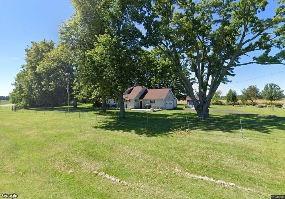
5925 Prairie Rd Springfield, OH 45502
Estimated Value: $226,933 - $270,000
2
Beds
1
Bath
1,176
Sq Ft
$209/Sq Ft
Est. Value
About This Home
This home is located at 5925 Prairie Rd, Springfield, OH 45502 and is currently estimated at $245,983, approximately $209 per square foot. 5925 Prairie Rd is a home located in Clark County with nearby schools including Northridge Elementary School, Kenton Ridge Middle & High School, and Emmanuel Christian Academy.
Ownership History
Date
Name
Owned For
Owner Type
Purchase Details
Closed on
Jul 24, 2000
Sold by
Ilges Karensue S
Bought by
Abshear Jeffrey K
Current Estimated Value
Home Financials for this Owner
Home Financials are based on the most recent Mortgage that was taken out on this home.
Original Mortgage
$79,800
Outstanding Balance
$27,418
Interest Rate
8.27%
Estimated Equity
$218,565
Create a Home Valuation Report for This Property
The Home Valuation Report is an in-depth analysis detailing your home's value as well as a comparison with similar homes in the area
Purchase History
| Date | Buyer | Sale Price | Title Company |
|---|---|---|---|
| Abshear Jeffrey K | $103,000 | Real Estate Title |
Source: Public Records
Mortgage History
| Date | Status | Borrower | Loan Amount |
|---|---|---|---|
| Open | Abshear Jeffrey K | $79,800 |
Source: Public Records
Tax History
| Year | Tax Paid | Tax Assessment Tax Assessment Total Assessment is a certain percentage of the fair market value that is determined by local assessors to be the total taxable value of land and additions on the property. | Land | Improvement |
|---|---|---|---|---|
| 2025 | $2,158 | $59,270 | $21,260 | $38,010 |
| 2024 | $2,087 | $49,260 | $15,430 | $33,830 |
| 2023 | $2,087 | $49,260 | $15,430 | $33,830 |
| 2022 | $862 | $49,260 | $15,430 | $33,830 |
| 2021 | $2,020 | $40,240 | $12,250 | $27,990 |
| 2020 | $1,953 | $38,880 | $12,250 | $26,630 |
| 2019 | $1,991 | $38,880 | $12,250 | $26,630 |
| 2018 | $1,942 | $36,390 | $12,250 | $24,140 |
| 2017 | $1,665 | $32,974 | $12,247 | $20,727 |
| 2016 | $1,654 | $32,974 | $12,247 | $20,727 |
| 2015 | $1,724 | $32,974 | $12,247 | $20,727 |
| 2014 | $1,724 | $32,974 | $12,247 | $20,727 |
| 2013 | $1,684 | $32,974 | $12,247 | $20,727 |
Source: Public Records
Map
Nearby Homes
- 4607 Plateau Dr S
- 4273 Kay Ave
- 4293 Yale St
- 4954 E County Line Rd
- 5060 Morris Rd
- 4500 Bosart Rd
- 1977 Willoughby Ave
- 4890 Brannan Dr W Unit 4890
- 1836 Dunseth Ln
- 1812 Willow Lakes Dr
- 1470 Oldham Dr Unit 12
- 5564 Ridgewood Rd E Unit 7
- 1398 Elizabeth Ct Unit 66
- 5393 Neer Rd
- 1495 Victorian Way
- 9 Middle Urbana Rd
- 1521 Erika Dr
- 4652 Reno Ln Unit 15
- 5033 Ridgewood Rd E
- 4028 Ryland Dr Unit 4028
- 5955 Prairie Rd
- 5975 Prairie Rd
- 5970 Prairie Rd
- 6016 Prairie Rd
- 6031 Prairie Rd
- 6052 Prairie Rd
- 6055 Prairie Rd
- 6080 Prairie Rd
- 5765 Prairie Rd
- 4575 Plateau Dr S
- 6114 Prairie Rd
- 4615 Plateau Dr S
- 5736 Prairie Rd
- 4611 Plateau Dr S
- 4605 Plateau Dr S
- 6140 Prairie Rd
- 4619 Plateau Dr S
- 5720 Prairie Rd
- 6162 Prairie Rd
- 4600 Plateau Dr N
Your Personal Tour Guide
Ask me questions while you tour the home.