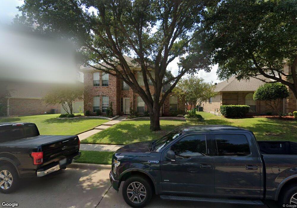
5925 Stewart Blvd the Colony, TX 75056
Estimated Value: $578,596 - $637,000
3
Beds
2
Baths
3,078
Sq Ft
$196/Sq Ft
Est. Value
About This Home
This home is located at 5925 Stewart Blvd, the Colony, TX 75056 and is currently estimated at $604,149, approximately $196 per square foot. 5925 Stewart Blvd is a home located in Denton County with nearby schools including Ethridge Elementary School, Lakeview Middle School, and The Colony High School.
Ownership History
Date
Name
Owned For
Owner Type
Purchase Details
Closed on
Feb 27, 1997
Sold by
Hampton Enterprises Inc
Bought by
Leichinger Jack R and Leichinger Leann L
Current Estimated Value
Home Financials for this Owner
Home Financials are based on the most recent Mortgage that was taken out on this home.
Original Mortgage
$150,250
Outstanding Balance
$18,447
Interest Rate
7.88%
Estimated Equity
$585,702
Purchase Details
Closed on
Sep 25, 1996
Sold by
Stewart Peninsula Development Partners
Bought by
Hampton Enterprises Inc
Home Financials for this Owner
Home Financials are based on the most recent Mortgage that was taken out on this home.
Original Mortgage
$125,068
Interest Rate
7.91%
Mortgage Type
VA
Create a Home Valuation Report for This Property
The Home Valuation Report is an in-depth analysis detailing your home's value as well as a comparison with similar homes in the area
Home Values in the Area
Average Home Value in this Area
Purchase History
| Date | Buyer | Sale Price | Title Company |
|---|---|---|---|
| Leichinger Jack R | -- | -- | |
| Hampton Enterprises Inc | -- | -- |
Source: Public Records
Mortgage History
| Date | Status | Borrower | Loan Amount |
|---|---|---|---|
| Open | Leichinger Jack R | $150,250 | |
| Previous Owner | Hampton Enterprises Inc | $125,068 |
Source: Public Records
Tax History Compared to Growth
Tax History
| Year | Tax Paid | Tax Assessment Tax Assessment Total Assessment is a certain percentage of the fair market value that is determined by local assessors to be the total taxable value of land and additions on the property. | Land | Improvement |
|---|---|---|---|---|
| 2025 | $5,715 | $545,259 | $85,404 | $540,853 |
| 2024 | $9,620 | $495,690 | $0 | $0 |
| 2023 | $5,722 | $450,627 | $85,404 | $463,186 |
| 2022 | $8,600 | $409,661 | $85,404 | $453,392 |
| 2021 | $8,295 | $372,419 | $55,901 | $316,518 |
| 2020 | $8,413 | $378,506 | $55,901 | $322,605 |
| 2019 | $8,483 | $369,519 | $55,901 | $317,099 |
| 2018 | $7,761 | $335,926 | $55,901 | $280,025 |
| 2017 | $7,371 | $315,545 | $50,466 | $271,139 |
| 2016 | $6,938 | $286,859 | $50,466 | $252,552 |
| 2015 | $5,777 | $260,781 | $54,348 | $206,433 |
| 2013 | -- | $226,252 | $46,584 | $179,668 |
Source: Public Records
Map
Nearby Homes
- 5984 Sandhill Cir
- 5900 Sandhill Cir
- 3812 Red Oak Trail
- 3812 Acacia Trail
- 3741 Cottonwood Springs Dr
- 6104 Ethridge Dr
- 3724 Saint Andrews Dr
- 6048 Cypress Cove Dr
- 3929 Harbor Dr
- 3528 Cottonwood Springs Dr
- 4049 Heron Cove Ln
- 6412 Stewart Blvd
- 5809 Spring Hollow Ln
- 6 James Cir
- 3912 Willow Bend Dr
- 4140 N Colony Blvd
- 4176 Clary Dr
- 4193 Newton St
- 6553 Westway Dr
- 4204 Ireland Dr
- 5929 Stewart Blvd
- 5921 Stewart Blvd
- 5973 Sandhill Cir
- 5916 Stewart Cir
- 5977 Sandhill Cir
- 5913 Stewart Blvd
- 5921 Sandhill Cir
- 5956 Sandhill Cir
- 5952 Sandhill Cir
- 5948 Sandhill Cir
- 5964 Sandhill Cir
- 5960 Sandhill Cir
- 5981 Sandhill Cir
- 5912 Stewart Cir
- 5944 Sandhill Cir
- 5968 Sandhill Cir
- 5917 Sandhill Cir
- 5908 Stewart Cir
- 5972 Sandhill Cir
- 5985 Sandhill Cir