Estimated Value: $1,042,036 - $1,297,000
--
Bed
--
Bath
2,254
Sq Ft
$505/Sq Ft
Est. Value
About This Home
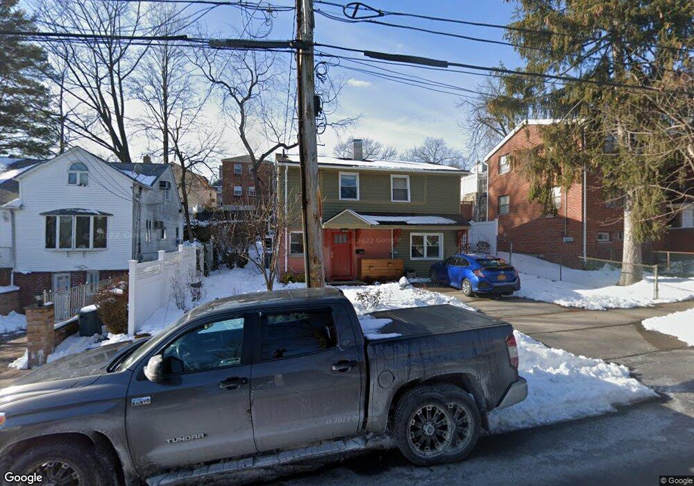
This home is located at 5927 Fieldston Rd, Bronx, NY 10471 and is currently estimated at $1,137,759, approximately $504 per square foot. 5927 Fieldston Rd is a home located in Bronx County with nearby schools including P.S. 81 - Robert J. Christen, Riverdale Kingsbridge Academy, and St Margaret Of Cortona School.
Ownership History
Date
Name
Owned For
Owner Type
Purchase Details
Closed on
May 14, 2015
Sold by
Friedman Philip and Saavedra Friedman Elizabeth
Bought by
Hanson Christina and Rahman Adeeb
Current Estimated Value
Home Financials for this Owner
Home Financials are based on the most recent Mortgage that was taken out on this home.
Original Mortgage
$410,000
Outstanding Balance
$316,991
Interest Rate
3.78%
Mortgage Type
New Conventional
Estimated Equity
$820,768
Purchase Details
Closed on
Sep 2, 1999
Sold by
Erde Steven M and Bernd Erde Paulette
Bought by
Friedman Philip and Friedman Elizabeth Saavedra
Home Financials for this Owner
Home Financials are based on the most recent Mortgage that was taken out on this home.
Original Mortgage
$240,000
Interest Rate
7.75%
Create a Home Valuation Report for This Property
The Home Valuation Report is an in-depth analysis detailing your home's value as well as a comparison with similar homes in the area
Home Values in the Area
Average Home Value in this Area
Purchase History
| Date | Buyer | Sale Price | Title Company |
|---|---|---|---|
| Hanson Christina | $650,000 | -- | |
| Friedman Philip | $320,000 | -- |
Source: Public Records
Mortgage History
| Date | Status | Borrower | Loan Amount |
|---|---|---|---|
| Open | Hanson Christina | $410,000 | |
| Previous Owner | Friedman Philip | $240,000 | |
| Closed | Friedman Philip | $48,000 |
Source: Public Records
Tax History Compared to Growth
Tax History
| Year | Tax Paid | Tax Assessment Tax Assessment Total Assessment is a certain percentage of the fair market value that is determined by local assessors to be the total taxable value of land and additions on the property. | Land | Improvement |
|---|---|---|---|---|
| 2025 | $10,912 | $54,743 | $18,387 | $36,356 |
| 2024 | $10,912 | $54,329 | $16,530 | $37,799 |
| 2023 | $9,676 | $51,254 | $15,926 | $35,328 |
| 2022 | $8,428 | $59,160 | $18,420 | $40,740 |
| 2021 | $9,601 | $56,640 | $18,420 | $38,220 |
| 2020 | $8,923 | $56,100 | $18,420 | $37,680 |
| 2019 | $9,471 | $57,840 | $18,420 | $39,420 |
| 2018 | $8,707 | $42,712 | $12,186 | $30,526 |
| 2017 | $8,214 | $40,296 | $13,203 | $27,093 |
| 2016 | $7,600 | $38,016 | $13,795 | $24,221 |
| 2015 | $4,585 | $38,016 | $14,781 | $23,235 |
| 2014 | $4,585 | $37,729 | $17,600 | $20,129 |
Source: Public Records
Map
Nearby Homes
- 5930 Tyndall Ave
- 5834 Fieldston Rd
- 5926 Spencer Ave
- 5918 Delafield Ave
- 6036 Liebig Ave
- 6033A Huxley Ave
- 227 W 260th St
- 5730 Mosholu Ave Unit 5F
- 5730 Mosholu Ave Unit 4-F
- 5730 Mosholu Ave Unit 6A
- 5922 Post Rd
- 204 W 260th St
- 5783 Mosholu Ave
- 6112 Fieldston Rd
- 6535 Broadway Unit 2G
- 6535 Broadway Unit 5C
- 6535 Broadway Unit 6
- 6535 Broadway Unit 2A
- 5648 Delafield Ave
- 6485 Broadway Unit 2K
- 5923 Fieldston Rd
- 5929 Fieldston Rd
- 5914 Tyndall Ave
- 5912 Tyndall Ave
- 5912 Tyndall Ave Unit 1
- 5916 Tyndall Ave
- 5910 Tyndall Ave
- 5918 Tyndall Ave
- 5908 Tyndall Ave
- 5933 Fieldston Rd
- 351 W 259th St
- 5926 Tyndall Ave
- 357 W 259th St
- 5920 Fieldston Rd
- 5924 Fieldston Rd
- 5912 Fieldston Rd
- 5928 Fieldston Rd
- 5910 Fieldston Rd
- 5910 Fieldston Rd Unit Building
- 5930 Fieldston Rd