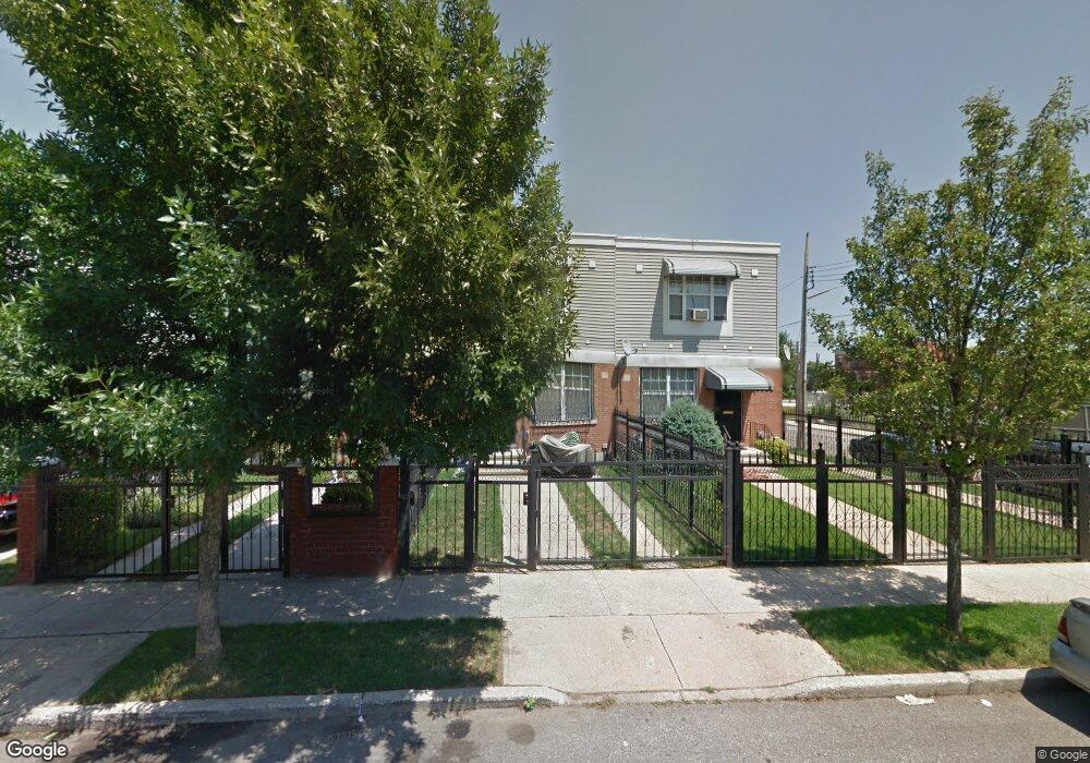
593 Alabama Ave Brooklyn, NY 11207
Brownsville NeighborhoodEstimated Value: $576,122 - $735,000
--
Bed
--
Bath
1,296
Sq Ft
$500/Sq Ft
Est. Value
About This Home
This home is located at 593 Alabama Ave, Brooklyn, NY 11207 and is currently estimated at $648,531, approximately $500 per square foot. 593 Alabama Ave is a home located in Kings County with nearby schools including P.S. 190 - Sheffield, Achievement First - East New York School, and Grace Christian Educational.
Ownership History
Date
Name
Owned For
Owner Type
Purchase Details
Closed on
Jun 21, 2021
Sold by
Pointdexter Travis As Sole Heir-At-Law A
Bought by
Poindexter Travis A
Current Estimated Value
Purchase Details
Closed on
Apr 19, 2000
Sold by
Nehemiah Housing Development Fund Co Inc
Bought by
Poindexter Audrey L
Home Financials for this Owner
Home Financials are based on the most recent Mortgage that was taken out on this home.
Original Mortgage
$70,000
Interest Rate
8.48%
Create a Home Valuation Report for This Property
The Home Valuation Report is an in-depth analysis detailing your home's value as well as a comparison with similar homes in the area
Home Values in the Area
Average Home Value in this Area
Purchase History
| Date | Buyer | Sale Price | Title Company |
|---|---|---|---|
| Poindexter Travis A | -- | -- | |
| Poindexter Audrey L | $95,000 | First American Title Ins Co |
Source: Public Records
Mortgage History
| Date | Status | Borrower | Loan Amount |
|---|---|---|---|
| Previous Owner | Poindexter Audrey L | $70,000 | |
| Closed | Poindexter Audrey L | $20,000 |
Source: Public Records
Tax History Compared to Growth
Tax History
| Year | Tax Paid | Tax Assessment Tax Assessment Total Assessment is a certain percentage of the fair market value that is determined by local assessors to be the total taxable value of land and additions on the property. | Land | Improvement |
|---|---|---|---|---|
| 2025 | $3,997 | $33,780 | $13,680 | $20,100 |
| 2024 | $3,997 | $31,620 | $13,680 | $17,940 |
| 2023 | $4,010 | $33,240 | $13,680 | $19,560 |
| 2022 | $1,106 | $32,760 | $13,680 | $19,080 |
| 2021 | $1,191 | $28,140 | $13,680 | $14,460 |
| 2020 | $893 | $26,340 | $13,680 | $12,660 |
| 2019 | $2,792 | $23,760 | $13,680 | $10,080 |
| 2018 | $2,495 | $16,456 | $7,267 | $9,189 |
| 2017 | $2,116 | $15,526 | $6,337 | $9,189 |
| 2016 | $1,700 | $14,648 | $5,459 | $9,189 |
| 2015 | $418 | $13,820 | $4,631 | $9,189 |
| 2014 | $418 | $13,820 | $4,631 | $9,189 |
Source: Public Records
Map
Nearby Homes
- 610 Alabama Ave
- 606 Alabama Ave
- 582 Williams Ave
- 589 Hinsdale St
- 578 Williams Ave
- 576 Williams Ave
- 650 Williams Ave
- 541 Hinsdale St
- 584 Hinsdale St
- 660 Williams Ave Unit 142
- 442 Newport St
- 679 Georgia Ave
- 533 Snediker Ave
- 661 Sheffield Ave
- 667 Sheffield Ave
- 694 Pennsylvania Ave
- 1825 Linden Blvd
- 494 Hegeman Ave
- 521 Hegeman Ave
- 1755 Linden Blvd
- 591 Alabama Ave
- 595 Alabama Ave
- 589 Alabama Ave
- 587 Alabama Ave
- 585 Alabama Ave
- 604 Georgia Ave
- 608 Georgia Ave Unit 3
- 608 Georgia Ave
- 602 Georgia Ave
- 583 Alabama Ave
- 599 Alabama Ave
- 598 Georgia Ave
- 601 Alabama Ave
- 596 Georgia Ave
- 579 Alabama Ave
- 592 Alabama Ave Unit 1
- 592 Georgia Ave
- 577 Alabama Ave
- 594 Alabama Ave
- 597 Alabama Ave