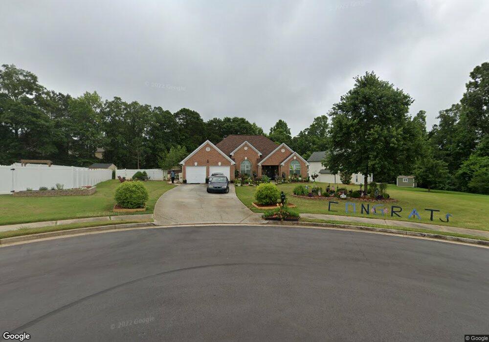
593 Andrews Dr Hampton, GA 30228
Estimated Value: $302,456 - $326,000
4
Beds
3
Baths
2,390
Sq Ft
$132/Sq Ft
Est. Value
About This Home
This home is located at 593 Andrews Dr, Hampton, GA 30228 and is currently estimated at $314,614, approximately $131 per square foot. 593 Andrews Dr is a home located in Clayton County with nearby schools including River's Edge Elementary School, Eddie White Academy, and Lovejoy High School.
Ownership History
Date
Name
Owned For
Owner Type
Purchase Details
Closed on
Oct 30, 2009
Sold by
Lane Tracy
Bought by
Lane Tracy and Watkins Tramichael
Current Estimated Value
Purchase Details
Closed on
Oct 27, 2008
Sold by
Mlmi Trust 2007-He3
Bought by
Lane Tracy
Purchase Details
Closed on
Feb 5, 2008
Sold by
Batiste Adrian and Batiste Nicole M
Bought by
Lasalle Bank Na
Create a Home Valuation Report for This Property
The Home Valuation Report is an in-depth analysis detailing your home's value as well as a comparison with similar homes in the area
Home Values in the Area
Average Home Value in this Area
Purchase History
| Date | Buyer | Sale Price | Title Company |
|---|---|---|---|
| Lane Tracy | -- | -- | |
| Lane Tracy | $110,000 | -- | |
| Lasalle Bank Na | $117,300 | -- |
Source: Public Records
Tax History Compared to Growth
Tax History
| Year | Tax Paid | Tax Assessment Tax Assessment Total Assessment is a certain percentage of the fair market value that is determined by local assessors to be the total taxable value of land and additions on the property. | Land | Improvement |
|---|---|---|---|---|
| 2025 | $2,095 | $120,000 | $10,400 | $109,600 |
| 2024 | $2,173 | $120,000 | $10,400 | $109,600 |
| 2023 | $3,596 | $127,400 | $10,400 | $117,000 |
| 2022 | $1,762 | $99,600 | $10,400 | $89,200 |
| 2021 | $2,643 | $75,960 | $10,400 | $65,560 |
| 2020 | $2,685 | $76,183 | $10,400 | $65,783 |
| 2019 | $2,659 | $74,572 | $9,600 | $64,972 |
| 2018 | $2,019 | $58,800 | $9,600 | $49,200 |
| 2017 | $2,024 | $58,800 | $9,600 | $49,200 |
| 2016 | $2,024 | $67,804 | $9,600 | $58,204 |
| 2015 | $1,390 | $0 | $0 | $0 |
| 2014 | $1,033 | $35,007 | $9,600 | $25,407 |
Source: Public Records
Map
Nearby Homes
- 11961 Markham Way
- 472 Andrews Dr
- 12283 Coldstream Ct
- 11800 Guelph Cir
- 574 Caledon Way
- 536 Caledon Way
- 12148 Flannery Ln
- 12216 Edgewater Dr
- 442 Toronto Cir
- 12275 Styron Dr
- 12001 Guelph Cir
- 12075 Haley Ln
- 12328 Edgewater Dr
- 0 Panhandle Rd Unit 7648796
- 0 Panhandle Rd Unit LOT 1 10559919
- 0 Panhandle Rd Unit LOT 4 10559933
- 0 Panhandle Rd Unit 10603376
- 0 Panhandle Rd Unit LOT 3 10559926
- 0 Panhandle Rd Unit LOT 2 10559924
- 12350 Riviera Dr
- 12153 Dickson Rd Unit 4
- 589 Andrews Dr
- 13050 North Hill Dr Unit 4
- 12165 Dickson Rd
- 536 Vaughan Dr
- 542 Vaughan Dr
- 530 Vaughan Dr
- 592 Andrews Dr Unit 4
- 12952 N Hill Dr Unit 236
- 12952 N Hill Dr
- 12952 North Hill Dr Unit 4
- 12128 Dominion Dr Unit 2
- 12952 N Hill Dr
- 548 Vaughan Dr
- 524 Vaughan Dr
- 580 Andrews Dr
- 12177 Dickson Rd Unit 1
- 573 Andrews Dr
- 554 Vaughan Dr
- 518 Vaughan Dr