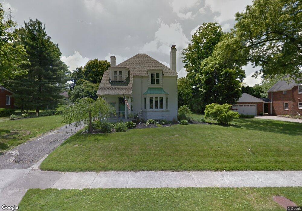
593 Coleman Rd Mansfield, OH 44903
Estimated Value: $174,000 - $189,000
3
Beds
2
Baths
1,983
Sq Ft
$92/Sq Ft
Est. Value
About This Home
This home is located at 593 Coleman Rd, Mansfield, OH 44903 and is currently estimated at $183,095, approximately $92 per square foot. 593 Coleman Rd is a home located in Richland County with nearby schools including Goal Digital Academy, Discovery School, and St. Peter's Elementary/Montessori School.
Ownership History
Date
Name
Owned For
Owner Type
Purchase Details
Closed on
Jan 28, 2000
Sold by
Morrow Gary A
Bought by
Phillips Daniel P
Current Estimated Value
Home Financials for this Owner
Home Financials are based on the most recent Mortgage that was taken out on this home.
Original Mortgage
$79,500
Outstanding Balance
$22,762
Interest Rate
7.84%
Mortgage Type
New Conventional
Estimated Equity
$160,333
Purchase Details
Closed on
Jun 3, 1996
Sold by
Est Wanda V Davis
Bought by
Morrow Gary A and Morrow Kecia M
Home Financials for this Owner
Home Financials are based on the most recent Mortgage that was taken out on this home.
Original Mortgage
$74,900
Interest Rate
7.99%
Mortgage Type
FHA
Purchase Details
Closed on
Feb 1, 1986
Create a Home Valuation Report for This Property
The Home Valuation Report is an in-depth analysis detailing your home's value as well as a comparison with similar homes in the area
Home Values in the Area
Average Home Value in this Area
Purchase History
We collect this data history from publicly available records. To have your information removed, we recommend requesting removal directly through your county’s website.
| Date | Buyer | Sale Price | Title Company |
|---|---|---|---|
| Phillips Daniel P | $85,000 | -- | |
| Morrow Gary A | $75,000 | -- | |
| -- | $56,000 | -- |
Source: Public Records
Mortgage History
We collect this data history from publicly available records. To have your information removed, we recommend requesting removal directly through your county’s website.
| Date | Status | Borrower | Loan Amount |
|---|---|---|---|
| Open | Phillips Daniel P | $79,500 | |
| Previous Owner | Morrow Gary A | $74,900 |
Source: Public Records
Tax History
| Year | Tax Paid | Tax Assessment Tax Assessment Total Assessment is a certain percentage of the fair market value that is determined by local assessors to be the total taxable value of land and additions on the property. | Land | Improvement |
|---|---|---|---|---|
| 2025 | $2,027 | $44,220 | $3,350 | $40,870 |
| 2024 | $2,117 | $44,220 | $3,350 | $40,870 |
| 2023 | $2,067 | $44,220 | $3,350 | $40,870 |
| 2022 | $1,784 | $31,890 | $2,870 | $29,020 |
| 2021 | $1,796 | $31,890 | $2,870 | $29,020 |
| 2020 | $1,837 | $31,890 | $2,870 | $29,020 |
| 2019 | $2,035 | $31,890 | $2,870 | $29,020 |
| 2018 | $2,008 | $31,890 | $2,870 | $29,020 |
| 2017 | $1,757 | $28,670 | $2,870 | $25,800 |
| 2016 | $1,785 | $28,250 | $3,960 | $24,290 |
| 2015 | $1,705 | $28,250 | $3,960 | $24,290 |
| 2014 | $1,683 | $28,250 | $3,960 | $24,290 |
| 2012 | $641 | $28,240 | $4,160 | $24,080 |
Source: Public Records
Map
Nearby Homes
- 679 Coleman Rd
- 551 Cline Ave
- 495 Davey Ave
- 575 Maple St
- 116 Stewart Ave S
- 394 Abbeyfeale Rd
- 108 Stewart Ave S
- 93 Parkwood Blvd
- 143 Fairlawn Ave
- 850 Arlington Ave
- 135 Fairlawn Ave
- 129 Fairlawn Ave
- 356 Townview Cir N
- 42 Parkwood Blvd
- 183 Carpenter Rd
- 655 Woodhill Rd
- 664 Woodhill Rd
- 236 Bowland Rd
- 530 Wood St
- 51 Lind Ave
- 585 Barnard Ave
- 591 Barnard Ave Unit 593
- 560 Marion Ave
- 532 Marion Ave
- 599 Barnard Ave
- 597 Barnard Ave
- 564 Marion Ave
- 584 Barnard Ave
- 594 Manchester Rd
- 580 Barnard Ave
- 592 Barnard Ave
- 607 Barnard Ave
- 600 Manchester Rd
- 598 Barnard Ave
- 611 Barnard Ave
- 606 Barnard Ave
- 603 Manchester Rd
- 570 Marion Ave 603-609 Manchester Rd
- 551 Marion Ave
- 608 Manchester Rd
Your Personal Tour Guide
Ask me questions while you tour the home.