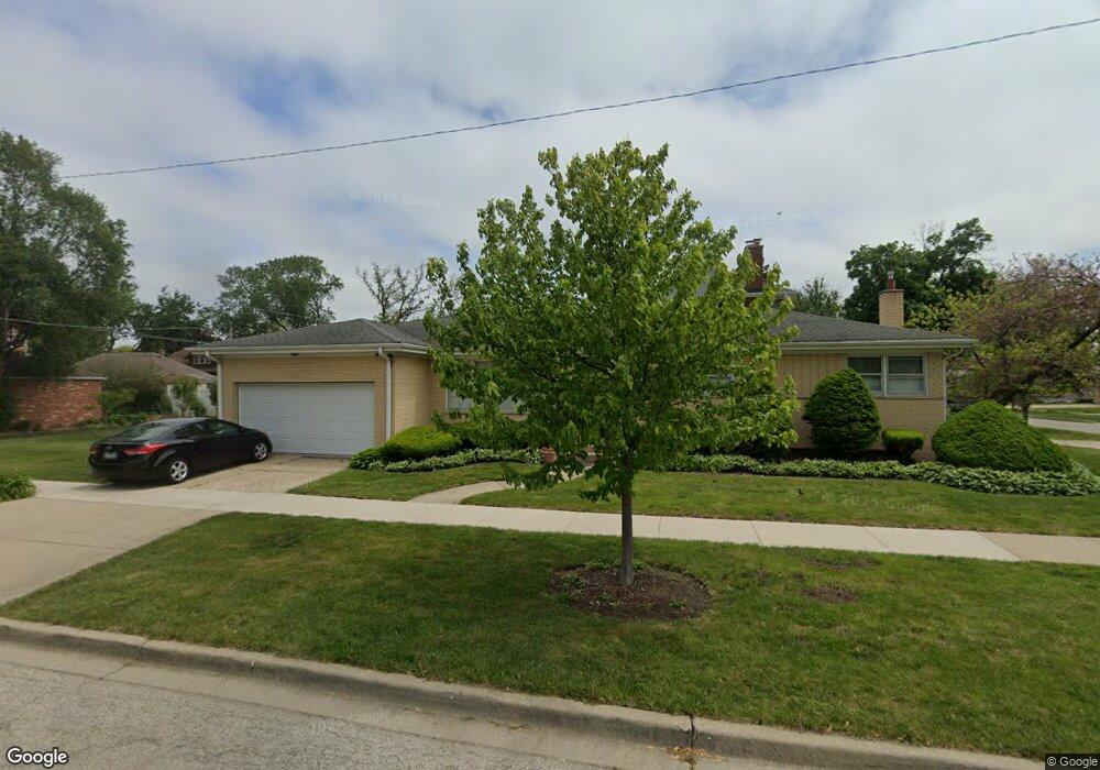
593 S 2nd Ave Des Plaines, IL 60016
Estimated Value: $377,000 - $403,000
3
Beds
2
Baths
1,181
Sq Ft
$330/Sq Ft
Est. Value
About This Home
This home is located at 593 S 2nd Ave, Des Plaines, IL 60016 and is currently estimated at $389,250, approximately $329 per square foot. 593 S 2nd Ave is a home located in Cook County with nearby schools including Forest Elementary School, Algonquin Middle School, and Maine West High School.
Ownership History
Date
Name
Owned For
Owner Type
Purchase Details
Closed on
Feb 20, 2007
Sold by
Voss Joyce A
Bought by
Drozdz Boleslaw and Drozdz Krystyna
Current Estimated Value
Home Financials for this Owner
Home Financials are based on the most recent Mortgage that was taken out on this home.
Original Mortgage
$252,000
Outstanding Balance
$149,645
Interest Rate
6.28%
Mortgage Type
Unknown
Estimated Equity
$239,605
Create a Home Valuation Report for This Property
The Home Valuation Report is an in-depth analysis detailing your home's value as well as a comparison with similar homes in the area
Home Values in the Area
Average Home Value in this Area
Purchase History
| Date | Buyer | Sale Price | Title Company |
|---|---|---|---|
| Drozdz Boleslaw | $315,000 | Attorneys Title Guaranty Fun |
Source: Public Records
Mortgage History
| Date | Status | Borrower | Loan Amount |
|---|---|---|---|
| Open | Drozdz Boleslaw | $252,000 |
Source: Public Records
Tax History
| Year | Tax Paid | Tax Assessment Tax Assessment Total Assessment is a certain percentage of the fair market value that is determined by local assessors to be the total taxable value of land and additions on the property. | Land | Improvement |
|---|---|---|---|---|
| 2025 | $5,929 | $31,000 | $6,390 | $24,610 |
| 2024 | $5,929 | $25,804 | $5,325 | $20,479 |
| 2023 | $6,067 | $27,000 | $5,325 | $21,675 |
| 2022 | $6,067 | $27,000 | $5,325 | $21,675 |
| 2021 | $4,468 | $17,865 | $4,260 | $13,605 |
| 2020 | $4,461 | $17,865 | $4,260 | $13,605 |
| 2019 | $4,617 | $20,586 | $4,260 | $16,326 |
| 2018 | $4,255 | $17,663 | $3,727 | $13,936 |
| 2017 | $4,683 | $19,316 | $3,727 | $15,589 |
| 2016 | $4,674 | $19,316 | $3,727 | $15,589 |
| 2015 | $5,025 | $19,244 | $3,195 | $16,049 |
| 2014 | $4,935 | $19,244 | $3,195 | $16,049 |
| 2013 | $5,047 | $20,119 | $3,195 | $16,924 |
Source: Public Records
Map
Nearby Homes
- 1107 E Prairie Ave
- 890 North Ave
- 390 S Western Ave Unit 706
- 584 S 4th Ave
- 886 E Thacker St
- 1258 Brown St Unit 302
- 1325 Perry St Unit 606
- 1160 Evergreen Ave
- 787 Graceland Ave Unit 202B
- 556 Orchard Ct
- 1378 Perry St Unit 412
- 1277 E Thacker St Unit 303
- 1349 E Washington St Unit 404A
- 652 E Prairie Ave
- 821 Lexington Cir E
- 1333 Willow Ave
- 365 Graceland Ave Unit 205A
- 900 Center St Unit 3A
- 373 Woodbridge St
- 1048 E Walnut Ave
- 1014 Greenview Ave
- 1022 Greenview Ave
- 992 Greenview Ave
- 994 Greenview Ave
- 1028 Greenview Ave
- 1015 Woodlawn Ave
- 1021 Woodlawn Ave
- 989 Woodlawn Ave
- 1036 Greenview Ave
- 1005 Greenview Ave
- 1013 Greenview Ave
- 1021 Greenview Ave
- 1029 Woodlawn Ave
- 1029 Woodlawn Ave
- 987 Greenview Ave
- 976 Greenview Ave
- 979 Woodlawn Ave
- 1044 Greenview Ave
- 1037 Woodlawn Ave
- 1031 Greenview Ave
Your Personal Tour Guide
Ask me questions while you tour the home.