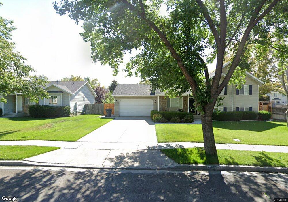
593 W 480 N American Fork, UT 84003
Estimated Value: $329,000 - $439,000
2
Beds
2
Baths
1,056
Sq Ft
$349/Sq Ft
Est. Value
About This Home
This home is located at 593 W 480 N, American Fork, UT 84003 and is currently estimated at $368,527, approximately $348 per square foot. 593 W 480 N is a home located in Utah County with nearby schools including Shelley Elementary School, American Fork Junior High School, and American Fork High School.
Ownership History
Date
Name
Owned For
Owner Type
Purchase Details
Closed on
Apr 29, 2019
Sold by
Peterson Maria F
Bought by
Sparks Kari
Current Estimated Value
Home Financials for this Owner
Home Financials are based on the most recent Mortgage that was taken out on this home.
Original Mortgage
$150,750
Outstanding Balance
$98,645
Interest Rate
4.3%
Mortgage Type
New Conventional
Estimated Equity
$269,882
Purchase Details
Closed on
Dec 9, 2016
Sold by
Peterson Dean V and Peterson Maria F
Bought by
Peterson Dean V and Peterson Maria F
Purchase Details
Closed on
Jul 30, 2002
Sold by
Favila Jes F and Favila Brenda L
Bought by
Peterson Dean and Peterson Maria F
Purchase Details
Closed on
Feb 7, 2000
Sold by
Ar Mitch Inc
Bought by
Sorensen Shane L and Sorensen Wendy R
Home Financials for this Owner
Home Financials are based on the most recent Mortgage that was taken out on this home.
Original Mortgage
$136,400
Interest Rate
8.06%
Create a Home Valuation Report for This Property
The Home Valuation Report is an in-depth analysis detailing your home's value as well as a comparison with similar homes in the area
Home Values in the Area
Average Home Value in this Area
Purchase History
| Date | Buyer | Sale Price | Title Company |
|---|---|---|---|
| Sparks Kari | -- | Utah First Title Ins Agency | |
| Peterson Dean V | -- | Access Title Co | |
| Peterson Dean | -- | First American Title Insuran | |
| Sorensen Shane L | -- | -- |
Source: Public Records
Mortgage History
| Date | Status | Borrower | Loan Amount |
|---|---|---|---|
| Open | Sparks Kari | $150,750 | |
| Previous Owner | Sorensen Shane L | $136,400 |
Source: Public Records
Tax History
| Year | Tax Paid | Tax Assessment Tax Assessment Total Assessment is a certain percentage of the fair market value that is determined by local assessors to be the total taxable value of land and additions on the property. | Land | Improvement |
|---|---|---|---|---|
| 2025 | $1,593 | $171,875 | -- | -- |
| 2024 | $1,593 | $177,045 | $0 | $0 |
| 2023 | $1,398 | $164,670 | $0 | $0 |
| 2022 | $1,522 | $176,935 | $0 | $0 |
| 2021 | $1,247 | $226,500 | $34,000 | $192,500 |
| 2020 | $1,150 | $202,600 | $30,400 | $172,200 |
| 2019 | $983 | $179,100 | $26,900 | $152,200 |
| 2018 | $873 | $152,000 | $22,800 | $129,200 |
| 2017 | $772 | $72,600 | $0 | $0 |
| 2016 | $756 | $66,000 | $0 | $0 |
| 2015 | $796 | $66,000 | $0 | $0 |
| 2014 | $772 | $63,250 | $0 | $0 |
Source: Public Records
Map
Nearby Homes
- 589 W 480 N
- 777 W State Rd
- 164 N 450 W
- 831 N 600 W
- 599 W 860 N
- 822 W 800 St N Unit LOT319
- 484 N 950 W Unit 7
- 822 N 860 W Unit 317
- 120 N 350 W Unit 127
- 120 N 350 W Unit 133
- 120 N 350 W Unit 130
- 120 N 350 W Unit 129
- 120 N 350 W Unit 131
- 764 W 880 North St Unit 308
- 217 W Main St
- 621 N 100 W
- 525 W 990 N
- 4007 W 1000 N
- 3947 W 1000 N Unit 439
- 3971 W 1000 N Unit 441
Your Personal Tour Guide
Ask me questions while you tour the home.