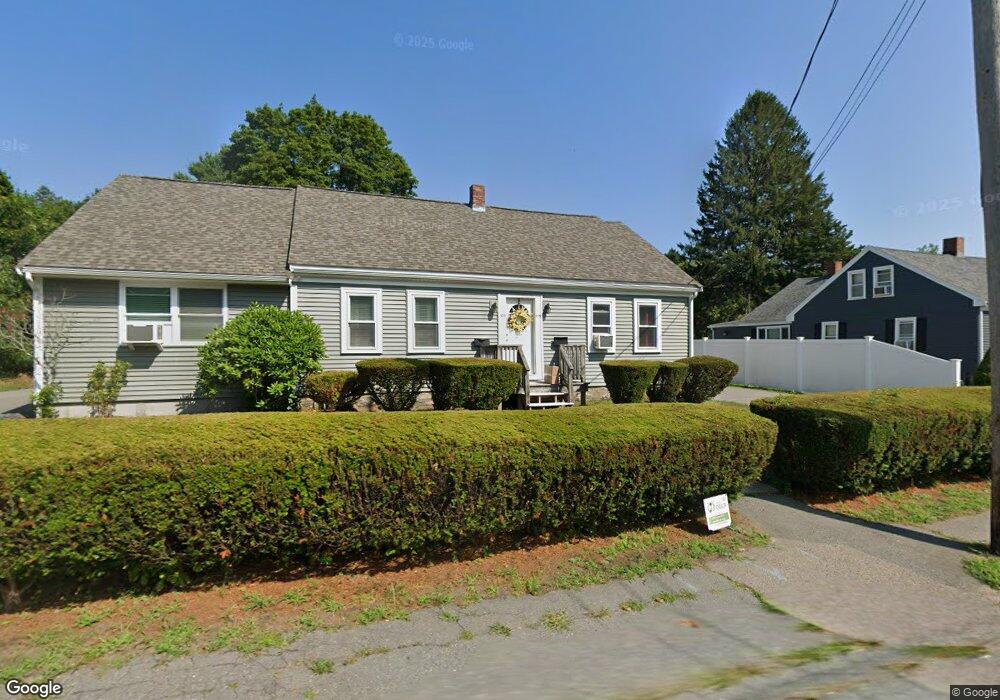
593 Whittenton St Taunton, MA 02780
Whittenton NeighborhoodEstimated Value: $470,000 - $660,000
3
Beds
2
Baths
2,246
Sq Ft
$258/Sq Ft
Est. Value
About This Home
This home is located at 593 Whittenton St, Taunton, MA 02780 and is currently estimated at $579,816, approximately $258 per square foot. 593 Whittenton St is a home located in Bristol County with nearby schools including Benjamin Friedman Middle School, Joseph C. Chamberlain Elementary School, and Taunton High School.
Ownership History
Date
Name
Owned For
Owner Type
Purchase Details
Closed on
Oct 27, 2020
Sold by
Macdonald Robert B
Bought by
Robert B Macdonald Lt and Macdonald
Current Estimated Value
Home Financials for this Owner
Home Financials are based on the most recent Mortgage that was taken out on this home.
Original Mortgage
$102,000
Outstanding Balance
$90,350
Interest Rate
2.8%
Mortgage Type
New Conventional
Estimated Equity
$489,466
Purchase Details
Closed on
Apr 4, 2017
Sold by
Macdonald Robert B
Bought by
Robert B Macdonald Irt and Macdonald
Create a Home Valuation Report for This Property
The Home Valuation Report is an in-depth analysis detailing your home's value as well as a comparison with similar homes in the area
Home Values in the Area
Average Home Value in this Area
Purchase History
| Date | Buyer | Sale Price | Title Company |
|---|---|---|---|
| Robert B Macdonald Lt | -- | None Available | |
| Macdonald Robert B | -- | None Available | |
| Robert B Macdonald Irt | -- | -- |
Source: Public Records
Mortgage History
| Date | Status | Borrower | Loan Amount |
|---|---|---|---|
| Open | Macdonald Robert B | $102,000 |
Source: Public Records
Tax History Compared to Growth
Tax History
| Year | Tax Paid | Tax Assessment Tax Assessment Total Assessment is a certain percentage of the fair market value that is determined by local assessors to be the total taxable value of land and additions on the property. | Land | Improvement |
|---|---|---|---|---|
| 2025 | $5,588 | $510,800 | $123,700 | $387,100 |
| 2024 | $4,792 | $428,200 | $123,700 | $304,500 |
| 2023 | $4,425 | $367,200 | $123,700 | $243,500 |
| 2022 | $4,523 | $343,200 | $103,100 | $240,100 |
| 2021 | $4,067 | $286,400 | $93,700 | $192,700 |
| 2020 | $3,902 | $262,600 | $93,700 | $168,900 |
| 2019 | $3,631 | $230,400 | $93,700 | $136,700 |
| 2018 | $3,399 | $216,200 | $94,700 | $121,500 |
| 2017 | $3,159 | $201,100 | $89,800 | $111,300 |
| 2016 | $3,111 | $198,400 | $87,100 | $111,300 |
| 2015 | $2,873 | $191,400 | $86,400 | $105,000 |
| 2014 | $2,821 | $193,100 | $86,400 | $106,700 |
Source: Public Records
Map
Nearby Homes
- 0 Whittenton St
- 0 Montclair Ave Unit 72130752
- 750 Whittenton St Unit 523
- 750 Whittenton St Unit 1021
- 3 4th Ave
- 3 4th Ave Unit 1
- 3 4th Ave Unit 2
- 59 Edgehill Rd
- 214 Eldridge St
- 68 Sabbatia Ln
- 16 Hunter St Unit A
- 22 Garfield St
- 86 Lakeview Ave
- 193 Fremont St
- 8 Spinnaker Ln Unit B
- 110 Eldridge St Unit B
- 9 Abbey Ln
- 96 Danforth St Unit 49
- 12 Lisa Dr
- 71 Eldridge St
- 603 Whittenton St
- 583 Whittenton St
- 588 Whittenton St
- 580 Whittenton St
- 596 Whittenton St
- 596 Whittenton St Unit 1
- 579 Whittenton St
- 625 Whittenton St
- 600 Whittenton St
- 612 Whittenton St
- 620 Whittenton St
- 629 Whittenton St
- 562 Whittenton St
- 563 Whittenton St
- 630 Whittenton St
- 631 Whittenton St
- 560 Whittenton St
- 519 Whittenton St
- 551 Whittenton St
- 521 Whittenton St