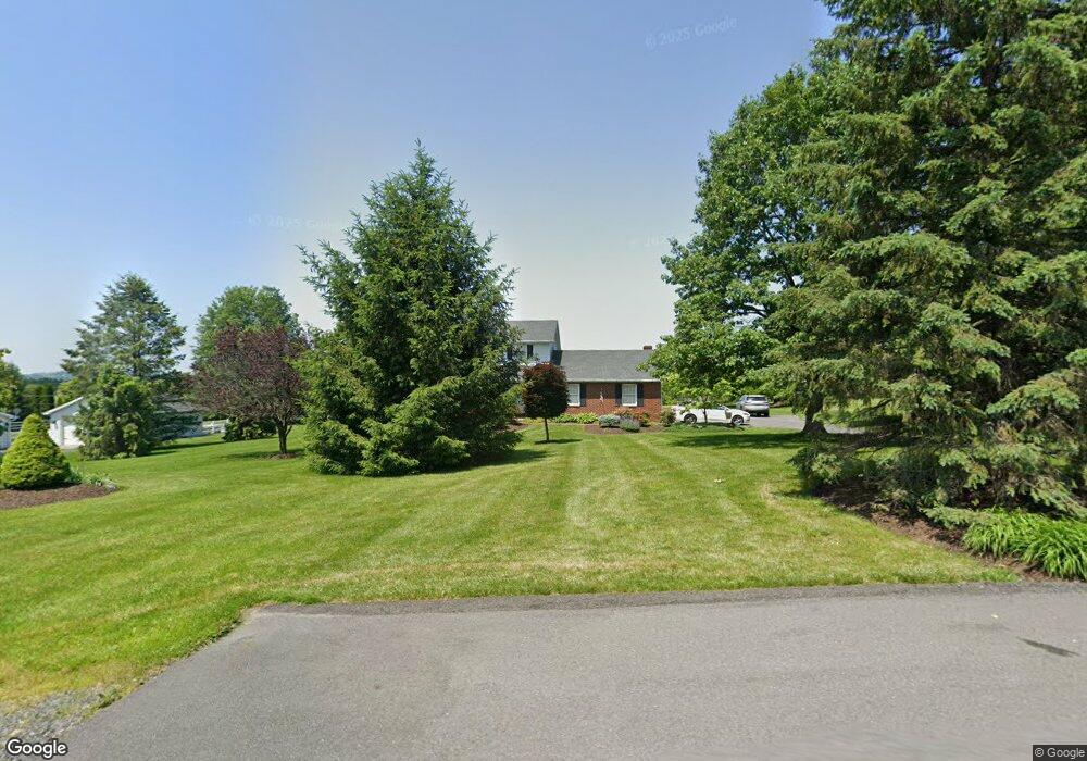
5930 Bottom Rd Slatington, PA 18080
Washington Township NeighborhoodEstimated Value: $409,000 - $535,000
4
Beds
3
Baths
2,359
Sq Ft
$200/Sq Ft
Est. Value
About This Home
This home is located at 5930 Bottom Rd, Slatington, PA 18080 and is currently estimated at $472,194, approximately $200 per square foot. 5930 Bottom Rd is a home located in Lehigh County with nearby schools including Deep Creek Central Elementary School, Grassfield Elementary School, and Peters Elementary School.
Ownership History
Date
Name
Owned For
Owner Type
Purchase Details
Closed on
Apr 13, 2018
Sold by
Wukitsch Gallus F and Wukitsch Cynthia J
Bought by
Wukitsch Gallus F and Wukitsch Cynthia J
Current Estimated Value
Purchase Details
Closed on
Oct 11, 1993
Sold by
J Iii Wukitsch G and Wukitsch Miller C
Bought by
Wukitsch Gallus F and Wukitsch Cynthia J
Purchase Details
Closed on
Oct 16, 1979
Bought by
Wukitsch G F
Create a Home Valuation Report for This Property
The Home Valuation Report is an in-depth analysis detailing your home's value as well as a comparison with similar homes in the area
Home Values in the Area
Average Home Value in this Area
Purchase History
| Date | Buyer | Sale Price | Title Company |
|---|---|---|---|
| Wukitsch Gallus F | -- | None Available | |
| Wukitsch Gallus F | -- | -- | |
| Wukitsch G F | $14,900 | -- |
Source: Public Records
Tax History Compared to Growth
Tax History
| Year | Tax Paid | Tax Assessment Tax Assessment Total Assessment is a certain percentage of the fair market value that is determined by local assessors to be the total taxable value of land and additions on the property. | Land | Improvement |
|---|---|---|---|---|
| 2025 | $7,113 | $241,500 | $64,100 | $177,400 |
| 2024 | $6,990 | $241,500 | $64,100 | $177,400 |
| 2023 | $6,798 | $241,500 | $64,100 | $177,400 |
| 2022 | $6,676 | $241,500 | $177,400 | $64,100 |
| 2021 | $6,563 | $241,500 | $64,100 | $177,400 |
| 2020 | $6,422 | $241,500 | $64,100 | $177,400 |
| 2019 | $6,255 | $241,500 | $64,100 | $177,400 |
| 2018 | $6,106 | $241,500 | $64,100 | $177,400 |
| 2017 | $6,088 | $241,500 | $64,100 | $177,400 |
| 2016 | -- | $241,500 | $64,100 | $177,400 |
| 2015 | -- | $241,500 | $64,100 | $177,400 |
| 2014 | -- | $241,500 | $64,100 | $177,400 |
Source: Public Records
Map
Nearby Homes
- 5734 Route 873
- 5706 Pennsylvania 873
- 5706 Route 873
- 3735 Highland Rd
- 6265 Venture Ct
- 5905 Glencrest Blvd
- 6210 Hazen Ct
- 6313 Nisbet Ct
- 6337 Nisbet Ct
- 5651 Park Valley Rd
- 3576 Neffs Laurys Rd
- 6215 Rachel Dr
- 5191 Cassidy Dr
- 5353 Route 309
- 5148 Pennsylvania 873
- 5820 Harvest Place
- 5153 Shawnee Blvd
- 6752 Old Grange Rd
- 6614 Oak Dr
- 5033 Ancinetta Dr
- 5942 Bottom Rd
- 5918 Bottom Rd
- 4127 Park Ave
- 5954 Bottom Rd
- 4145 Park Ave
- 4122 Park Ave
- 5967 Bottom Rd Unit 6007
- 4163 Park Ave
- 4235 Carolyn Dr
- 6010 Bottom Rd
- 4229 Carolyn Dr
- 4241 Carolyn Dr
- 6019 Bottom Rd
- 4223 Carolyn Dr
- 4247 Carolyn Dr
- 6031 Bottom Rd
- 4259 Carolyn Dr
- 4217 Carolyn Dr
- 4253 Carolyn Dr
- 4241 Park Ave