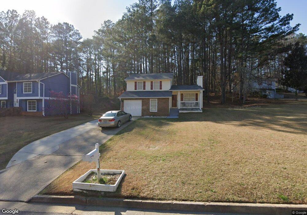
5930 Rock Rd Unit 5 Union City, GA 30291
Estimated Value: $218,000 - $233,000
3
Beds
2
Baths
1,116
Sq Ft
$201/Sq Ft
Est. Value
About This Home
This home is located at 5930 Rock Rd Unit 5, Union City, GA 30291 and is currently estimated at $224,669, approximately $201 per square foot. 5930 Rock Rd Unit 5 is a home located in Fulton County with nearby schools including Liberty Point Elementary School, Camp Creek Middle School, and Langston Hughes High School.
Ownership History
Date
Name
Owned For
Owner Type
Purchase Details
Closed on
Nov 23, 1999
Sold by
Poole Bobby D
Bought by
Bankers Trust Co /Ga
Current Estimated Value
Purchase Details
Closed on
Apr 22, 1994
Sold by
Secretary Of Va
Bought by
Poole Bobby D
Home Financials for this Owner
Home Financials are based on the most recent Mortgage that was taken out on this home.
Original Mortgage
$70,000
Interest Rate
6.75%
Mortgage Type
VA
Purchase Details
Closed on
May 4, 1993
Sold by
Sims Jonathan K Andrea
Bought by
Itt Residential Capital Corp
Create a Home Valuation Report for This Property
The Home Valuation Report is an in-depth analysis detailing your home's value as well as a comparison with similar homes in the area
Home Values in the Area
Average Home Value in this Area
Purchase History
| Date | Buyer | Sale Price | Title Company |
|---|---|---|---|
| Bankers Trust Co /Ga | $69,637 | -- | |
| Poole Bobby D | $70,000 | -- | |
| Itt Residential Capital Corp | $55,800 | -- | |
| Secretary Of Va | -- | -- |
Source: Public Records
Mortgage History
| Date | Status | Borrower | Loan Amount |
|---|---|---|---|
| Previous Owner | Poole Bobby D | $70,000 |
Source: Public Records
Tax History Compared to Growth
Tax History
| Year | Tax Paid | Tax Assessment Tax Assessment Total Assessment is a certain percentage of the fair market value that is determined by local assessors to be the total taxable value of land and additions on the property. | Land | Improvement |
|---|---|---|---|---|
| 2025 | $1,072 | $70,160 | $17,480 | $52,680 |
| 2023 | $2,131 | $75,480 | $20,440 | $55,040 |
| 2022 | $627 | $52,520 | $13,200 | $39,320 |
| 2021 | $512 | $39,880 | $8,200 | $31,680 |
| 2020 | $512 | $39,440 | $8,120 | $31,320 |
| 2019 | $833 | $29,600 | $5,800 | $23,800 |
| 2018 | $391 | $23,640 | $3,160 | $20,480 |
| 2017 | $407 | $23,640 | $3,160 | $20,480 |
| 2016 | $474 | $27,280 | $5,080 | $22,200 |
| 2015 | $904 | $27,280 | $5,080 | $22,200 |
| 2014 | $275 | $16,520 | $2,040 | $14,480 |
Source: Public Records
Map
Nearby Homes
- 5910 Rock Rd
- 5856 Rock Rd
- 0 Lower Dixie Lake Rd Unit 22475153
- 0 Lower Dixie Lake Rd Unit 7515143
- 4695 Ravenwood Loop
- 3227 Diamond Bluff
- 6024 Diamond Ln
- 6000 Diamond Ln
- 5900 Union Woods Way
- 0 Lakeside Dr Unit 22475152
- 0 Lakeside Dr Unit 7515650
- 000 Highpoint Rd
- 99 Highpoint Rd
- 4605 Ravenwood Loop
- 4611 Ravenwood Loop
- 4615 Ravenwood Loop
- 0 Highpoint Rd Unit 10553938
- 5545 Union Pointe Place
- 5934 Rock Ct
- 5934 Rock Ct Unit 5934
- 5936 Rock Ct
- 5937 Rock Rd
- 5927 Rock Rd
- 5856 Rock Rd Unit 5856
- 5856 Rock Rd
- 5856 Rock Rd
- 5858 Rock Rd
- 5844 Rock Rd
- 5947 Rock Rd
- 5917 Rock Rd Unit 5
- 5898 Rock Rd Unit 5
- 5874 Rock Rd
- 5944 Rock Ct
- 0 Rock Rd Unit 7403123
- 0 Rock Rd Unit 7173870
- 0 Rock Rd Unit 7454431
- 0 Rock Rd Unit 7332184
- 0 Rock Rd Unit 7170266