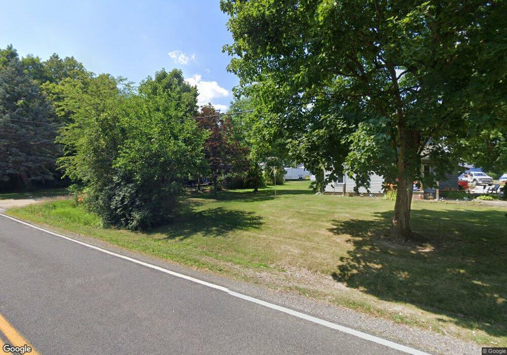
5931 Branch Rd Medina, OH 44256
Estimated Value: $280,000 - $308,000
3
Beds
3
Baths
1,248
Sq Ft
$233/Sq Ft
Est. Value
About This Home
This home is located at 5931 Branch Rd, Medina, OH 44256 and is currently estimated at $291,074, approximately $233 per square foot. 5931 Branch Rd is a home located in Medina County with nearby schools including Buckeye Intermediate School, Buckeye Primary School, and Buckeye Junior High School.
Ownership History
Date
Name
Owned For
Owner Type
Purchase Details
Closed on
Jun 19, 2009
Sold by
Tecco Michael W
Bought by
Tecco Michael W
Current Estimated Value
Home Financials for this Owner
Home Financials are based on the most recent Mortgage that was taken out on this home.
Original Mortgage
$137,566
Outstanding Balance
$87,337
Interest Rate
4.86%
Mortgage Type
FHA
Estimated Equity
$203,737
Purchase Details
Closed on
May 5, 1999
Sold by
Tecco Linda L
Bought by
Tecco Michael W
Purchase Details
Closed on
Feb 23, 1999
Sold by
Tecco Michael
Bought by
Tecco Linda L
Create a Home Valuation Report for This Property
The Home Valuation Report is an in-depth analysis detailing your home's value as well as a comparison with similar homes in the area
Home Values in the Area
Average Home Value in this Area
Purchase History
| Date | Buyer | Sale Price | Title Company |
|---|---|---|---|
| Tecco Michael W | $169,000 | -- | |
| Tecco Michael W | -- | -- | |
| Tecco Linda L | -- | -- |
Source: Public Records
Mortgage History
| Date | Status | Borrower | Loan Amount |
|---|---|---|---|
| Open | Tecco Michael W | $137,566 |
Source: Public Records
Tax History Compared to Growth
Tax History
| Year | Tax Paid | Tax Assessment Tax Assessment Total Assessment is a certain percentage of the fair market value that is determined by local assessors to be the total taxable value of land and additions on the property. | Land | Improvement |
|---|---|---|---|---|
| 2024 | $2,743 | $69,300 | $19,960 | $49,340 |
| 2023 | $2,743 | $69,300 | $19,960 | $49,340 |
| 2022 | $2,688 | $69,300 | $19,960 | $49,340 |
| 2021 | $2,280 | $54,570 | $15,720 | $38,850 |
| 2020 | $2,313 | $54,570 | $15,720 | $38,850 |
| 2019 | $2,314 | $54,570 | $15,720 | $38,850 |
| 2018 | $2,381 | $54,300 | $16,810 | $37,490 |
| 2017 | $2,386 | $54,300 | $16,810 | $37,490 |
| 2016 | $2,458 | $54,300 | $16,810 | $37,490 |
| 2015 | $2,359 | $50,750 | $15,720 | $35,030 |
| 2014 | $2,349 | $50,750 | $15,720 | $35,030 |
| 2013 | $2,353 | $50,750 | $15,720 | $35,030 |
Source: Public Records
Map
Nearby Homes
- 970 Pine Tree Ct
- 750 Winston Cir
- 648 Jamestown Place
- 799 Savannah Trail
- 6572 W Smith Rd
- 6253 Norwalk Rd
- 5720 Lafayette Rd
- 5501 Arapaho Way
- 585 Birch Hill Dr
- 885 Norwegian Wood Dr
- 6730 Stone Rd
- 330 Foundry St
- 5233 Eagles Nest Ln
- 892 Yesterday Ln
- 4575 Rocky Mountain Dr
- 5443 Daintree Ln
- 538 W Smith Rd
- 366 S Prospect St
- 738 Spruce St
- 822 Oak St
- 5945 Branch Rd
- 1115 Branch Rd
- 5969 Branch Rd
- 1075 Branch Rd
- Enterprise Dr
- 6025 Branch Rd
- 1060 Branch Rd
- 6049 Branch Rd
- 0 Enterprise Dr
- 6071 Branch Rd
- 6081 Branch Rd
- 989 Branch Rd
- 299 Westgrove Ct
- 301 Westgrove Ct
- 309 Westgrove Ct
- 315 Westgrove Ct
- 985 Branch Rd
- 295 Westgrove Ct
- 321 Westgrove Ct
- 327 Westgrove Ct
