Estimated Value: $1,435,000 - $1,475,000
Studio
--
Bath
4,158
Sq Ft
$350/Sq Ft
Est. Value
About This Home
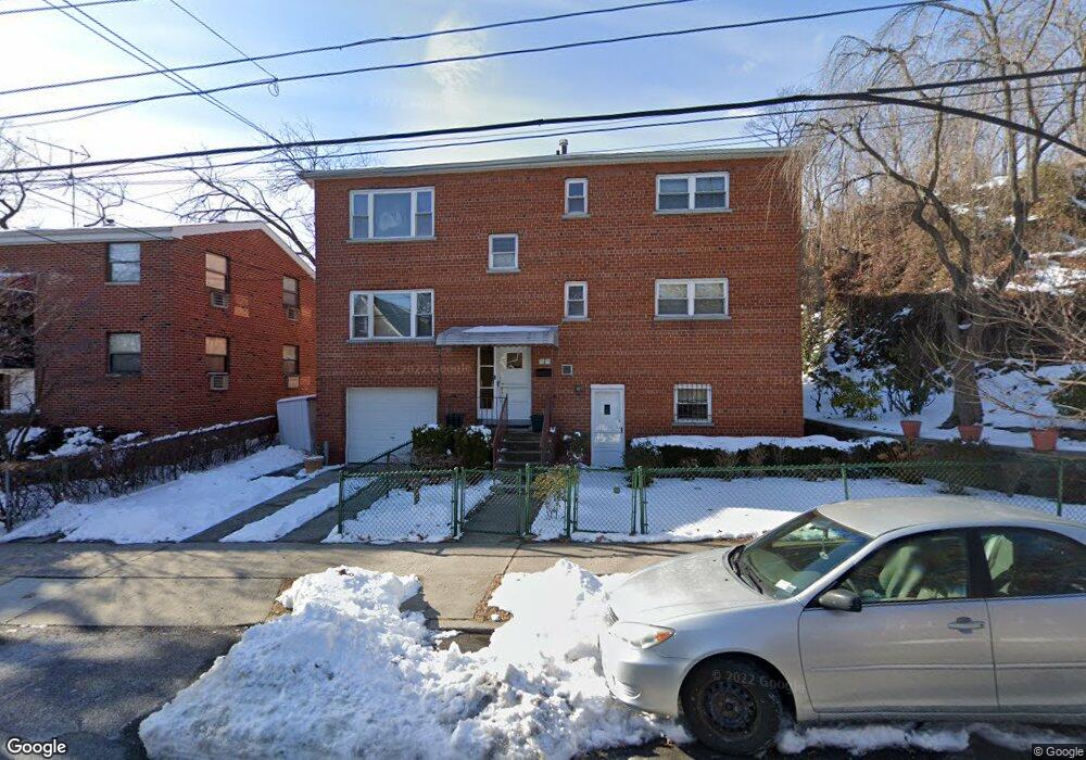
This home is located at 5933 Fieldston Rd, Bronx, NY 10471 and is currently estimated at $1,455,000, approximately $349 per square foot. 5933 Fieldston Rd is a home located in Bronx County with nearby schools including P.S. 81 - Robert J. Christen, John R Bonfield Elementary School, and Riverdale Kingsbridge Academy.
Ownership History
Date
Name
Owned For
Owner Type
Purchase Details
Closed on
Nov 27, 2018
Sold by
Salanitre Laurie
Bought by
Salanitre Susan
Current Estimated Value
Purchase Details
Closed on
Aug 5, 2010
Sold by
Salanitre Laurie and Salanitre Susan
Bought by
Salanitre Laurie and Salanitre Susan
Purchase Details
Closed on
May 3, 1991
Sold by
Salanitre Ernest and Salanitre Grace
Bought by
Salanitre Ernest and Salanitre Grace
Create a Home Valuation Report for This Property
The Home Valuation Report is an in-depth analysis detailing your home's value as well as a comparison with similar homes in the area
Purchase History
| Date | Buyer | Sale Price | Title Company |
|---|---|---|---|
| Salanitre Susan | -- | -- | |
| Salanitre Laurie | -- | -- | |
| Salanitre Ernest | -- | -- |
Source: Public Records
Tax History Compared to Growth
Tax History
| Year | Tax Paid | Tax Assessment Tax Assessment Total Assessment is a certain percentage of the fair market value that is determined by local assessors to be the total taxable value of land and additions on the property. | Land | Improvement |
|---|---|---|---|---|
| 2025 | $15,878 | $82,529 | $17,323 | $65,206 |
| 2024 | $15,878 | $79,056 | $16,928 | $62,128 |
| 2023 | $7,765 | $76,464 | $16,486 | $59,978 |
| 2022 | $7,277 | $91,620 | $22,380 | $69,240 |
| 2021 | $7,237 | $96,180 | $22,380 | $73,800 |
| 2020 | $7,279 | $83,220 | $22,380 | $60,840 |
| 2019 | $13,781 | $85,800 | $22,380 | $63,420 |
| 2018 | $12,989 | $63,720 | $14,198 | $49,522 |
| 2017 | $12,384 | $60,750 | $17,593 | $43,157 |
| 2016 | $11,457 | $57,312 | $16,819 | $40,493 |
| 2015 | $6,912 | $57,312 | $23,703 | $33,609 |
| 2014 | $6,912 | $54,900 | $24,840 | $30,060 |
Source: Public Records
Map
Nearby Homes
- 305 W 259th St
- 5834 Fieldston Rd
- 6036 Liebig Ave
- 5918 Delafield Ave
- 5715 Mosholu Ave Unit 2E
- 227 W 260th St
- 5730 Mosholu Ave Unit 6A
- 204 W 260th St
- 5775 Mosholu Ave Unit 3A
- 6535 Broadway Unit 6
- 6535 Broadway Unit 2A
- 6535 Broadway Unit 2
- 6535 Broadway Unit 4J
- 6535 Broadway Unit 5C
- 6133 Fieldston Rd
- 6495 Broadway Unit 5R
- 6004 Netherland Ave
- 351 W 262nd St
- 6209 Spencer Terrace
- 568-L W 261st St
- 5929 Fieldston Rd
- 5926 Tyndall Ave
- 360 W 260th St
- 5918 Tyndall Ave
- 348 W 260th St
- 5930 Tyndall Ave
- 5927 Fieldston Rd
- 362 W 260th St Unit 2
- 362 W 260th St
- 5916 Tyndall Ave
- 5930 Fieldston Rd
- 5934 Fieldston Rd
- 5938 Fieldston Rd
- 5914 Tyndall Ave
- 5928 Fieldston Rd
- 5924 Fieldston Rd
- 5912 Tyndall Ave
- 5912 Tyndall Ave Unit 1
- 5923 Fieldston Rd
- 312 W 260th St