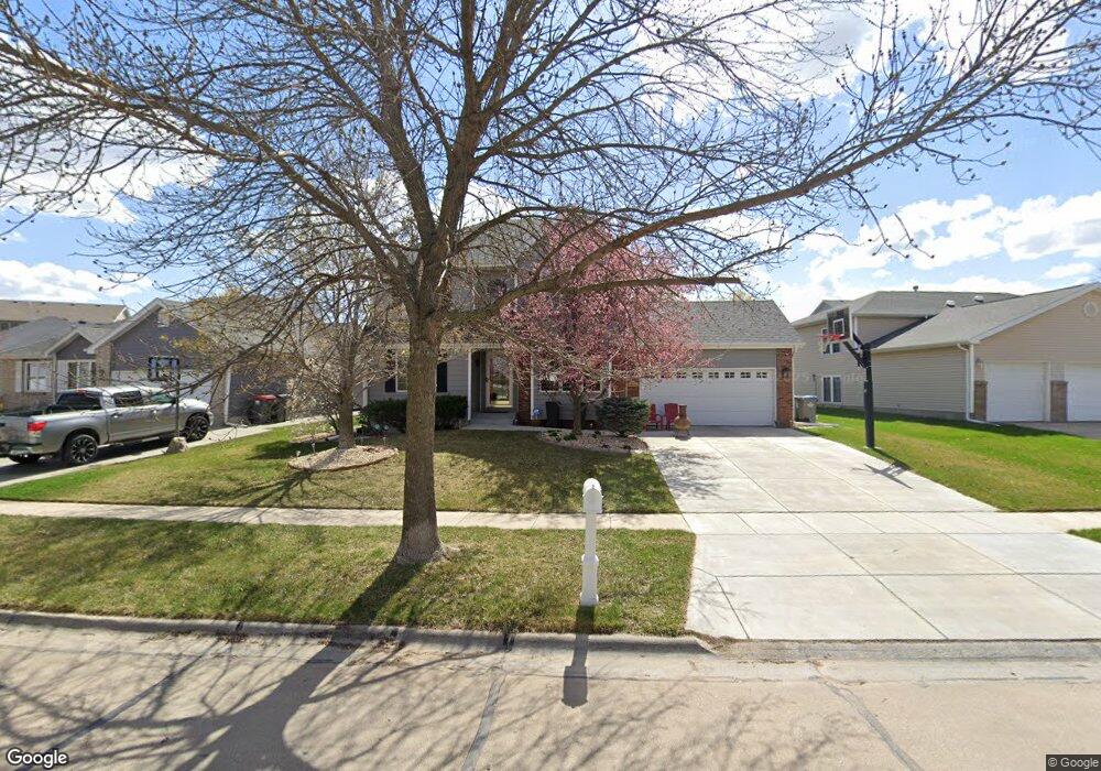
5933 S 81st St Lincoln, NE 68516
Edenton South NeighborhoodEstimated Value: $380,645 - $463,000
3
Beds
3
Baths
1,937
Sq Ft
$220/Sq Ft
Est. Value
About This Home
This home is located at 5933 S 81st St, Lincoln, NE 68516 and is currently estimated at $426,161, approximately $220 per square foot. 5933 S 81st St is a home located in Lancaster County with nearby schools including Maxey Elementary School, Moore Middle School, and Lincoln East High School.
Ownership History
Date
Name
Owned For
Owner Type
Purchase Details
Closed on
Feb 21, 2001
Sold by
Cameron Corporation
Bought by
Rowen Tyge D and Rowen Shannon M
Current Estimated Value
Home Financials for this Owner
Home Financials are based on the most recent Mortgage that was taken out on this home.
Original Mortgage
$171,800
Outstanding Balance
$60,988
Interest Rate
6.85%
Estimated Equity
$365,173
Purchase Details
Closed on
Jan 7, 1999
Sold by
Cheney Ridge Partners
Bought by
Cameron Corp
Create a Home Valuation Report for This Property
The Home Valuation Report is an in-depth analysis detailing your home's value as well as a comparison with similar homes in the area
Home Values in the Area
Average Home Value in this Area
Purchase History
| Date | Buyer | Sale Price | Title Company |
|---|---|---|---|
| Rowen Tyge D | $178,000 | -- | |
| Cameron Corp | $32,000 | -- |
Source: Public Records
Mortgage History
| Date | Status | Borrower | Loan Amount |
|---|---|---|---|
| Open | Rowen Tyge D | $171,800 |
Source: Public Records
Tax History Compared to Growth
Tax History
| Year | Tax Paid | Tax Assessment Tax Assessment Total Assessment is a certain percentage of the fair market value that is determined by local assessors to be the total taxable value of land and additions on the property. | Land | Improvement |
|---|---|---|---|---|
| 2025 | $4,482 | $345,700 | $62,000 | $283,700 |
| 2024 | $4,482 | $324,300 | $62,000 | $262,300 |
| 2023 | $5,435 | $324,300 | $62,000 | $262,300 |
| 2022 | $5,166 | $259,200 | $60,000 | $199,200 |
| 2021 | $4,887 | $259,200 | $60,000 | $199,200 |
| 2020 | $4,725 | $247,300 | $60,000 | $187,300 |
| 2019 | $4,726 | $247,300 | $60,000 | $187,300 |
| 2018 | $4,282 | $223,100 | $60,000 | $163,100 |
| 2017 | $4,322 | $223,100 | $60,000 | $163,100 |
| 2016 | $4,325 | $222,100 | $45,000 | $177,100 |
| 2015 | $4,356 | $222,100 | $45,000 | $177,100 |
| 2014 | $3,777 | $191,200 | $45,000 | $146,200 |
| 2013 | -- | $191,200 | $45,000 | $146,200 |
Source: Public Records
Map
Nearby Homes
- 5624 Barrington Cir
- 5614 S 80th St
- 10111 S 78th St
- 8101 Cheney Ridge Rd
- 5431 S 79th St
- 7501 Stevens Ridge Rd
- 7501 Karl Dr
- 5811 S 88th St
- 5441 S 88th St
- 6500 E Shore Dr
- 6154 S 87th St
- 5241 Troon Dr
- 6400 S 84th St
- 6151 Laroche Rd
- 6165 Laroche Rd
- 5335 Troon Dr
- 8610 Oakmont Dr
- 5921 Arrowwood Rd
- 8729 Remi Dr
- 8439 Birkett Dr
- 5925 S 81st St
- 5943 S 81st St
- 8040 Hanna Pointe Place
- 5915 S 81st St
- 5953 S 81st St
- 8048 Hanna Pointe Place
- 8032 Hanna Pointe Place
- 5932 S 81st St
- 8024 Hanna Pointe Place
- 5924 S 81st St
- 5940 S 81st St
- 8058 Hanna Pointe Place
- 5907 S 80th St
- 5907 S 81st St
- 5948 S 81st St
- 8016 Hanna Pointe Place
- 5908 S 81st St
- 5954 S 81st St
- 5960 S 81st St
- 5900 S 81st St