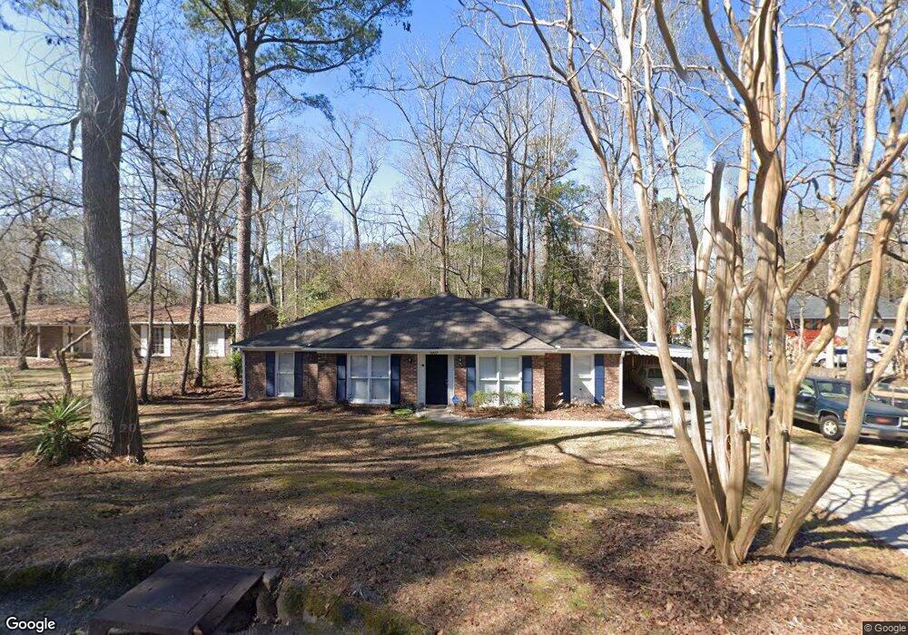
5937 Fornof Rd Columbus, GA 31909
Midland NeighborhoodEstimated Value: $188,000 - $211,767
3
Beds
2
Baths
1,429
Sq Ft
$140/Sq Ft
Est. Value
About This Home
This home is located at 5937 Fornof Rd, Columbus, GA 31909 and is currently estimated at $199,942, approximately $139 per square foot. 5937 Fornof Rd is a home located in Muscogee County with nearby schools including Waddell Elementary School, Midland Middle School, and Shaw High School.
Ownership History
Date
Name
Owned For
Owner Type
Purchase Details
Closed on
Apr 29, 2020
Sold by
Bastone Louis A
Bought by
Jackson William A
Current Estimated Value
Home Financials for this Owner
Home Financials are based on the most recent Mortgage that was taken out on this home.
Original Mortgage
$120,673
Outstanding Balance
$106,933
Interest Rate
3.3%
Mortgage Type
FHA
Estimated Equity
$93,009
Purchase Details
Closed on
Nov 8, 2013
Sold by
Flynn Michael C
Bought by
Bastone Louis A
Home Financials for this Owner
Home Financials are based on the most recent Mortgage that was taken out on this home.
Original Mortgage
$98,400
Interest Rate
4.26%
Mortgage Type
New Conventional
Create a Home Valuation Report for This Property
The Home Valuation Report is an in-depth analysis detailing your home's value as well as a comparison with similar homes in the area
Home Values in the Area
Average Home Value in this Area
Purchase History
| Date | Buyer | Sale Price | Title Company |
|---|---|---|---|
| Jackson William A | $122,900 | -- | |
| Bastone Louis A | $123,000 | -- |
Source: Public Records
Mortgage History
| Date | Status | Borrower | Loan Amount |
|---|---|---|---|
| Open | Jackson William A | $120,673 | |
| Previous Owner | Bastone Louis A | $98,400 |
Source: Public Records
Tax History Compared to Growth
Tax History
| Year | Tax Paid | Tax Assessment Tax Assessment Total Assessment is a certain percentage of the fair market value that is determined by local assessors to be the total taxable value of land and additions on the property. | Land | Improvement |
|---|---|---|---|---|
| 2025 | $263 | $67,204 | $11,644 | $55,560 |
| 2024 | $263 | $67,204 | $11,644 | $55,560 |
| 2023 | $2,647 | $67,204 | $11,644 | $55,560 |
| 2022 | $2,093 | $51,272 | $11,644 | $39,628 |
| 2021 | $2,007 | $49,160 | $11,040 | $38,120 |
| 2020 | $2,017 | $49,388 | $11,644 | $37,744 |
| 2019 | $2,023 | $49,388 | $11,644 | $37,744 |
| 2018 | $2,023 | $49,388 | $11,644 | $37,744 |
| 2017 | $2,068 | $49,388 | $11,644 | $37,744 |
| 2016 | $2,030 | $49,200 | $5,847 | $43,353 |
| 2015 | $2,032 | $49,200 | $5,847 | $43,353 |
| 2014 | $2,034 | $49,200 | $5,847 | $43,353 |
| 2013 | -- | $48,000 | $5,847 | $42,153 |
Source: Public Records
Map
Nearby Homes
- 5408 Old Dominion Rd
- 5966 Fornof Rd
- 5324 Colony Dr
- 5422 Colony Dr
- 6127 Stony Creek Dr
- 5791 Bishop Dr
- 5804 Dearborn Ave
- 6263 Potomac Cir
- 6333 Stony Creek Dr
- 6137 Stoneway Dr
- 5028 Warm Springs Rd
- 6 Jamestown Ct
- 5378 Misty Ln
- 6251 Rockefeller Dr
- 6222 Goodwin Dr
- 5623 Hodges Dr
- 5621 Hodges Dr
- 5619 Hodges Dr
- 5045 Old Post Rd
- 4847 Warm Springs Rd
- 5941 Fornof Rd
- 5925 Fornof Rd
- 5936 Fornof Rd
- 5919 Fornof Rd
- 5924 Fornof Rd
- 5940 Fornof Rd
- 5947 Fornof Rd
- 5949 Fornof Rd
- 5918 Fornof Rd
- 5913 Fornof Rd
- 5948 Fornof Rd
- 5909 Fornof Rd
- 5963 Fornof Rd
- 5952 Fornof Rd
- 5939 Highpoint Dr
- 5943 Highpoint Dr
- 5927 Highpoint Dr
- 5905 Fornof Rd
- 5951 Highpoint Dr
- 5921 Highpoint Dr