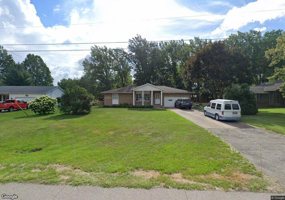
5939 Hoover Blvd Lorain, OH 44053
Estimated Value: $200,000 - $256,000
3
Beds
2
Baths
1,647
Sq Ft
$140/Sq Ft
Est. Value
About This Home
This home is located at 5939 Hoover Blvd, Lorain, OH 44053 and is currently estimated at $230,459, approximately $139 per square foot. 5939 Hoover Blvd is a home located in Lorain County with nearby schools including Vincent Elementary School, Durling Middle School, and Clearview High School.
Ownership History
Date
Name
Owned For
Owner Type
Purchase Details
Closed on
Oct 27, 2010
Sold by
Federal Home Loan Mortgage Corporation
Bought by
Melendez William R and Melendez Leonora A
Current Estimated Value
Purchase Details
Closed on
Jun 2, 2010
Sold by
Ambrosio Leonard J
Bought by
Federal Home Loan Mortgage Corp
Purchase Details
Closed on
Mar 5, 2002
Sold by
Vera Tkacs
Bought by
Ambrosio Leonard J
Home Financials for this Owner
Home Financials are based on the most recent Mortgage that was taken out on this home.
Original Mortgage
$102,000
Interest Rate
7.11%
Create a Home Valuation Report for This Property
The Home Valuation Report is an in-depth analysis detailing your home's value as well as a comparison with similar homes in the area
Home Values in the Area
Average Home Value in this Area
Purchase History
| Date | Buyer | Sale Price | Title Company |
|---|---|---|---|
| Melendez William R | $62,000 | Attorney | |
| Federal Home Loan Mortgage Corp | $64,000 | None Available | |
| Ambrosio Leonard J | $117,500 | Northstar Title Services |
Source: Public Records
Mortgage History
| Date | Status | Borrower | Loan Amount |
|---|---|---|---|
| Previous Owner | Ambrosio Leonard J | $102,000 |
Source: Public Records
Tax History Compared to Growth
Tax History
| Year | Tax Paid | Tax Assessment Tax Assessment Total Assessment is a certain percentage of the fair market value that is determined by local assessors to be the total taxable value of land and additions on the property. | Land | Improvement |
|---|---|---|---|---|
| 2024 | $2,530 | $65,415 | $16,240 | $49,175 |
| 2023 | $2,050 | $43,764 | $12,775 | $30,989 |
| 2022 | $2,116 | $43,764 | $12,775 | $30,989 |
| 2021 | $2,222 | $43,764 | $12,775 | $30,989 |
| 2020 | $2,083 | $37,210 | $10,860 | $26,350 |
| 2019 | $2,074 | $37,210 | $10,860 | $26,350 |
| 2018 | $2,129 | $37,210 | $10,860 | $26,350 |
| 2017 | $2,171 | $35,330 | $10,780 | $24,550 |
| 2016 | $2,168 | $35,330 | $10,780 | $24,550 |
| 2015 | $2,114 | $35,330 | $10,780 | $24,550 |
| 2014 | $2,016 | $34,420 | $10,500 | $23,920 |
| 2013 | $1,992 | $34,420 | $10,500 | $23,920 |
Source: Public Records
Map
Nearby Homes
- 6328 Baldwin Blvd
- 0 Appleseed Dr
- 6321 Baldwin Blvd
- 4977-4985 Oberlin Ave
- V/L N Ridge Rd
- 529 Bayberry Rd
- 380 N Ridge Rd W
- 724 Hampshire Ct
- 4590 Broadway
- 45305 N Ridge Rd
- 4610 Ashland Ave
- 3948 Reid Ave Unit 29
- 3946 Reid Ave Unit G8
- 1106 W 42nd Place
- 5208 7 Pines Dr
- 5204 7 Pines Dr
- 4002 Washington Ave
- 317 E 44th St
- 43995 Middle Ridge Rd
- 3964 Josephine St
- 5847 Hoover Blvd
- 5856 Hoover Blvd
- 5821 Hoover Blvd
- 5844 Hoover Blvd
- 796 Cooper Foster Park Rd W
- 5847 Clement Dr
- 740 Cooper Foster Park Rd W
- 5832 Hoover Blvd
- 5823 Hoover Blvd
- 5916 Clement Dr
- 810 Cooper Foster Park Rd W
- 5860 Clement Dr
- 5820 Hoover Blvd
- 5831 Clement Dr
- 730 Cooper Foster Park Rd W
- 815 Cooper Foster Park Rd W
- 5846 Clement Dr
- 5811 Hoover Blvd
- 710 Cooper Foster Park Rd W
- 5830 Clement Dr